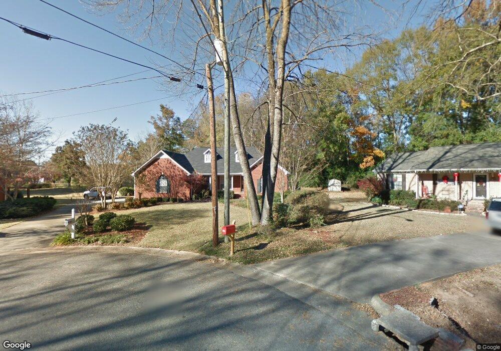
512 Cottondale Dr Bessemer, AL 35023
Estimated Value: $210,000 - $249,000
3
Beds
2
Baths
2,033
Sq Ft
$115/Sq Ft
Est. Value
About This Home
This home is located at 512 Cottondale Dr, Bessemer, AL 35023 and is currently estimated at $233,850, approximately $115 per square foot. 512 Cottondale Dr is a home located in Jefferson County with nearby schools including Hueytown Elementary School, Hueytown Primary School, and Hueytown Middle School.
Ownership History
Date
Name
Owned For
Owner Type
Purchase Details
Closed on
Jul 3, 2019
Sold by
Clark Rhonda F Ball
Bought by
Clark Roger
Current Estimated Value
Purchase Details
Closed on
Apr 28, 2010
Sold by
Ball Rhonda F and Clark Roger
Bought by
Clark Rhonda F Ball and Clark Roger
Purchase Details
Closed on
Dec 22, 2009
Sold by
Northcutt Michael Lance and Northcutt Marette
Bought by
Ball Rhonda F
Home Financials for this Owner
Home Financials are based on the most recent Mortgage that was taken out on this home.
Original Mortgage
$176,739
Interest Rate
4.87%
Mortgage Type
FHA
Create a Home Valuation Report for This Property
The Home Valuation Report is an in-depth analysis detailing your home's value as well as a comparison with similar homes in the area
Home Values in the Area
Average Home Value in this Area
Purchase History
| Date | Buyer | Sale Price | Title Company |
|---|---|---|---|
| Clark Roger | -- | -- | |
| Clark Rhonda F Ball | $1,000 | None Available | |
| Ball Rhonda F | $180,000 | None Available |
Source: Public Records
Mortgage History
| Date | Status | Borrower | Loan Amount |
|---|---|---|---|
| Previous Owner | Ball Rhonda F | $176,739 |
Source: Public Records
Tax History Compared to Growth
Tax History
| Year | Tax Paid | Tax Assessment Tax Assessment Total Assessment is a certain percentage of the fair market value that is determined by local assessors to be the total taxable value of land and additions on the property. | Land | Improvement |
|---|---|---|---|---|
| 2024 | $1,256 | $21,780 | -- | -- |
| 2022 | $1,142 | $19,870 | $2,500 | $17,370 |
| 2021 | $975 | $17,090 | $2,500 | $14,590 |
| 2020 | $980 | $17,090 | $2,500 | $14,590 |
| 2019 | $975 | $17,100 | $0 | $0 |
| 2018 | $936 | $16,460 | $0 | $0 |
| 2017 | $936 | $16,460 | $0 | $0 |
| 2016 | $936 | $16,460 | $0 | $0 |
| 2015 | $936 | $16,460 | $0 | $0 |
| 2014 | $976 | $16,200 | $0 | $0 |
| 2013 | $976 | $16,200 | $0 | $0 |
Source: Public Records
Map
Nearby Homes
- 302 Pope Dr
- 103 Hill Ave
- 231 Lowery Dr
- 441 Covenant Cir Unit 3
- 102 Pine Ave
- 116 Louis Ave
- 3364 Warrior River Rd
- 1458 Hueytown Rd
- 628 S Parkell Ave
- 1440 Hueytown Rd
- 1436 Hueytown Rd
- 91 Vines Ave Unit 1
- 107 Vines Ave
- 125 Honeysuckle Rd
- 1422 Hueytown Rd
- 108 Jones Ave
- 912 Clark Mountain Rd N
- 1420 Hueytown Rd
- 961 Clark Mountain Rd N
- 3197 Allison Bonnett Memorial Dr
- 514 Cottondale Dr
- 510 Cottondale Dr
- 316 Hill Ave
- 508 Cottondale Dr
- 318 Hill Ave
- 526 Cottondale Dr
- 506 Cottondale Dr
- 314 Hill Ave
- 309 Pope Dr
- 319 Hill Ave
- 504 Cottondale Dr
- 204 Florence St
- 208 Florence St
- 528 Cottondale Dr
- 106 Prospect Dr
- 312 Hill Ave
- 310 Hill Ave
- 313 Pope Dr
- 212 Florence St
- 534 Cottondale Dr Unit 1