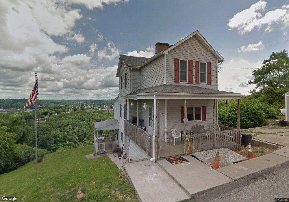
512 Crossland St McKeesport, PA 15133
Estimated Value: $108,000 - $145,000
3
Beds
2
Baths
1,328
Sq Ft
$93/Sq Ft
Est. Value
About This Home
This home is located at 512 Crossland St, McKeesport, PA 15133 and is currently estimated at $123,427, approximately $92 per square foot. 512 Crossland St is a home located in Allegheny County with nearby schools including South Allegheny Elementary School, South Allegheny High School, and Young Scholars of Greater Allegheny Charter School.
Ownership History
Date
Name
Owned For
Owner Type
Purchase Details
Closed on
Sep 26, 2008
Sold by
Rosso Phil
Bought by
Kasyan Nicholas E
Current Estimated Value
Home Financials for this Owner
Home Financials are based on the most recent Mortgage that was taken out on this home.
Original Mortgage
$46,296
Outstanding Balance
$30,823
Interest Rate
6.54%
Mortgage Type
FHA
Estimated Equity
$92,604
Purchase Details
Closed on
Apr 23, 2002
Sold by
Wells Fargo Bank Minnesota Na
Bought by
Rosso Phil
Purchase Details
Closed on
Feb 28, 2002
Sold by
Barkley Loretta J
Bought by
Salomon Brothers Mtg Securities Vii Inc
Create a Home Valuation Report for This Property
The Home Valuation Report is an in-depth analysis detailing your home's value as well as a comparison with similar homes in the area
Home Values in the Area
Average Home Value in this Area
Purchase History
| Date | Buyer | Sale Price | Title Company |
|---|---|---|---|
| Kasyan Nicholas E | $50,000 | -- | |
| Rosso Phil | $10,900 | -- | |
| Salomon Brothers Mtg Securities Vii Inc | $947 | -- |
Source: Public Records
Mortgage History
| Date | Status | Borrower | Loan Amount |
|---|---|---|---|
| Open | Kasyan Nicholas E | $46,296 |
Source: Public Records
Tax History Compared to Growth
Tax History
| Year | Tax Paid | Tax Assessment Tax Assessment Total Assessment is a certain percentage of the fair market value that is determined by local assessors to be the total taxable value of land and additions on the property. | Land | Improvement |
|---|---|---|---|---|
| 2025 | $178 | $27,700 | $12,600 | $15,100 |
| 2024 | $1,056 | $27,700 | $12,600 | $15,100 |
| 2023 | $1,015 | $27,700 | $12,600 | $15,100 |
| 2022 | $950 | $27,700 | $12,600 | $15,100 |
| 2021 | $131 | $27,700 | $12,600 | $15,100 |
| 2020 | $904 | $27,700 | $12,600 | $15,100 |
| 2019 | $858 | $27,700 | $12,600 | $15,100 |
| 2018 | $131 | $27,700 | $12,600 | $15,100 |
| 2017 | $814 | $27,700 | $12,600 | $15,100 |
| 2016 | $216 | $45,700 | $12,600 | $33,100 |
| 2015 | $216 | $45,700 | $12,600 | $33,100 |
| 2014 | $1,342 | $45,700 | $12,600 | $33,100 |
Source: Public Records
Map
Nearby Homes
- 1817 Gray St
- 320 Dersam St
- 335-345 Dersam St
- 603 Hays St
- 813 Lauck Ave
- 1317 New York Ave
- 1220 Romine Ave
- 1332 Beverly Rd
- 112 June Dr
- 2908 Woodrow St
- 1310 Beverly Rd
- 2302 Walnut St
- 1120 Portsmouth Dr
- 1517 Beaver St
- 1405/1407 Walnut St
- 0 Washington Blvd
- 1419 Washington Blvd
- 1600 Coursin St
- 0 Bailie Ave
- 1009 Oakland Ave
- 1923 Myer Ave
- 1926 Myer Ave
- 1919 Myer Ave
- 504 Crossland St
- 1920 New York Ave
- 1916 New York Ave
- 603 Burbridge St
- 1928 Myer Ave
- 699 Burbridge St
- 701 Burbridge St
- 1914 New York Ave
- 1925 New York Ave
- 705 Burbridge St
- 1921 New York Ave
- 1917 New York Ave
- 1910 New York Ave
- 707 Burbridge St
- 1915 New York Ave
- 711 Burbridge St
- 1913 New York Ave