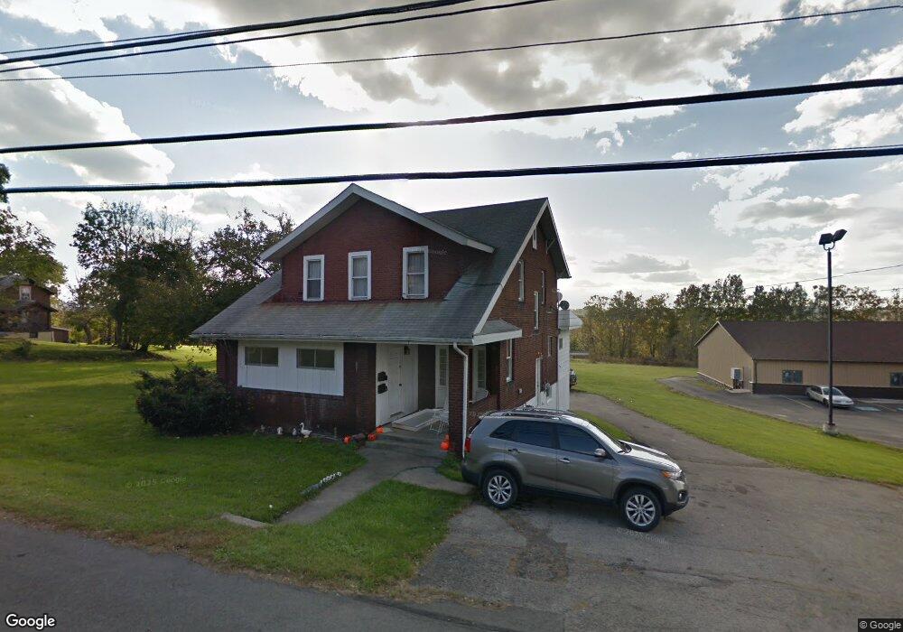
512 E Main St Uniontown, PA 15401
Estimated Value: $159,000 - $232,703
4
Beds
2
Baths
2,280
Sq Ft
$80/Sq Ft
Est. Value
About This Home
This home is located at 512 E Main St, Uniontown, PA 15401 and is currently estimated at $182,426, approximately $80 per square foot. 512 E Main St is a home located in Fayette County with nearby schools including Laurel Highlands Senior High School, St. John the Evangelist School, and Chestnut Ridge Christian Academy.
Ownership History
Date
Name
Owned For
Owner Type
Purchase Details
Closed on
Feb 8, 2010
Sold by
Route 40 Properties Inc
Bought by
Lafayette Post No 51
Current Estimated Value
Purchase Details
Closed on
Nov 28, 2006
Sold by
Risimtim Inc
Bought by
Route 40 Properties Inc
Purchase Details
Closed on
Apr 25, 2006
Sold by
George Esquire Joseph M
Bought by
Risimtim Inc
Home Financials for this Owner
Home Financials are based on the most recent Mortgage that was taken out on this home.
Original Mortgage
$125,000
Interest Rate
6.4%
Mortgage Type
Future Advance Clause Open End Mortgage
Create a Home Valuation Report for This Property
The Home Valuation Report is an in-depth analysis detailing your home's value as well as a comparison with similar homes in the area
Home Values in the Area
Average Home Value in this Area
Purchase History
| Date | Buyer | Sale Price | Title Company |
|---|---|---|---|
| Lafayette Post No 51 | $125,000 | None Available | |
| Route 40 Properties Inc | -- | None Available | |
| Risimtim Inc | $125,000 | None Available |
Source: Public Records
Mortgage History
| Date | Status | Borrower | Loan Amount |
|---|---|---|---|
| Previous Owner | Risimtim Inc | $125,000 |
Source: Public Records
Tax History Compared to Growth
Tax History
| Year | Tax Paid | Tax Assessment Tax Assessment Total Assessment is a certain percentage of the fair market value that is determined by local assessors to be the total taxable value of land and additions on the property. | Land | Improvement |
|---|---|---|---|---|
| 2025 | $924 | $32,370 | $10,000 | $22,370 |
| 2024 | $980 | $35,340 | $12,970 | $22,370 |
| 2023 | $1,885 | $35,340 | $12,970 | $22,370 |
| 2022 | $1,867 | $35,340 | $12,970 | $22,370 |
| 2021 | $1,815 | $35,340 | $12,970 | $22,370 |
| 2020 | $1,815 | $35,340 | $12,970 | $22,370 |
| 2019 | $1,667 | $35,340 | $12,970 | $22,370 |
| 2018 | $1,617 | $35,340 | $12,970 | $22,370 |
| 2017 | $1,617 | $35,340 | $12,970 | $22,370 |
| 2016 | -- | $35,340 | $12,970 | $22,370 |
| 2015 | -- | $35,340 | $12,970 | $22,370 |
| 2014 | -- | $70,680 | $25,940 | $44,740 |
Source: Public Records
Map
Nearby Homes
- 302 Crossland Ave
- 86 Virginia Ave
- 67 Stewart Ave
- 149 Coolspring St
- 8 1/2 Apple St
- 23 Thomas St
- 192 Searight Ave
- 32 Coolspring St
- 30 Collins Ave
- 404 Shannon Dr
- 246 Coolspring St
- 26 Belmont Cir
- 1019 Kimberly Dr
- 63 Evans St
- 200 Evans St
- 81 Baron Ct
- 76 Baron Ct
- 26 Sycamore St
- 0 Cleveland Ave
- 25 E Craig St