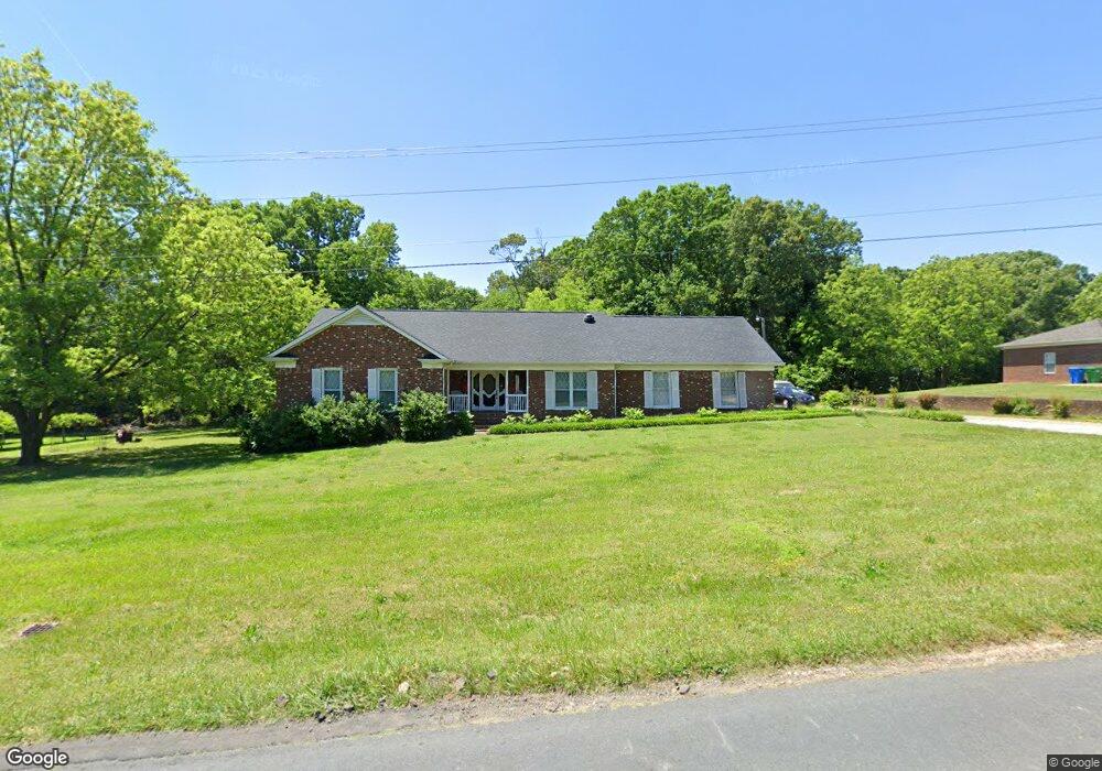
512 Elm St Locust, NC 28097
Estimated Value: $400,155 - $450,000
3
Beds
2
Baths
1,994
Sq Ft
$213/Sq Ft
Est. Value
About This Home
This home is located at 512 Elm St, Locust, NC 28097 and is currently estimated at $424,039, approximately $212 per square foot. 512 Elm St is a home located in Stanly County with nearby schools including Locust Elementary School, West Stanly Middle School, and West Stanly High School.
Ownership History
Date
Name
Owned For
Owner Type
Purchase Details
Closed on
Jun 24, 2011
Sold by
Hatley Judy Hathcock and Hathcock Judy B
Bought by
Blalock Cindy
Current Estimated Value
Home Financials for this Owner
Home Financials are based on the most recent Mortgage that was taken out on this home.
Original Mortgage
$166,500
Outstanding Balance
$114,889
Interest Rate
4.65%
Mortgage Type
New Conventional
Estimated Equity
$309,150
Purchase Details
Closed on
Feb 9, 2006
Sold by
Blacock Cindy H and Blacock Mark B
Bought by
Hathecock Judy B
Create a Home Valuation Report for This Property
The Home Valuation Report is an in-depth analysis detailing your home's value as well as a comparison with similar homes in the area
Home Values in the Area
Average Home Value in this Area
Purchase History
| Date | Buyer | Sale Price | Title Company |
|---|---|---|---|
| Blalock Cindy | $185,000 | None Available | |
| Hathecock Judy B | -- | None Available |
Source: Public Records
Mortgage History
| Date | Status | Borrower | Loan Amount |
|---|---|---|---|
| Open | Blalock Cindy | $166,500 |
Source: Public Records
Tax History Compared to Growth
Tax History
| Year | Tax Paid | Tax Assessment Tax Assessment Total Assessment is a certain percentage of the fair market value that is determined by local assessors to be the total taxable value of land and additions on the property. | Land | Improvement |
|---|---|---|---|---|
| 2025 | $2,783 | $302,526 | $64,590 | $237,936 |
| 2024 | $2,306 | $211,553 | $37,970 | $173,583 |
| 2023 | $2,306 | $211,553 | $37,970 | $173,583 |
| 2022 | $2,410 | $211,553 | $37,970 | $173,583 |
| 2021 | $2,388 | $211,553 | $37,970 | $173,583 |
| 2020 | $2,116 | $178,125 | $32,565 | $145,560 |
| 2019 | $2,138 | $178,125 | $32,565 | $145,560 |
| 2018 | $2,013 | $178,125 | $32,565 | $145,560 |
| 2017 | $2,013 | $178,125 | $32,565 | $145,560 |
| 2016 | $1,876 | $166,047 | $32,430 | $133,617 |
| 2015 | $1,995 | $166,047 | $32,430 | $133,617 |
| 2014 | $1,831 | $166,047 | $32,430 | $133,617 |
Source: Public Records
Map
Nearby Homes
- 606 Elm St
- 124 Hickory Ridge Dr
- 128 Hickory Ridge Dr
- 00 S Beverly Dr
- 105 Berea Baptist Church Rd
- 103 Berea Baptist Church Rd
- 27 Berea Baptist Church Rd
- 708 Redah Ave
- 402 Church St
- 169 Abigail Ln
- 540 Church St
- 24990 Birdhouse Ln Unit 4
- 211 Drive Inn Rd
- 159 Kingston Dr
- 134 Kerri Dawn Ln
- 146 Kerri Dawn Ln
- 417 Kiser Ln
- 174 Willow Creek Dr
- 319 N Central Ave
- 203 Vanderbilt Blvd