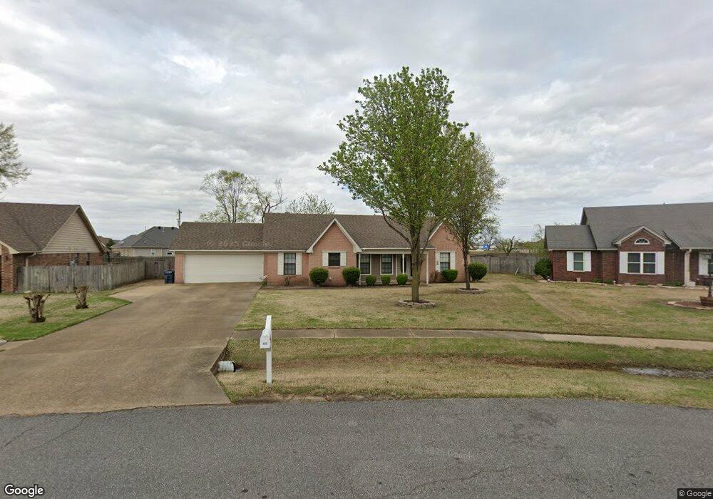
512 Fair Oaks Cir Marion, AR 72364
Estimated Value: $220,999 - $261,000
3
Beds
2
Baths
1,612
Sq Ft
$146/Sq Ft
Est. Value
About This Home
This home is located at 512 Fair Oaks Cir, Marion, AR 72364 and is currently estimated at $235,500, approximately $146 per square foot. 512 Fair Oaks Cir is a home located in Crittenden County with nearby schools including Herbert Carter Global Community Magnet School, Marion Visual Performing Arts Magnet, and Marion Junior High School.
Ownership History
Date
Name
Owned For
Owner Type
Purchase Details
Closed on
Oct 4, 2021
Sold by
Williams Bruce R and Williams Kay M
Bought by
Williams Bruce R and Williams Kay M
Current Estimated Value
Purchase Details
Closed on
Apr 28, 2016
Sold by
Apgar Tiffany A and Apgar Debra A
Bought by
Wells Fargo Bank Na
Purchase Details
Closed on
May 28, 2007
Sold by
Apgar Mark J
Bought by
Key Tiffany A
Purchase Details
Closed on
Feb 12, 2007
Sold by
Apgar Debra A
Bought by
Apgar -Key Tiffany A
Purchase Details
Closed on
Nov 23, 2004
Sold by
Not Provided
Bought by
Key Daniel and Key Tiffany
Create a Home Valuation Report for This Property
The Home Valuation Report is an in-depth analysis detailing your home's value as well as a comparison with similar homes in the area
Home Values in the Area
Average Home Value in this Area
Purchase History
| Date | Buyer | Sale Price | Title Company |
|---|---|---|---|
| Williams Bruce R | -- | None Available | |
| Wells Fargo Bank Na | $102,247 | -- | |
| Key Tiffany A | -- | -- | |
| Apgar -Key Tiffany A | -- | -- | |
| Key Daniel | $130,000 | -- |
Source: Public Records
Tax History Compared to Growth
Tax History
| Year | Tax Paid | Tax Assessment Tax Assessment Total Assessment is a certain percentage of the fair market value that is determined by local assessors to be the total taxable value of land and additions on the property. | Land | Improvement |
|---|---|---|---|---|
| 2024 | $1,784 | $30,310 | $5,600 | $24,710 |
| 2023 | $1,784 | $30,310 | $5,600 | $24,710 |
| 2022 | $1,783 | $30,310 | $5,600 | $24,710 |
| 2021 | $1,647 | $30,310 | $5,600 | $24,710 |
| 2020 | $1,438 | $30,310 | $5,600 | $24,710 |
| 2019 | $1,191 | $23,310 | $5,400 | $17,910 |
| 2018 | $1,257 | $23,310 | $5,400 | $17,910 |
| 2017 | $1,257 | $0 | $0 | $0 |
| 2016 | $1,200 | $23,310 | $5,400 | $17,910 |
| 2015 | $917 | $23,310 | $5,400 | $17,910 |
| 2014 | $1,000 | $24,850 | $5,400 | $19,450 |
Source: Public Records
Map
Nearby Homes
- 1901 State Highway 77
- 713 Carter Dr
- 715 Carter Dr
- 2011 State Highway 77
- 105 Morningside Dr
- 111 Primo Cir
- 99 Meadowbrook Cir
- 132 Morningside Dr
- 103 Stonehenge Cove
- 365 Belle Meade Cove
- 694 Riverwest Cir
- 683 Riverwest Cir
- 292 Shiloh Dr
- 256 Rivertrace Dr
- 802 Chickory Cove
- 800 Chickory Cove
- 829 Sorrell Cir
- 0 Canal St
- 812 Canal St
- 92 S Currie Ave
- 514 Fair Oaks Cir
- 510 Fair Oaks Cir
- 223 Whispering Wind Cir
- 221 Whispering Wind Cir
- 516 Fair Oaks Cir
- 508 Fair Oaks Cir
- 225 Whispering Wind Cir
- 505 Fair Oaks Cir
- 506 Fair Oaks Cir
- 518 Fair Oaks Cir
- 219 Whispering Wind Cir
- 227 Whispering Wind Cir
- 507 Fair Oaks Cir
- 503 Fair Oaks Cir
- 504 Fair Oaks Cir
- 217 Whispering Wind Cir
- 229 Whispering Wind Cir
- 1865 State Highway 77
- 520 Fair Oaks Cir
- 226 Whispering Wind Cir