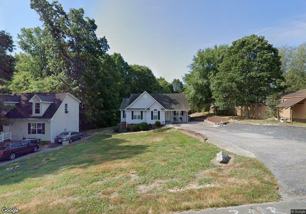
512 Glen Cir Asheboro, NC 27203
Estimated Value: $216,000 - $252,000
Studio
2
Baths
1,330
Sq Ft
$176/Sq Ft
Est. Value
About This Home
This home is located at 512 Glen Cir, Asheboro, NC 27203 and is currently estimated at $234,101, approximately $176 per square foot. 512 Glen Cir is a home located in Randolph County with nearby schools including Balfour Elementary School, North Asheboro Middle School, and Asheboro High School.
Ownership History
Date
Name
Owned For
Owner Type
Purchase Details
Closed on
Jul 1, 2011
Sold by
Crane Samuel and Crane Hannah W
Bought by
Wheless Donna Denise
Current Estimated Value
Home Financials for this Owner
Home Financials are based on the most recent Mortgage that was taken out on this home.
Original Mortgage
$95,027
Outstanding Balance
$65,108
Interest Rate
4.5%
Mortgage Type
FHA
Estimated Equity
$168,993
Purchase Details
Closed on
May 19, 2010
Sold by
Fannie Mae
Bought by
Crane Samuel and Crane Hannah W
Home Financials for this Owner
Home Financials are based on the most recent Mortgage that was taken out on this home.
Original Mortgage
$86,336
Interest Rate
4.83%
Mortgage Type
FHA
Purchase Details
Closed on
Dec 28, 2009
Sold by
Simpson Maria A and Simpson Stanley W
Bought by
Federal National Mortgage Association
Purchase Details
Closed on
Feb 18, 1997
Bought by
Wheless Donna Denise
Create a Home Valuation Report for This Property
The Home Valuation Report is an in-depth analysis detailing your home's value as well as a comparison with similar homes in the area
Home Values in the Area
Average Home Value in this Area
Purchase History
| Date | Buyer | Sale Price | Title Company |
|---|---|---|---|
| Wheless Donna Denise | $97,500 | None Available | |
| Crane Samuel | -- | None Available | |
| Federal National Mortgage Association | $115,488 | None Available | |
| Wheless Donna Denise | $89,000 | -- |
Source: Public Records
Mortgage History
| Date | Status | Borrower | Loan Amount |
|---|---|---|---|
| Open | Wheless Donna Denise | $95,027 | |
| Previous Owner | Crane Samuel | $86,336 |
Source: Public Records
Tax History
| Year | Tax Paid | Tax Assessment Tax Assessment Total Assessment is a certain percentage of the fair market value that is determined by local assessors to be the total taxable value of land and additions on the property. | Land | Improvement |
|---|---|---|---|---|
| 2025 | $2,016 | $152,130 | $23,210 | $128,920 |
| 2024 | $2,016 | $152,130 | $23,210 | $128,920 |
| 2023 | $2,016 | $152,130 | $23,210 | $128,920 |
| 2022 | $1,636 | $113,470 | $20,410 | $93,060 |
| 2021 | $1,636 | $113,470 | $20,410 | $93,060 |
| 2020 | $1,636 | $113,470 | $20,410 | $93,060 |
| 2019 | $1,636 | $113,470 | $20,410 | $93,060 |
| 2018 | $1,507 | $102,720 | $16,560 | $86,160 |
| 2016 | $1,507 | $102,724 | $16,560 | $86,164 |
| 2015 | $1,510 | $102,724 | $16,560 | $86,164 |
| 2014 | $1,474 | $102,724 | $16,560 | $86,164 |
Source: Public Records
Map
Nearby Homes
- 307 Sunrise Ave
- 203 Sunrise Ave
- 1962 & 1966 Lakeview Rd
- 1931 Greenwood Rd
- 2148 Sarina Dr
- 2411 Regency Dr
- 2392 Hickory Forest Dr
- 404 Sharon Ave
- 728 Central Falls Rd
- 734 Central Falls Rd
- 2339 Hickory Forest Dr
- 1240 Old Liberty Rd
- 1684 Pen Oak Dr
- 2411 Whirlwind Ln
- 00-00 4th Park Ave Unit L20-22
- 00-00 4th Park Ave
- 1058 Pearl Ct
- 206 Mcknight St
- 0 1st Park Ave
- 0 Robins Nest Dr
Your Personal Tour Guide
Ask me questions while you tour the home.