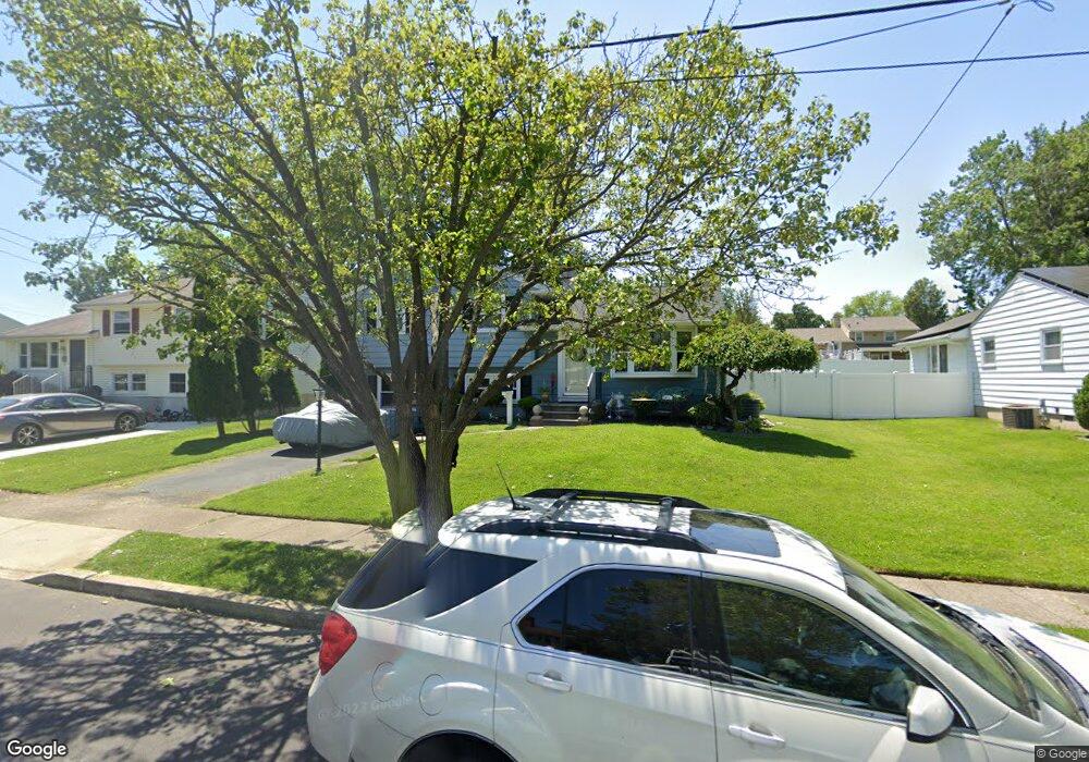
512 Mathews Ave Blackwood, NJ 08012
Estimated Value: $301,000 - $336,000
3
Beds
1
Bath
1,485
Sq Ft
$210/Sq Ft
Est. Value
About This Home
This home is located at 512 Mathews Ave, Blackwood, NJ 08012 and is currently estimated at $312,441, approximately $210 per square foot. 512 Mathews Ave is a home located in Camden County with nearby schools including Highland Regional High School and St. Teresa Regional School.
Ownership History
Date
Name
Owned For
Owner Type
Purchase Details
Closed on
Oct 29, 2008
Sold by
U S Bank Na
Bought by
Hunt Joseph
Current Estimated Value
Home Financials for this Owner
Home Financials are based on the most recent Mortgage that was taken out on this home.
Original Mortgage
$146,072
Interest Rate
6.17%
Mortgage Type
FHA
Purchase Details
Closed on
Jul 3, 2008
Sold by
Mansell Thomas R
Bought by
U S Bank Na
Purchase Details
Closed on
Aug 30, 2005
Sold by
Kay Robert
Bought by
Mansell Thomas R
Home Financials for this Owner
Home Financials are based on the most recent Mortgage that was taken out on this home.
Original Mortgage
$156,400
Interest Rate
6.34%
Purchase Details
Closed on
Oct 30, 2002
Sold by
Duer John S
Bought by
Kay Robert G
Home Financials for this Owner
Home Financials are based on the most recent Mortgage that was taken out on this home.
Original Mortgage
$103,920
Interest Rate
6.16%
Create a Home Valuation Report for This Property
The Home Valuation Report is an in-depth analysis detailing your home's value as well as a comparison with similar homes in the area
Home Values in the Area
Average Home Value in this Area
Purchase History
| Date | Buyer | Sale Price | Title Company |
|---|---|---|---|
| Hunt Joseph | $148,000 | -- | |
| U S Bank Na | $169,134 | -- | |
| Mansell Thomas R | $195,500 | -- | |
| Kay Robert G | $129,000 | -- |
Source: Public Records
Mortgage History
| Date | Status | Borrower | Loan Amount |
|---|---|---|---|
| Previous Owner | Hunt Joseph | $146,072 | |
| Previous Owner | Mansell Thomas R | $156,400 | |
| Previous Owner | Kay Robert G | $103,920 |
Source: Public Records
Tax History Compared to Growth
Tax History
| Year | Tax Paid | Tax Assessment Tax Assessment Total Assessment is a certain percentage of the fair market value that is determined by local assessors to be the total taxable value of land and additions on the property. | Land | Improvement |
|---|---|---|---|---|
| 2025 | $6,519 | $147,200 | $53,000 | $94,200 |
| 2024 | $6,325 | $147,200 | $53,000 | $94,200 |
| 2023 | $6,325 | $147,200 | $53,000 | $94,200 |
| 2022 | $6,257 | $147,200 | $53,000 | $94,200 |
| 2021 | $6,112 | $147,200 | $53,000 | $94,200 |
| 2020 | $6,107 | $147,200 | $53,000 | $94,200 |
| 2019 | $5,966 | $147,200 | $53,000 | $94,200 |
| 2018 | $5,934 | $147,200 | $53,000 | $94,200 |
| 2017 | $5,711 | $147,200 | $53,000 | $94,200 |
| 2016 | $5,576 | $147,200 | $53,000 | $94,200 |
| 2015 | $5,168 | $165,500 | $53,000 | $112,500 |
| 2014 | $5,766 | $165,500 | $53,000 | $112,500 |
Source: Public Records
Map
Nearby Homes
- 531 Estelle Ave
- 143 Grand Ave
- 331 Dearborne Ave
- 197 Indiana Ave
- 10 Frankford Ave
- 248 Davistown Rd
- 169 Indiana Ave
- 127 Jerome Ave
- 602 Linda Ave
- 110 Indiana Ave
- 3 Cloverdale Rd
- 0 Evergreen Ave
- 512 E Church St
- 40 Woodlane Dr
- 134 W Central Ave
- 237 Marshall Ave
- 116 N Pennsylvania Ave
- 155 Lakefront St
- 81 Southwind Dr
- 234 W Church St
- 506 Mathews Ave
- 518 Mathews Ave
- 513 Estelle Ave
- 524 Mathews Ave
- 500 Mathews Ave
- 507 Estelle Ave
- 519 Estelle Ave
- 513 Mathews Ave
- 501 Estelle Ave
- 507 Mathews Ave
- 519 Mathews Ave
- 525 Estelle Ave
- 530 Mathews Ave
- 501 Mathews Ave
- 525 Mathews Ave
- 200 Drexel Ave
- 213 Drexel Ave
- 512 Lehigh Ave
- 512 Estelle Ave
- 219 Drexel Ave