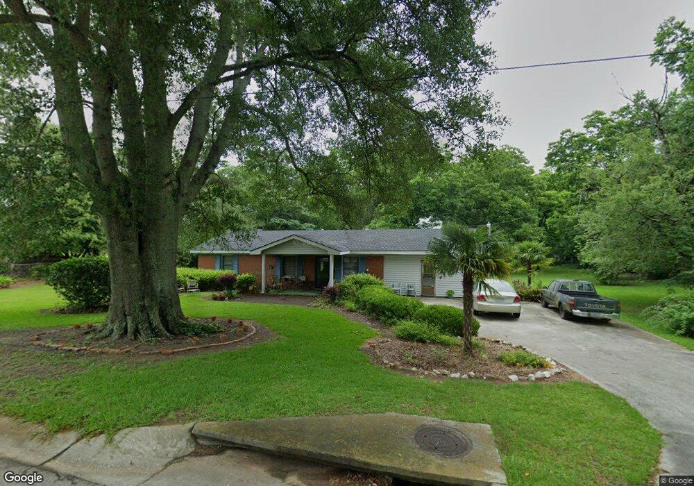
512 N Broad St Doerun, GA 31744
Estimated Value: $124,000 - $217,000
--
Bed
--
Bath
1,532
Sq Ft
$109/Sq Ft
Est. Value
About This Home
This home is located at 512 N Broad St, Doerun, GA 31744 and is currently estimated at $166,686, approximately $108 per square foot. 512 N Broad St is a home with nearby schools including Doerun Elementary School, C.A. Gray Junior High School, and Willie J. Williams Middle School.
Ownership History
Date
Name
Owned For
Owner Type
Purchase Details
Closed on
Sep 18, 2015
Sold by
Shelton Nina F
Bought by
Shelton Nina F and Daniels Dorothy
Current Estimated Value
Purchase Details
Closed on
Jan 18, 2011
Sold by
Daniels John
Bought by
Daniels Dorothy Ruth
Purchase Details
Closed on
Apr 29, 2010
Sold by
Daniels John
Bought by
Daniels John and Daniels Dorothy Ruth
Create a Home Valuation Report for This Property
The Home Valuation Report is an in-depth analysis detailing your home's value as well as a comparison with similar homes in the area
Home Values in the Area
Average Home Value in this Area
Purchase History
| Date | Buyer | Sale Price | Title Company |
|---|---|---|---|
| Shelton Nina F | $58,000 | -- | |
| Daniels Dorothy Ruth | -- | -- | |
| Daniels John | -- | -- |
Source: Public Records
Tax History Compared to Growth
Tax History
| Year | Tax Paid | Tax Assessment Tax Assessment Total Assessment is a certain percentage of the fair market value that is determined by local assessors to be the total taxable value of land and additions on the property. | Land | Improvement |
|---|---|---|---|---|
| 2024 | $1,278 | $41,999 | $6,149 | $35,850 |
| 2023 | $1,086 | $30,749 | $6,149 | $24,600 |
| 2022 | $858 | $28,951 | $6,149 | $22,802 |
| 2021 | $787 | $25,981 | $6,149 | $19,832 |
| 2020 | $801 | $25,981 | $6,149 | $19,832 |
| 2019 | $892 | $26,198 | $6,149 | $20,049 |
| 2018 | $784 | $23,194 | $3,145 | $20,049 |
| 2017 | $779 | $23,194 | $3,145 | $20,049 |
| 2016 | $784 | $23,194 | $3,145 | $20,049 |
| 2015 | $785 | $23,194 | $3,145 | $20,049 |
| 2014 | $807 | $23,194 | $3,145 | $20,049 |
| 2013 | -- | $23,194 | $3,144 | $20,049 |
Source: Public Records
Map
Nearby Homes
- 104 Union Ln
- 825 N Green St
- 715 W Robinson Ave
- 511 W Broad Ave
- 417 W Bay Ave
- 318 E Culpepper Ave
- 512 Hagin Still Rd
- 0 Sam Sells Rd
- 2329 Evergreen Rd
- 340 Belk Rd
- 1791 Funston Sigsbee Rd
- 4409 Georgia 112
- 1485 Bay Rd
- 712 Blackberry Rd
- 0 Brest Station Rd Unit 10642758
- 156 E Maple St
- 155 N Kreuger St
- 378 Old S R 33
- 330/332 Debbie Ln
- 9765 Morey Hill Rd
- 222 W Union Dr
- 446 N Broad St
- 207 W Cemetary Ave
- 123 W Cemetary Ave
- 304 Hadden Ave
- 223 Union Ln
- 434 N Broad St
- 615 N Broad St
- 439 N Broad St
- 120 W Union Cir
- 623 N Broad St
- 408 N Broad St
- 608 N Green St
- 622 N Green St
- 413 N Broad St
- 706 N Green St
- 707 N Broad St
- 614 N Green St
- 714 N Green St
- 411 N Church St