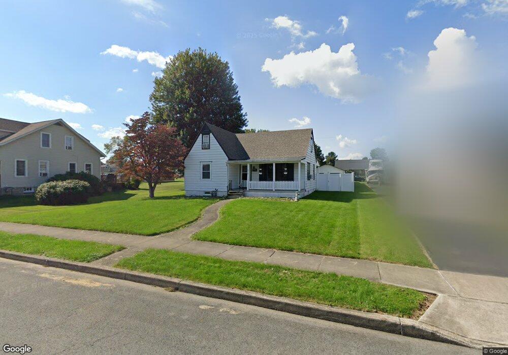
512 N High St Selinsgrove, PA 17870
Estimated Value: $194,000 - $230,000
--
Bed
--
Bath
--
Sq Ft
10,019
Sq Ft Lot
About This Home
This home is located at 512 N High St, Selinsgrove, PA 17870 and is currently estimated at $212,126. 512 N High St is a home located in Snyder County with nearby schools including Selinsgrove Area Elementary School, Selinsgrove Intermediate School, and Selinsgrove Area Middle School.
Ownership History
Date
Name
Owned For
Owner Type
Purchase Details
Closed on
Nov 6, 2020
Sold by
Royer Jennifer L
Bought by
Asher Elizabeth K
Current Estimated Value
Home Financials for this Owner
Home Financials are based on the most recent Mortgage that was taken out on this home.
Original Mortgage
$170,000
Outstanding Balance
$151,276
Interest Rate
2.8%
Mortgage Type
New Conventional
Estimated Equity
$60,850
Purchase Details
Closed on
Aug 25, 2016
Sold by
Hall Linda L
Bought by
Royer Jennifer L
Home Financials for this Owner
Home Financials are based on the most recent Mortgage that was taken out on this home.
Original Mortgage
$146,015
Interest Rate
3.43%
Mortgage Type
New Conventional
Create a Home Valuation Report for This Property
The Home Valuation Report is an in-depth analysis detailing your home's value as well as a comparison with similar homes in the area
Home Values in the Area
Average Home Value in this Area
Purchase History
| Date | Buyer | Sale Price | Title Company |
|---|---|---|---|
| Asher Elizabeth K | $170,000 | Multi Cnty Land Abstract Co | |
| Royer Jennifer L | $142,000 | None Available |
Source: Public Records
Mortgage History
| Date | Status | Borrower | Loan Amount |
|---|---|---|---|
| Open | Asher Elizabeth K | $170,000 | |
| Previous Owner | Royer Jennifer L | $146,015 |
Source: Public Records
Tax History Compared to Growth
Tax History
| Year | Tax Paid | Tax Assessment Tax Assessment Total Assessment is a certain percentage of the fair market value that is determined by local assessors to be the total taxable value of land and additions on the property. | Land | Improvement |
|---|---|---|---|---|
| 2025 | $1,889 | $15,790 | $3,120 | $12,670 |
| 2024 | $1,773 | $15,790 | $3,120 | $12,670 |
| 2023 | $708 | $15,790 | $3,120 | $12,670 |
| 2022 | $1,702 | $15,790 | $3,120 | $12,670 |
| 2021 | $1,686 | $15,790 | $3,120 | $12,670 |
| 2020 | $1,679 | $15,790 | $3,120 | $12,670 |
| 2019 | $1,671 | $15,790 | $3,120 | $12,670 |
| 2018 | $1,655 | $15,790 | $3,120 | $12,670 |
| 2017 | $1,639 | $15,790 | $3,120 | $12,670 |
| 2016 | $881 | $15,790 | $3,120 | $12,670 |
| 2015 | $58,127 | $15,790 | $3,120 | $12,670 |
| 2014 | $58,127 | $15,790 | $3,120 | $12,670 |
Source: Public Records
Map
Nearby Homes
- 500 N Orange St
- 722 N 8th St
- 511 N 10th St
- 207 Orange St Unit 209
- 211 W Pine St
- 223 E Pine St
- 00 S Market St
- Lot 1 522 Route S
- 20 Quarry Rd
- 321 Pleasant Dr
- 9130 State Route 147
- 1262 N Old Trail
- 456 State School Rd
- 0 Mill Rd
- 0 Roosevelt Ave
- 12 Minton Dr
- 594 Augusta Dr
- 107 Saint Andrews Way
- 81 Saint Andrews Way
- 79 Saint Andrews Way