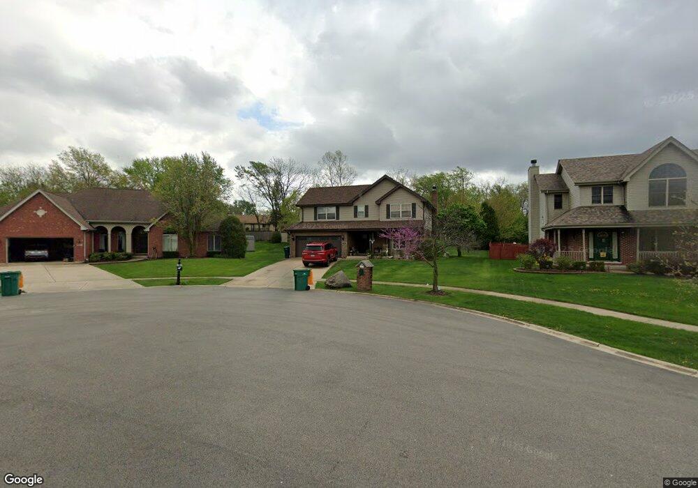
512 Navajo Ct New Lenox, IL 60451
Estimated Value: $427,155 - $502,000
--
Bed
--
Bath
--
Sq Ft
0.32
Acres
About This Home
This home is located at 512 Navajo Ct, New Lenox, IL 60451 and is currently estimated at $476,289. 512 Navajo Ct is a home located in Will County with nearby schools including Haines Elementary School, Oster-Oakview School, and Lincoln Way West.
Ownership History
Date
Name
Owned For
Owner Type
Purchase Details
Closed on
Apr 9, 2024
Sold by
Chisholm Donald C and Chisholm Genelle M
Bought by
Chisholm Land Trust and Chisholm
Current Estimated Value
Purchase Details
Closed on
Aug 21, 2000
Sold by
Standard Bank & Trust Company
Bought by
Chisholm Donald C and Chisholm Genelle M
Home Financials for this Owner
Home Financials are based on the most recent Mortgage that was taken out on this home.
Original Mortgage
$183,000
Interest Rate
8.26%
Create a Home Valuation Report for This Property
The Home Valuation Report is an in-depth analysis detailing your home's value as well as a comparison with similar homes in the area
Home Values in the Area
Average Home Value in this Area
Purchase History
| Date | Buyer | Sale Price | Title Company |
|---|---|---|---|
| Chisholm Land Trust | -- | None Listed On Document | |
| Chisholm Donald C | $216,500 | -- |
Source: Public Records
Mortgage History
| Date | Status | Borrower | Loan Amount |
|---|---|---|---|
| Previous Owner | Chisholm Donald C | $183,000 |
Source: Public Records
Tax History Compared to Growth
Tax History
| Year | Tax Paid | Tax Assessment Tax Assessment Total Assessment is a certain percentage of the fair market value that is determined by local assessors to be the total taxable value of land and additions on the property. | Land | Improvement |
|---|---|---|---|---|
| 2024 | $10,929 | $139,687 | $33,732 | $105,955 |
| 2023 | $10,929 | $127,335 | $30,749 | $96,586 |
| 2022 | $9,847 | $117,305 | $28,327 | $88,978 |
| 2021 | $9,382 | $110,322 | $26,641 | $83,681 |
| 2020 | $9,097 | $106,385 | $25,690 | $80,695 |
| 2019 | $8,802 | $103,086 | $24,893 | $78,193 |
| 2018 | $8,562 | $99,532 | $24,035 | $75,497 |
| 2017 | $8,326 | $96,671 | $23,344 | $73,327 |
| 2016 | $8,122 | $94,083 | $22,719 | $71,364 |
| 2015 | $7,914 | $91,122 | $22,004 | $69,118 |
| 2014 | $7,914 | $89,997 | $21,732 | $68,265 |
| 2013 | $7,914 | $91,210 | $22,025 | $69,185 |
Source: Public Records
Map
Nearby Homes
- 506 Navajo Dr
- 3301 Irondale Ct
- 3420 Avondale Ln
- 0 Silver Cross Blvd
- 1301 Silver Cross Blvd
- 1001 Scottsdale Ln
- 1999 Silver Cross Blvd
- 14119 W Maple Rd
- 1006 Mountain View Dr
- 1106 Weston Way
- 200 Montieth St
- 937 Saddle Ridge Dr
- 939 Saddle Ridge Dr
- 2417 Fleetwood Dr
- 2602 Timber Springs Dr
- 2412 Fleetwood Dr
- 1500 Ramp
- 1101 Colonial Dr Unit 1
- 2208 Fiesta Dr
- 1111 Colonial Dr Unit 1
- 510 Navajo Ct
- 514 Navajo Ct Unit 1
- 508 Navajo Dr
- 1611 Pine Grove Ln
- 516 Navajo Ct
- 513 Navajo Ct
- 1601 Pine Grove Ln
- 1621 Pine Grove Ln
- 504 Navajo Dr
- 515 Navajo Ct
- 507 Navajo Dr
- 509 Navajo Dr
- 505 Navajo Dr
- 3309 Navajo Dr
- 3306 Navajo Dr
- 502 Navajo Dr
- 1701 Pine Grove Ln
- 503 Navajo Dr
- 3304 Navajo Dr
- 3307 Navajo Dr