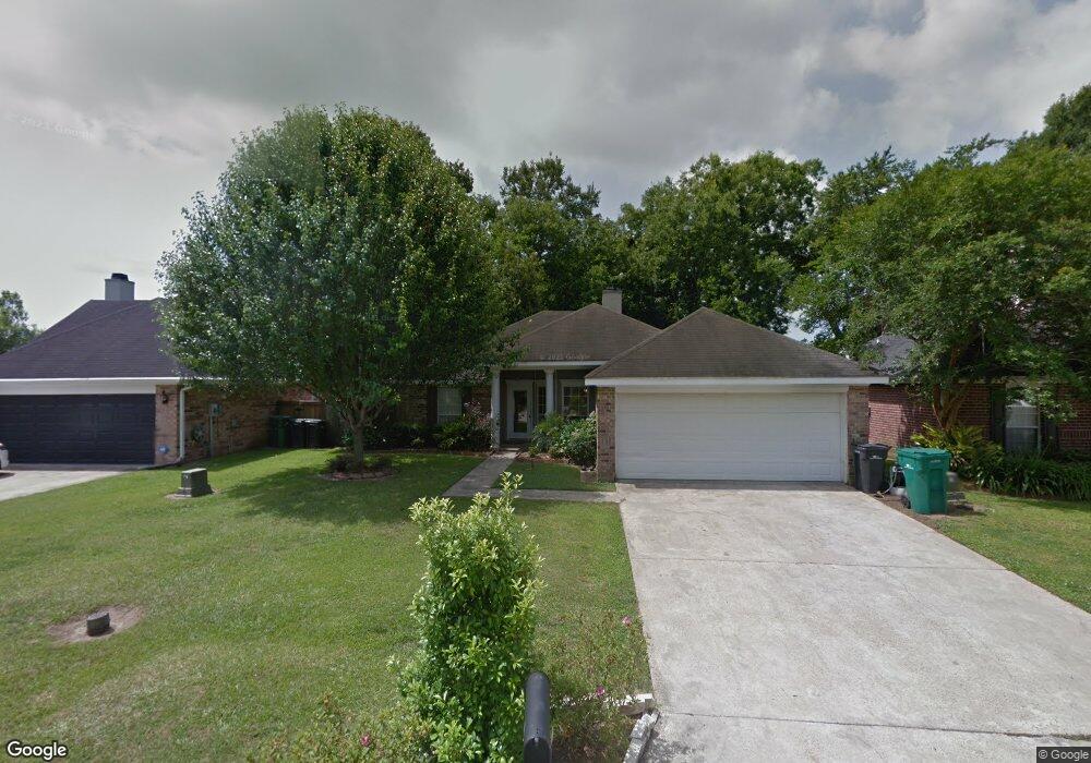
512 Pear Tree Cir Broussard, LA 70518
Estimated Value: $205,627 - $220,000
--
Bed
--
Bath
1,300
Sq Ft
$165/Sq Ft
Est. Value
About This Home
This home is located at 512 Pear Tree Cir, Broussard, LA 70518 and is currently estimated at $214,407, approximately $164 per square foot. 512 Pear Tree Cir is a home located in Lafayette Parish with nearby schools including Katharine Drexel Elementary School, Martial Billeaud Elementary School, and Broussard Middle School.
Ownership History
Date
Name
Owned For
Owner Type
Purchase Details
Closed on
Nov 24, 2021
Sold by
Evolutionary Builders
Bought by
Mccoy Deidra
Current Estimated Value
Purchase Details
Closed on
Apr 1, 2016
Sold by
Alpha Capital Us Bank
Bought by
Alleman Danielle Rochelle
Purchase Details
Closed on
Jun 14, 2012
Sold by
Rochelle Allemsn Danielle
Bought by
Alpha Capital
Purchase Details
Closed on
Apr 22, 2007
Sold by
Alleman Danielle Rochelle and State Of Louisiana
Bought by
Mississippi Land Company Inc
Create a Home Valuation Report for This Property
The Home Valuation Report is an in-depth analysis detailing your home's value as well as a comparison with similar homes in the area
Home Values in the Area
Average Home Value in this Area
Purchase History
| Date | Buyer | Sale Price | Title Company |
|---|---|---|---|
| Mccoy Deidra | $45,000 | None Available | |
| Alleman Danielle Rochelle | $13,711 | None Available | |
| Alpha Capital | -- | None Available | |
| Mississippi Land Company Inc | -- | None Available |
Source: Public Records
Tax History Compared to Growth
Tax History
| Year | Tax Paid | Tax Assessment Tax Assessment Total Assessment is a certain percentage of the fair market value that is determined by local assessors to be the total taxable value of land and additions on the property. | Land | Improvement |
|---|---|---|---|---|
| 2024 | $1,525 | $17,600 | $2,000 | $15,600 |
| 2023 | $1,525 | $14,350 | $2,000 | $12,350 |
| 2022 | $1,222 | $14,140 | $2,000 | $12,140 |
| 2021 | $1,227 | $14,140 | $2,000 | $12,140 |
| 2020 | $1,226 | $14,140 | $2,000 | $12,140 |
| 2019 | $1,165 | $14,140 | $2,000 | $12,140 |
| 2018 | $1,191 | $14,140 | $2,000 | $12,140 |
| 2017 | $1,190 | $14,140 | $2,000 | $12,140 |
| 2015 | $1,186 | $14,140 | $2,000 | $12,140 |
| 2013 | -- | $14,140 | $2,000 | $12,140 |
Source: Public Records
Map
Nearby Homes
- 108 Portsmouth Dr
- 100 N Eola Rd
- 102 Riesling Cir
- 104 Bismark Dr
- 1036 Garber Rd
- Cali Plan at Oakmont
- Denton Plan at Oakmont
- Justin Plan at Oakmont
- Kingston Plan at Oakmont
- Rosemont Plan at Oakmont
- Huntsville Plan at Oakmont
- Lakeview Plan at Oakmont
- Fargo Plan at Oakmont
- Bellvue Plan at Oakmont
- 101 Snapping Ln
- 104 Tortoise Ln
- 107 Snapping Ln
- 111 Tortoise Ln
- 103 Chattanooga Place
- 116 Cypress Ridge Rd
- 514 Pear Tree Cir
- 510 Pear Tree Cir
- 508 Pear Tree Cir
- 516 Pear Tree Cir
- 511 Pear Tree Cir
- 509 Pear Tree Cir
- 106 Berrybrook Ave
- 104 Berrybrook Ave
- 506 Pear Tree Cir
- 507 Pear Tree Cir
- 518 Pear Tree Cir
- 102 Berrybrook Ave
- 600 Pear Tree Cir
- 505 Pear Tree Cir
- 110 Berrybrook Ave
- 504 Pear Tree Cir
- 602 Pear Tree Cir
- 100 Berrybrook Ave
- 103 Weeping Willow Blvd
- 105 Berrybrook Ave