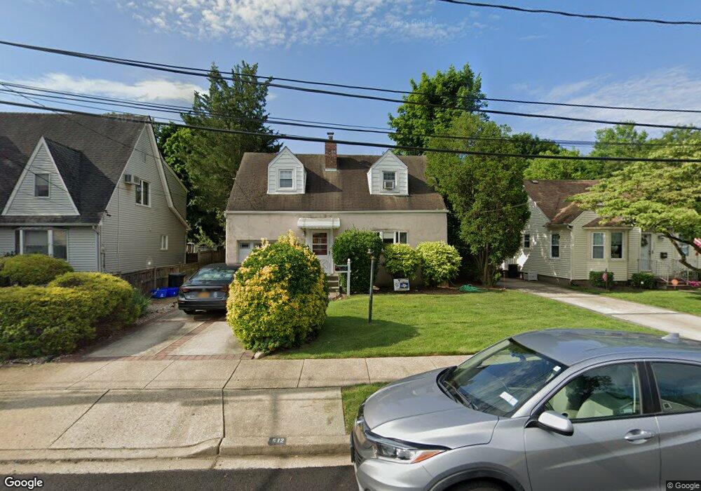
512 Portland Ave North Baldwin, NY 11510
Estimated Value: $504,376 - $611,000
--
Bed
1
Bath
888
Sq Ft
$628/Sq Ft
Est. Value
About This Home
This home is located at 512 Portland Ave, North Baldwin, NY 11510 and is currently estimated at $557,688, approximately $628 per square foot. 512 Portland Ave is a home located in Nassau County with nearby schools including Baldwin Senior High School.
Ownership History
Date
Name
Owned For
Owner Type
Purchase Details
Closed on
Jul 24, 2001
Sold by
Reilly Daniel
Bought by
Croshere Robert C
Current Estimated Value
Purchase Details
Closed on
Jan 17, 1996
Sold by
Thomas Carolyn
Bought by
Reilly Daniel and Reilly Dawn
Home Financials for this Owner
Home Financials are based on the most recent Mortgage that was taken out on this home.
Original Mortgage
$111,900
Interest Rate
7.13%
Create a Home Valuation Report for This Property
The Home Valuation Report is an in-depth analysis detailing your home's value as well as a comparison with similar homes in the area
Home Values in the Area
Average Home Value in this Area
Purchase History
| Date | Buyer | Sale Price | Title Company |
|---|---|---|---|
| Croshere Robert C | $225,500 | James Burdi | |
| Reilly Daniel | $115,400 | -- |
Source: Public Records
Mortgage History
| Date | Status | Borrower | Loan Amount |
|---|---|---|---|
| Previous Owner | Reilly Daniel | $111,900 |
Source: Public Records
Tax History Compared to Growth
Tax History
| Year | Tax Paid | Tax Assessment Tax Assessment Total Assessment is a certain percentage of the fair market value that is determined by local assessors to be the total taxable value of land and additions on the property. | Land | Improvement |
|---|---|---|---|---|
| 2025 | $10,788 | $385 | $160 | $225 |
| 2024 | $3,031 | $385 | $160 | $225 |
| 2023 | $9,796 | $385 | $160 | $225 |
| 2022 | $9,796 | $385 | $160 | $225 |
| 2021 | $13,301 | $373 | $155 | $218 |
| 2020 | $9,813 | $565 | $532 | $33 |
| 2019 | $9,516 | $565 | $532 | $33 |
| 2018 | $8,908 | $565 | $0 | $0 |
| 2017 | $5,303 | $565 | $532 | $33 |
| 2016 | $8,026 | $565 | $532 | $33 |
| 2015 | $2,584 | $565 | $532 | $33 |
| 2014 | $2,584 | $565 | $532 | $33 |
| 2013 | $2,420 | $565 | $532 | $33 |
Source: Public Records
Map
Nearby Homes
- 555 Portland Ave
- 1874 Rockville Dr
- 569 Seaman Ave
- 578 Seaman Ave
- 19 Meadow Ln
- 1905 Bryant Place
- 1887 Bryant Place
- 1900 Carleton Place
- 495 Emerson Ave
- 549 Emerson Ave
- 441 New York Ave
- 610 Emerson Ave
- 1875 Harte St
- 1869 Harte St
- 134 Fonda Rd
- 566 Stowe Ave
- 2 Florence St
- 639 Lakeview Ave
- 2 Twain St
- 39 Gateway
- 506 Portland Ave
- 516 Portland Ave
- 502 Portland Ave
- 511 Ashland Ave
- 507 Ashland Ave
- 517 Ashland Ave
- 2014 Chestnut St
- 2010 Chestnut St
- 496 Portland Ave
- 2020 Chestnut St
- 503 Ashland Ave
- 515 Portland Ave
- 511 Portland Ave
- 519 Portland Ave
- 525 Ashland Ave
- 497 Ashland Ave
- 525 Portland Ave
- 499 Portland Ave
- 505 Portland Ave
- 531 Ashland Ave