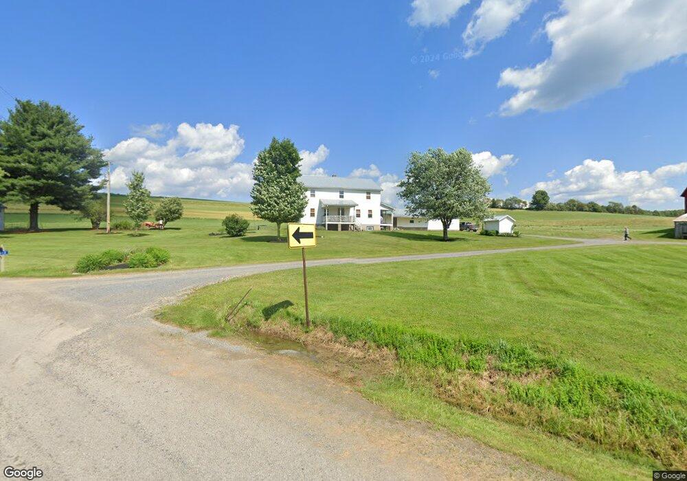
512 Pushersiding Rd Ulysses, PA 16948
Estimated Value: $223,000
--
Bed
--
Bath
1,200
Sq Ft
$186/Sq Ft
Est. Value
About This Home
This home is located at 512 Pushersiding Rd, Ulysses, PA 16948 and is currently estimated at $223,000, approximately $185 per square foot. 512 Pushersiding Rd is a home located in Potter County with nearby schools including Northern Potter Children's School and Northern Potter Junior/Senior High School.
Ownership History
Date
Name
Owned For
Owner Type
Purchase Details
Closed on
Dec 29, 2011
Sold by
Yoder Aden L and Yoder Annie
Bought by
Kosa E Gene and Kosa Kurt A
Current Estimated Value
Home Financials for this Owner
Home Financials are based on the most recent Mortgage that was taken out on this home.
Original Mortgage
$425,000
Outstanding Balance
$291,646
Interest Rate
4%
Mortgage Type
Purchase Money Mortgage
Estimated Equity
-$68,646
Create a Home Valuation Report for This Property
The Home Valuation Report is an in-depth analysis detailing your home's value as well as a comparison with similar homes in the area
Home Values in the Area
Average Home Value in this Area
Purchase History
| Date | Buyer | Sale Price | Title Company |
|---|---|---|---|
| Kosa E Gene | $423,500 | None Available |
Source: Public Records
Mortgage History
| Date | Status | Borrower | Loan Amount |
|---|---|---|---|
| Open | Kosa E Gene | $425,000 |
Source: Public Records
Tax History Compared to Growth
Tax History
| Year | Tax Paid | Tax Assessment Tax Assessment Total Assessment is a certain percentage of the fair market value that is determined by local assessors to be the total taxable value of land and additions on the property. | Land | Improvement |
|---|---|---|---|---|
| 2025 | $5,825 | $80,480 | $33,000 | $47,480 |
| 2024 | $5,444 | $80,480 | $33,000 | $47,480 |
| 2023 | $4,375 | $80,480 | $33,000 | $47,480 |
| 2022 | $4,231 | $80,480 | $33,000 | $47,480 |
| 2021 | $4,231 | $80,480 | $33,000 | $47,480 |
| 2020 | $4,166 | $80,480 | $33,000 | $47,480 |
| 2019 | $4,091 | $80,480 | $33,000 | $47,480 |
| 2018 | $3,947 | $80,480 | $33,000 | $47,480 |
| 2017 | -- | $80,480 | $33,000 | $47,480 |
| 2016 | $3,729 | $80,480 | $33,000 | $47,480 |
| 2015 | -- | $80,480 | $33,000 | $47,480 |
| 2012 | -- | $80,480 | $33,000 | $47,480 |
Source: Public Records
Map
Nearby Homes
- 101 Cowburn Rd
- 359 Gazdag Rd
- 0 N Brookland Rd Unit 31722991
- 0 Hamilton Rd
- 313 N Brookland Rd
- 313 N Brookland Rd N
- 514 Kidney Rd
- 0 T455
- 350 Brown Rd
- 301 Brown Rd
- 2955 Genesee Mills Rd
- 1508 Peet Brook Rd
- 142 Main St
- 436 Teeter Rd
- 00 Ellisburg Rd
- 1358 S Brookland Rd
- 49 Outback Ln
- 0 Paynesville Hill Rd
- 1060 Brookland Road (Lot C)
- 1070
- 471 Pushersiding Rd
- 439 Pushersiding Rd
- 172 Kibbeville Rd
- 582 Pushersiding Rd
- 1384 State Route 49 W
- 39 Kibbeville Rd
- 759 Pushersiding Rd
- 759 Pushersiding Rd
- 736 Pushersiding Rd
- 37 Kibbeville Rd
- 31 Kibbeville Rd
- 1204 State Route 49 W
- 1425 State Route 49 W
- 1860 State Route 49 W
- 1848 State Route 49 W
- 1587 State Route 49 W
- 1202 State Route 49 W
- 239 Pushersiding Rd
- 1818 Route 49
- RR 1 Box 1820 Route 49