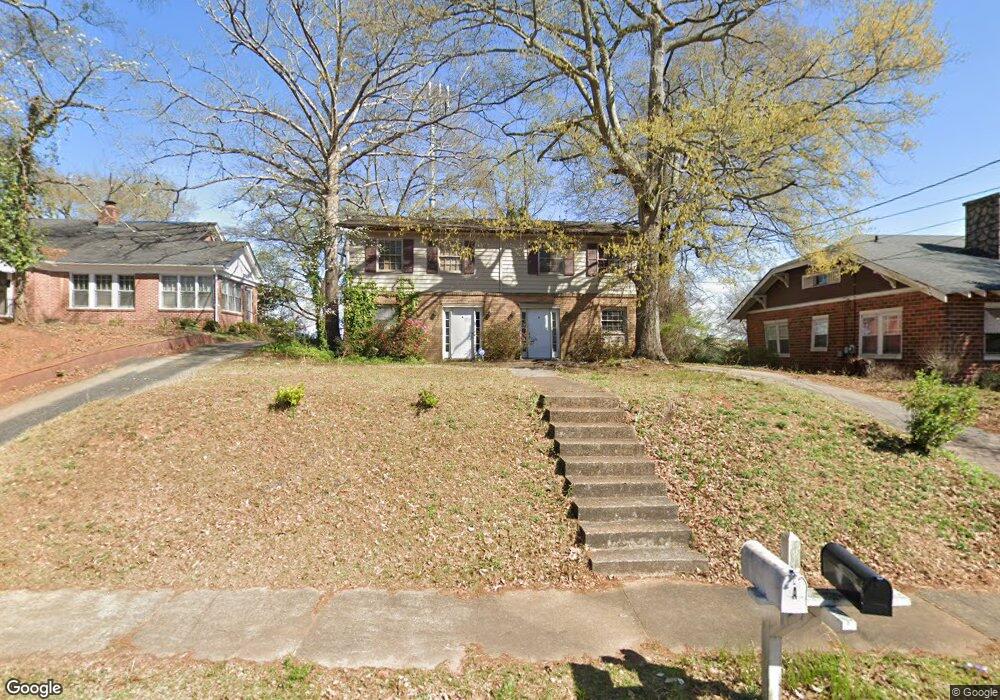
512 Ridley Ave Lagrange, GA 30240
Estimated Value: $176,000 - $234,534
4
Beds
2
Baths
2,706
Sq Ft
$76/Sq Ft
Est. Value
About This Home
This home is located at 512 Ridley Ave, Lagrange, GA 30240 and is currently estimated at $205,884, approximately $76 per square foot. 512 Ridley Ave is a home located in Troup County with nearby schools including Franklin Forest Elementary School, Hollis Hand Elementary School, and Ethel W. Kight Elementary School.
Ownership History
Date
Name
Owned For
Owner Type
Purchase Details
Closed on
Feb 27, 2024
Sold by
Porter William
Bought by
512 Ridley Avenue Llc
Current Estimated Value
Purchase Details
Closed on
Feb 23, 2023
Sold by
Purcell Jonathan
Bought by
Porter William
Purchase Details
Closed on
Sep 9, 1982
Sold by
Purcell Mark Henry
Bought by
Purcell Dupree
Purchase Details
Closed on
Sep 7, 1982
Sold by
Purcell Dupree
Bought by
Purcell Mark Henry
Create a Home Valuation Report for This Property
The Home Valuation Report is an in-depth analysis detailing your home's value as well as a comparison with similar homes in the area
Purchase History
| Date | Buyer | Sale Price | Title Company |
|---|---|---|---|
| 512 Ridley Avenue Llc | -- | -- | |
| Porter William | $129,530 | -- | |
| Purcell Dupree | $78,000 | -- | |
| Purcell Mark Henry | -- | -- |
Source: Public Records
Tax History
| Year | Tax Paid | Tax Assessment Tax Assessment Total Assessment is a certain percentage of the fair market value that is determined by local assessors to be the total taxable value of land and additions on the property. | Land | Improvement |
|---|---|---|---|---|
| 2025 | $2,321 | $85,120 | $4,840 | $80,280 |
| 2024 | $2,192 | $80,360 | $4,840 | $75,520 |
| 2023 | $1,448 | $53,080 | $3,000 | $50,080 |
| 2022 | $1,391 | $49,840 | $3,000 | $46,840 |
| 2021 | $1,273 | $42,200 | $3,000 | $39,200 |
| 2020 | $1,273 | $42,200 | $3,000 | $39,200 |
| 2019 | $1,155 | $38,280 | $3,000 | $35,280 |
| 2018 | $995 | $33,000 | $3,000 | $30,000 |
| 2017 | $1,027 | $34,040 | $3,000 | $31,040 |
| 2016 | $995 | $32,997 | $3,000 | $29,997 |
| 2015 | $998 | $33,026 | $3,029 | $29,997 |
| 2014 | $952 | $31,447 | $3,029 | $28,418 |
| 2013 | -- | $33,663 | $3,032 | $30,631 |
Source: Public Records
Map
Nearby Homes
- 0 Ridley Ave Unit 10550104
- 609 Ridley Ave
- 707 Ridley Ave
- 611 Ridley Ave
- 615 Ridley Ave
- 709 Ridley Ave
- 301 E Bacon St
- 219 Banks St
- 109 Thomas St
- 222 Beechwood Cir
- 102 Dogwood Dr
- 202 Park Hill Dr
- 206 Broad St
- 706 N Harlem Cir
- 131 Foch St
- 105 Saynor Cir
- 900 North St
- 101 McGee St
- 110 Russell St
- 616 S Harlem Cir
- 514 Ridley Ave
- 510 Ridley Ave
- 508 Ridley Ave
- 516 Ridley Ave
- 517 Ridley Ave
- 513 Ridley Ave
- 515 Ridley Ave
- 506 Ridley Ave
- 511 Ridley Ave Unit 14
- 511 Ridley Ave
- 511 Ridley Ave Unit N/A
- 600 Ridley Ave
- 103 Highland Ave
- 504 Ridley Ave
- 100 Highland Ave
- 509 Ridley Ave
- 502 Ridley Ave
- 602 Ridley Ave
- 507 Ridley Ave
- 107 Highland Ave
Your Personal Tour Guide
Ask me questions while you tour the home.