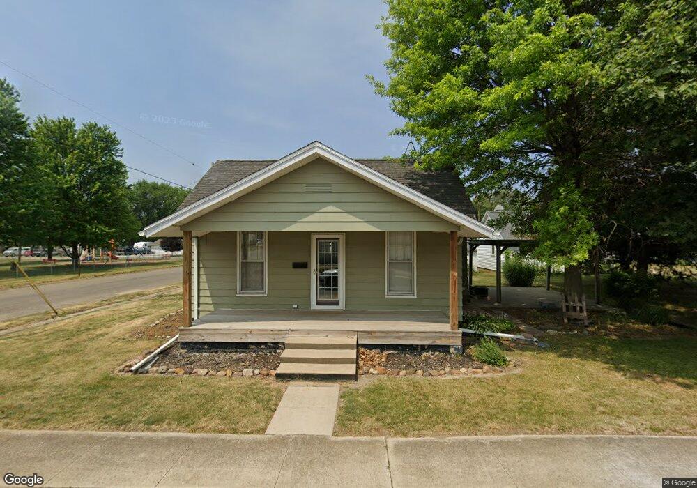
512 S Jefferson St Lewistown, IL 61542
Estimated Value: $54,098 - $65,000
--
Bed
--
Bath
--
Sq Ft
6,403
Sq Ft Lot
About This Home
This home is located at 512 S Jefferson St, Lewistown, IL 61542 and is currently estimated at $59,275. 512 S Jefferson St is a home located in Fulton County with nearby schools including Central Elementary School, Lewistown Elementary School, and Lewistown Junior/Senior High School.
Ownership History
Date
Name
Owned For
Owner Type
Purchase Details
Closed on
May 10, 2024
Sold by
Hoffman Richard N and Hoffman Janet S
Bought by
Strube Mary A
Current Estimated Value
Home Financials for this Owner
Home Financials are based on the most recent Mortgage that was taken out on this home.
Original Mortgage
$50,505
Outstanding Balance
$49,670
Interest Rate
6%
Mortgage Type
Construction
Estimated Equity
$9,605
Create a Home Valuation Report for This Property
The Home Valuation Report is an in-depth analysis detailing your home's value as well as a comparison with similar homes in the area
Home Values in the Area
Average Home Value in this Area
Purchase History
| Date | Buyer | Sale Price | Title Company |
|---|---|---|---|
| Strube Mary A | $50,000 | Terrill Title |
Source: Public Records
Mortgage History
| Date | Status | Borrower | Loan Amount |
|---|---|---|---|
| Open | Strube Mary A | $50,505 |
Source: Public Records
Tax History Compared to Growth
Tax History
| Year | Tax Paid | Tax Assessment Tax Assessment Total Assessment is a certain percentage of the fair market value that is determined by local assessors to be the total taxable value of land and additions on the property. | Land | Improvement |
|---|---|---|---|---|
| 2024 | $1,556 | $18,670 | $1,540 | $17,130 |
| 2023 | $1,556 | $17,860 | $1,470 | $16,390 |
| 2022 | $1,611 | $17,860 | $1,470 | $16,390 |
| 2021 | $1,611 | $15,840 | $1,470 | $14,370 |
| 2020 | $1,516 | $15,310 | $1,420 | $13,890 |
| 2019 | $1,550 | $15,550 | $1,440 | $14,110 |
| 2018 | $1,538 | $15,250 | $1,410 | $13,840 |
| 2017 | $1,488 | $15,250 | $1,410 | $13,840 |
| 2016 | $1,473 | $14,730 | $1,360 | $13,370 |
| 2015 | $735 | $14,730 | $1,360 | $13,370 |
| 2013 | -- | $16,310 | $1,330 | $14,980 |
| 2012 | -- | $15,910 | $1,300 | $14,610 |
Source: Public Records
Map
Nearby Homes
- 200 W Avenue B
- 330 W Avenue G
- 704 S Main St
- 376 W Euclid Ave
- 111 N Broadway St
- 101 W Macarthur Ave
- 13 Melrose Ln
- 1124 S Illinois St
- 000 Highway 24
- 1026 N Main St
- 602 E Nimintz Ave
- 15937 U S 24
- 0 N Highway 9 County Rd Unit RMAPA1260470
- 1428 N Main St
- 12676 E County 14 Hwy
- 16853 N Wright Rd
- County 14 Lot Unit WP001
- 14953 E Grain Bin Rd
- 10315 E County 14 Hwy
- 10206 E County 14 Hwy
- 515 S Madison St
- 513 S Jefferson St
- 511 S Madison St
- 509 S Madison St
- 304 W D Ave
- 221 West Ave E
- 304 W Avenue D
- 221 W Avenue Ave E
- 222 W Avenue D
- 516 S Madison St
- 410 S Jefferson St
- 320 W Avenue D
- 504 S Madison St
- 221 W Avenue E
- 411 S Jefferson St
- 604 S Adams St
- 615 S Jefferson St
- 422 W Avenue E
- 409 S Madison St
- 604 S Madison St