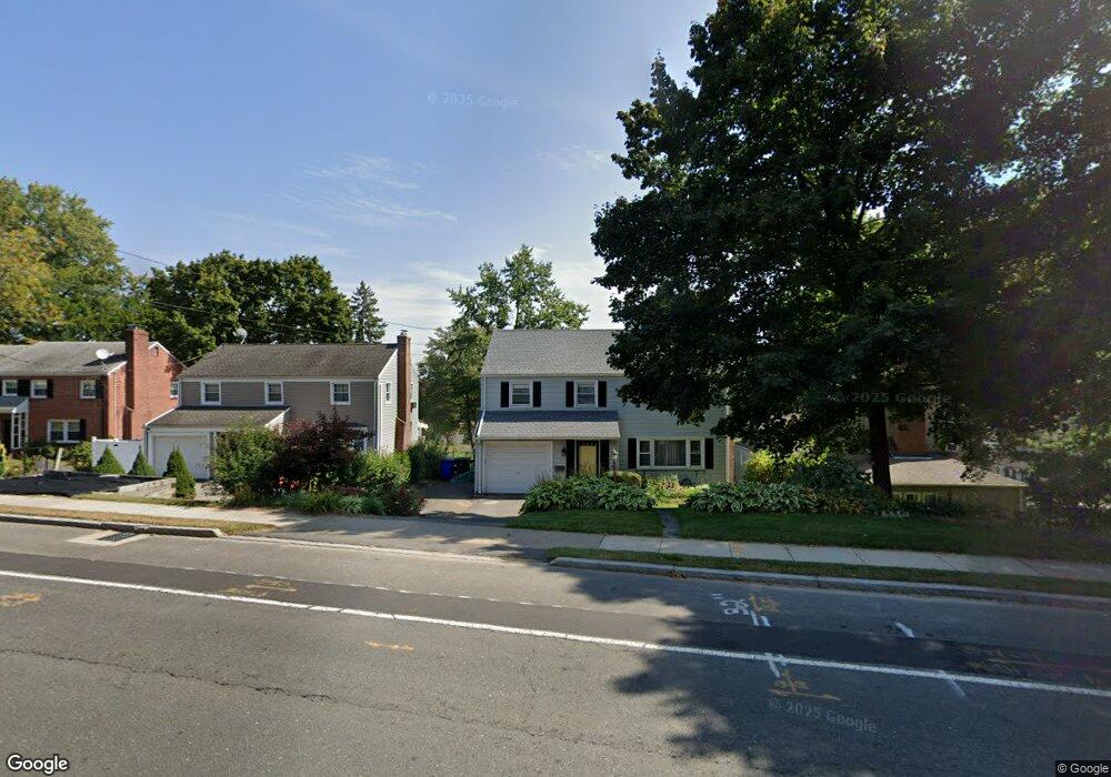
512 S Main St West Hartford, CT 06110
Estimated Value: $392,000 - $476,000
4
Beds
3
Baths
1,504
Sq Ft
$287/Sq Ft
Est. Value
About This Home
This home is located at 512 S Main St, West Hartford, CT 06110 and is currently estimated at $431,201, approximately $286 per square foot. 512 S Main St is a home located in Hartford County with nearby schools including Wolcott School, Sedgwick Middle School, and Conard High School.
Ownership History
Date
Name
Owned For
Owner Type
Purchase Details
Closed on
Feb 4, 2013
Sold by
Cox Millicent
Bought by
Cox Richard L and Cox Millicent
Current Estimated Value
Purchase Details
Closed on
Jan 31, 2002
Sold by
Michalowski Christian and Michalowski Pina M
Bought by
Wilson Millicent G
Home Financials for this Owner
Home Financials are based on the most recent Mortgage that was taken out on this home.
Original Mortgage
$150,000
Interest Rate
7.15%
Purchase Details
Closed on
Jun 1, 1995
Sold by
Bucceri Joseph and Bucceri Beth Ann
Bought by
Michalowski Christian and Michalowski Pina
Home Financials for this Owner
Home Financials are based on the most recent Mortgage that was taken out on this home.
Original Mortgage
$110,430
Interest Rate
2.5%
Mortgage Type
Unknown
Create a Home Valuation Report for This Property
The Home Valuation Report is an in-depth analysis detailing your home's value as well as a comparison with similar homes in the area
Home Values in the Area
Average Home Value in this Area
Purchase History
| Date | Buyer | Sale Price | Title Company |
|---|---|---|---|
| Cox Richard L | -- | -- | |
| Wilson Millicent G | $170,000 | -- | |
| Michalowski Christian | $120,000 | -- |
Source: Public Records
Mortgage History
| Date | Status | Borrower | Loan Amount |
|---|---|---|---|
| Previous Owner | Michalowski Christian | $150,000 | |
| Previous Owner | Michalowski Christian | $113,000 | |
| Previous Owner | Michalowski Christian | $110,430 |
Source: Public Records
Tax History Compared to Growth
Tax History
| Year | Tax Paid | Tax Assessment Tax Assessment Total Assessment is a certain percentage of the fair market value that is determined by local assessors to be the total taxable value of land and additions on the property. | Land | Improvement |
|---|---|---|---|---|
| 2025 | $8,010 | $178,880 | $45,600 | $133,280 |
| 2024 | $7,576 | $178,880 | $45,600 | $133,280 |
| 2023 | $7,320 | $178,880 | $45,600 | $133,280 |
| 2022 | $7,277 | $178,880 | $45,600 | $133,280 |
| 2021 | $5,915 | $139,440 | $45,600 | $93,840 |
| 2020 | $5,829 | $139,440 | $38,800 | $100,640 |
| 2019 | $5,829 | $139,440 | $38,780 | $100,660 |
| 2018 | $5,691 | $138,810 | $38,780 | $100,030 |
| 2017 | $5,780 | $140,840 | $40,810 | $100,030 |
| 2016 | $6,530 | $165,270 | $47,110 | $118,160 |
| 2015 | $6,331 | $165,270 | $47,110 | $118,160 |
| 2014 | $6,176 | $165,270 | $47,110 | $118,160 |
Source: Public Records
Map
Nearby Homes
- 479 S Main St
- 107 Westgate St
- 18 Federal St
- 24 Thorne Rd Unit 24
- 61 Colonial St
- 148 Colonial St
- 1 Valley Crest Dr
- 49 Somerset St
- 422 S Main St
- 123 Grove St
- 39 Cortland St
- 1145 New Britain Ave
- 108 Newington Rd
- 121 Cambridge St
- 305 Hampton Ct
- 25 Fowler Dr
- 90 Park Place Cir Unit 90
- 49 Park Place Cir Unit 49
- 42 Avery Rd
- 43 Burnham Dr