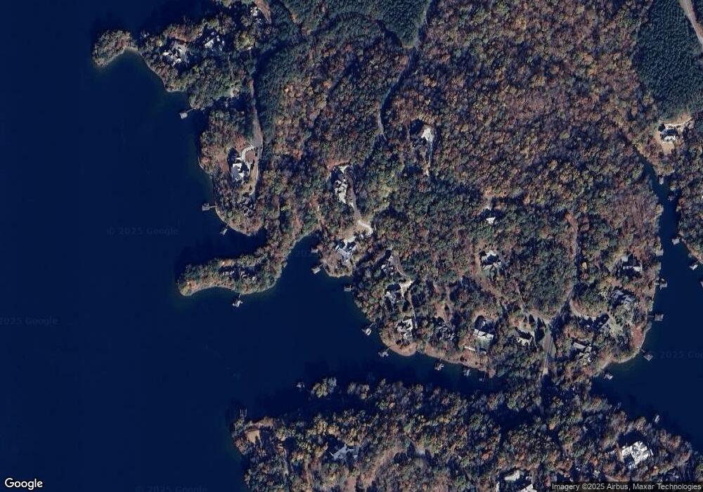
512 S Point Blvd Sunset, SC 29685
Shady Grove NeighborhoodEstimated Value: $777,000 - $1,999,000
3
Beds
4
Baths
4,648
Sq Ft
$299/Sq Ft
Est. Value
About This Home
This home is located at 512 S Point Blvd, Sunset, SC 29685 and is currently estimated at $1,388,000, approximately $298 per square foot. 512 S Point Blvd is a home located in Pickens County with nearby schools including Hagood Elementary School, Pickens Middle School, and Pickens High School.
Ownership History
Date
Name
Owned For
Owner Type
Purchase Details
Closed on
Oct 1, 2014
Sold by
Vanvanpage L Van and Page Carol A
Bought by
Wilson Stephen T and Wilson Megan R
Current Estimated Value
Purchase Details
Closed on
May 23, 2006
Sold by
Davis Greogry and Davis Deborah L
Bought by
Page Van L and Page Carol A
Home Financials for this Owner
Home Financials are based on the most recent Mortgage that was taken out on this home.
Original Mortgage
$502,500
Interest Rate
6.5%
Mortgage Type
Purchase Money Mortgage
Purchase Details
Closed on
May 1, 2005
Sold by
Byvw 215 Llc
Bought by
Davis C Gregory and Davis Deborah L
Purchase Details
Closed on
Dec 23, 2004
Sold by
Yorks Ben R
Bought by
Byvw 215 Llc
Home Financials for this Owner
Home Financials are based on the most recent Mortgage that was taken out on this home.
Original Mortgage
$250,000
Interest Rate
5.63%
Create a Home Valuation Report for This Property
The Home Valuation Report is an in-depth analysis detailing your home's value as well as a comparison with similar homes in the area
Home Values in the Area
Average Home Value in this Area
Purchase History
| Date | Buyer | Sale Price | Title Company |
|---|---|---|---|
| Wilson Stephen T | $335,000 | -- | |
| Page Van L | $620,000 | None Available | |
| Davis C Gregory | -- | None Available | |
| Byvw 215 Llc | $452,000 | None Available |
Source: Public Records
Mortgage History
| Date | Status | Borrower | Loan Amount |
|---|---|---|---|
| Previous Owner | Page Van L | $502,500 | |
| Previous Owner | Byvw 215 Llc | $250,000 |
Source: Public Records
Tax History Compared to Growth
Tax History
| Year | Tax Paid | Tax Assessment Tax Assessment Total Assessment is a certain percentage of the fair market value that is determined by local assessors to be the total taxable value of land and additions on the property. | Land | Improvement |
|---|---|---|---|---|
| 2024 | $4,758 | $19,800 | $19,800 | $0 |
| 2023 | $4,758 | $19,800 | $19,800 | $0 |
| 2022 | $4,775 | $19,800 | $19,800 | $0 |
| 2021 | $4,653 | $19,800 | $19,800 | $0 |
| 2020 | $4,471 | $19,800 | $19,800 | $0 |
| 2019 | $4,498 | $19,800 | $19,800 | $0 |
| 2018 | $4,754 | $20,100 | $20,100 | $0 |
| 2017 | $4,738 | $20,100 | $20,100 | $0 |
| 2015 | $4,654 | $20,100 | $0 | $0 |
| 2008 | -- | $26,700 | $26,700 | $0 |
Source: Public Records
Map
Nearby Homes
- 130 River Ridge Rd
- 201 Deep Cove Point
- 311 S Cove Rd
- 108 Cool Water Ct
- 194 Cool Water Way
- 117 Misty Water Loop
- 147 S Falls Rd
- 107 S Turtle Rock Rd
- 344 Long Cove Trail
- 805 Top Ridge Dr
- 00 Murphy Rd
- 00 Murphy Rd Unit 3.2 acres S. Side Mu
- 105 Great Camp Ct
- 604 Top Ridge Dr
- 800 Mirror Lake Ct
- 310 Top Ridge Dr
- 703 Timberbrook Trail
- 335 Long Cove Trail
- Lot 6 Bentwood Way
- 162 Ridge Top Ln
- 204 S Point Blvd
- 420 S Point Blvd Unit Reserve at Lake Keow
- 420 S Point Blvd
- 424 S Point Blvd Unit Reserve at Lake Keow
- 424 S Point Blvd
- 426 S Point Blvd
- 426 S Point Blvd Unit Lot A66
- 426 S Point Blvd Unit A 66
- 426 S Point Blvd Unit A 66
- 135 River Ridge Rd
- 436 S Point Blvd
- 436 S Point Blvd
- 440 S Point Blvd
- A56, 134 River Ridge Rd
- Lot A53 River Ridge Rd Unit 122 River Ridge Rd
- 106 Deep Cove Point
- 130 River Ridge Rd Unit A55
- 400 S Point Blvd
- 400 S Point Blvd Unit A59
- 138 River Ridge Rd
