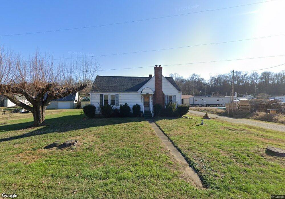
512 State Route 522 Wheelersburg, OH 45694
Estimated Value: $172,000 - $227,000
2
Beds
1
Bath
1,780
Sq Ft
$108/Sq Ft
Est. Value
About This Home
This home is located at 512 State Route 522, Wheelersburg, OH 45694 and is currently estimated at $192,876, approximately $108 per square foot. 512 State Route 522 is a home located in Scioto County with nearby schools including Wheelersburg Elementary School, Wheelersburg Middle School, and Wheelersburg High School.
Ownership History
Date
Name
Owned For
Owner Type
Purchase Details
Closed on
Oct 7, 2025
Sold by
Burton Kathy and Burton Michael
Bought by
Binion Linda S and Binion Daniel
Current Estimated Value
Home Financials for this Owner
Home Financials are based on the most recent Mortgage that was taken out on this home.
Original Mortgage
$40,000
Outstanding Balance
$40,000
Interest Rate
5.69%
Mortgage Type
New Conventional
Estimated Equity
$152,876
Purchase Details
Closed on
Nov 6, 2000
Bought by
Mootz Dorothy
Create a Home Valuation Report for This Property
The Home Valuation Report is an in-depth analysis detailing your home's value as well as a comparison with similar homes in the area
Home Values in the Area
Average Home Value in this Area
Purchase History
| Date | Buyer | Sale Price | Title Company |
|---|---|---|---|
| Binion Linda S | $30,000 | None Listed On Document | |
| Mootz Dorothy | -- | -- |
Source: Public Records
Mortgage History
| Date | Status | Borrower | Loan Amount |
|---|---|---|---|
| Open | Binion Linda S | $40,000 |
Source: Public Records
Tax History Compared to Growth
Tax History
| Year | Tax Paid | Tax Assessment Tax Assessment Total Assessment is a certain percentage of the fair market value that is determined by local assessors to be the total taxable value of land and additions on the property. | Land | Improvement |
|---|---|---|---|---|
| 2024 | $1,497 | $32,850 | $6,260 | $26,590 |
| 2023 | $1,497 | $32,850 | $6,260 | $26,590 |
| 2022 | $1,495 | $32,850 | $6,260 | $26,590 |
| 2021 | $1,329 | $29,420 | $5,720 | $23,700 |
| 2020 | $1,329 | $29,420 | $5,720 | $23,700 |
| 2019 | $1,329 | $26,790 | $5,440 | $21,350 |
| 2018 | $1,226 | $26,790 | $5,440 | $21,350 |
| 2017 | $1,287 | $26,790 | $5,440 | $21,350 |
| 2016 | $2,949 | $27,340 | $5,170 | $22,170 |
| 2015 | $1,313 | $27,340 | $5,170 | $22,170 |
| 2013 | $1,180 | $27,340 | $5,170 | $22,170 |
Source: Public Records
Map
Nearby Homes
- 112 Cherry St
- 0 Patriot Ridge Dr
- 0 Harrison Ave
- 175 Harrison Ave
- 10391 Gallia Pike
- 0 Ohio 522 Unit 152342
- 0 Gerlach Rd Unit 152351
- 0 Gerlach Rd
- 10 Hummingbird Ln
- 636 Havenwood Dr
- 645 Havenwood Dr
- 0 York Ave Unit 154110
- 1048 North St
- 3272 Big Pete Rd
- 3272 Big Pete Rd Unit A
- 0 Ohio River Rd Unit 152541
- 0 Ohio River Rd Unit 152771
- 0 Ohio River Rd Unit 58630
- 716 Connie Ave
- 12037 Gallia Pike
- 498 Ohio 522 Unit 1
- 498 Ohio 522
- 9399 Gallia Pike Rd
- 9411 Gallia Pike Rd
- 9417 Gallia Pike Rd
- 9391 Gallia Pike Rd
- 9433 Gallia Pike Rd
- 9433 Gallia Pike
- 9439 Gallia Pike
- 18 Park St
- 9445 Gallia Pike Rd
- 19 Park St
- 578 Ohio 522 Unit 1
- 578 Ohio 522
- 9398 Gallia Pike
- 0 Park St
- 9337 Gallia Pike Rd
- 9426 Gallia Pike Rd
- 9390 Gallia Pike Rd
- 67 High St