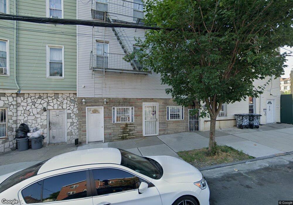
512 van Nest Ave Bronx, NY 10460
Van Nest NeighborhoodEstimated Value: $946,000 - $1,131,000
--
Bed
--
Bath
3,540
Sq Ft
$294/Sq Ft
Est. Value
About This Home
This home is located at 512 van Nest Ave, Bronx, NY 10460 and is currently estimated at $1,040,667, approximately $293 per square foot. 512 van Nest Ave is a home located in Bronx County with nearby schools including P.S. 083 The Donald Hertz School, Children's Aid College Preparatory Charter School, and Bold Charter School.
Ownership History
Date
Name
Owned For
Owner Type
Purchase Details
Closed on
May 19, 1998
Sold by
Lattini Antoinetta and Lattini Joseph
Bought by
Bourdon Angel
Current Estimated Value
Home Financials for this Owner
Home Financials are based on the most recent Mortgage that was taken out on this home.
Original Mortgage
$166,250
Interest Rate
7.04%
Create a Home Valuation Report for This Property
The Home Valuation Report is an in-depth analysis detailing your home's value as well as a comparison with similar homes in the area
Home Values in the Area
Average Home Value in this Area
Purchase History
| Date | Buyer | Sale Price | Title Company |
|---|---|---|---|
| Bourdon Angel | $175,000 | Fidelity National Title Ins |
Source: Public Records
Mortgage History
| Date | Status | Borrower | Loan Amount |
|---|---|---|---|
| Previous Owner | Bourdon Angel | $166,250 |
Source: Public Records
Tax History Compared to Growth
Tax History
| Year | Tax Paid | Tax Assessment Tax Assessment Total Assessment is a certain percentage of the fair market value that is determined by local assessors to be the total taxable value of land and additions on the property. | Land | Improvement |
|---|---|---|---|---|
| 2025 | $6,681 | $36,743 | $6,685 | $30,058 |
| 2024 | $6,681 | $34,664 | $6,943 | $27,721 |
| 2023 | $6,358 | $32,704 | $5,788 | $26,916 |
| 2022 | $5,872 | $44,160 | $8,580 | $35,580 |
| 2021 | $6,190 | $42,960 | $8,580 | $34,380 |
| 2020 | $6,185 | $47,460 | $8,580 | $38,880 |
| 2019 | $5,750 | $39,780 | $8,580 | $31,200 |
| 2018 | $5,258 | $27,253 | $5,739 | $21,514 |
| 2017 | $4,942 | $25,712 | $7,550 | $18,162 |
| 2016 | $4,830 | $25,712 | $7,383 | $18,329 |
| 2015 | $2,670 | $25,516 | $9,413 | $16,103 |
| 2014 | $2,670 | $24,073 | $7,549 | $16,524 |
Source: Public Records
Map
Nearby Homes
- 506 van Nest Ave
- 504 van Nest Ave
- 508 van Nest Ave
- 500 van Nest Ave
- 1622 Van Buren St
- 1760 E Tremont Ave
- 518 Morris Park Ave
- 1713 Taylor Ave
- 1738 Melville St
- 591 van Nest Ave
- 1517 Rosedale Ave
- 1513 Rosedale Ave
- 1735 Mansion St
- 1479 Rosedale Ave
- 633 Mead St
- 677 van Nest Ave
- 679 van Nest Ave
- 1129 E Tremont Ave
- 1721 White Plains Rd
- 1443 Beach Ave
- 514 van Nest Ave
- 510 van Nest Ave
- 518 van Nest Ave
- 1635 Van Buren St
- 1631 Van Buren St
- 1629 Van Buren St
- 1638 Van Buren St
- 1703 Van Buren St
- 1627 Van Buren St
- 524 van Nest Ave
- 511 van Nest Ave
- 1634 Van Buren St
- 513 van Nest Ave
- 513 van Nest Ave Unit 3
- 526 van Nest Ave
- 509 van Nest Ave
- 515 van Nest Ave
- 1624 Adams St
- 1625 Van Buren St