Estimated Value: $63,240 - $111,000
1
Bed
1
Bath
684
Sq Ft
$123/Sq Ft
Est. Value
About This Home
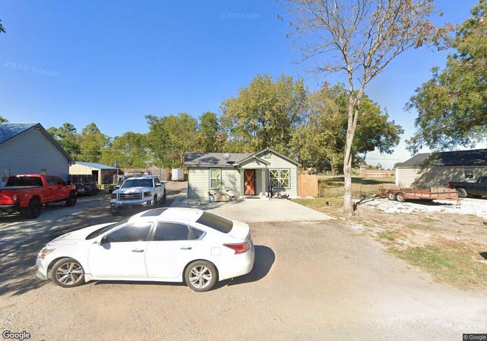
This home is located at 512 W 1st St, Ada, OK 74820 and is currently estimated at $83,810, approximately $122 per square foot. 512 W 1st St is a home located in Pontotoc County with nearby schools including ADA Early Childhood Center, Washington Elementary School, and Hayes Elementary School.
Ownership History
Date
Name
Owned For
Owner Type
Purchase Details
Closed on
Mar 24, 2006
Sold by
Cain Jastin and Cain Belinda
Bought by
Tusek Christopher John and Tusek Laura Gone
Current Estimated Value
Home Financials for this Owner
Home Financials are based on the most recent Mortgage that was taken out on this home.
Original Mortgage
$14,850
Outstanding Balance
$638
Interest Rate
6.21%
Mortgage Type
New Conventional
Estimated Equity
$83,172
Purchase Details
Closed on
Aug 1, 2002
Sold by
Carolynn Roger and Carolynn Boles
Bought by
Justin Cain
Purchase Details
Closed on
Mar 7, 2001
Sold by
G and E
Bought by
Carolynn Roger and Carolynn Boles
Purchase Details
Closed on
Mar 1, 2000
Sold by
Carolynn Roger and Carolynn Boles
Bought by
G and E
Purchase Details
Closed on
Dec 30, 1998
Sold by
Kathy Randal and Kathy Albright
Bought by
Carolynn Roger and Carolynn Boles
Purchase Details
Closed on
Apr 15, 1994
Sold by
Lida Hilton
Bought by
Randal Albright and Randal
Create a Home Valuation Report for This Property
The Home Valuation Report is an in-depth analysis detailing your home's value as well as a comparison with similar homes in the area
Home Values in the Area
Average Home Value in this Area
Purchase History
| Date | Buyer | Sale Price | Title Company |
|---|---|---|---|
| Tusek Christopher John | $16,500 | None Available | |
| Justin Cain | $17,500 | -- | |
| Carolynn Roger | $35,000 | -- | |
| G | $15,000 | -- | |
| Carolynn Roger | $16,000 | -- | |
| Randal Albright | $6,000 | -- |
Source: Public Records
Mortgage History
| Date | Status | Borrower | Loan Amount |
|---|---|---|---|
| Open | Tusek Christopher John | $14,850 |
Source: Public Records
Tax History Compared to Growth
Tax History
| Year | Tax Paid | Tax Assessment Tax Assessment Total Assessment is a certain percentage of the fair market value that is determined by local assessors to be the total taxable value of land and additions on the property. | Land | Improvement |
|---|---|---|---|---|
| 2025 | $220 | $2,215 | $900 | $1,315 |
| 2024 | $220 | $2,110 | $900 | $1,210 |
| 2023 | $220 | $2,010 | $900 | $1,110 |
| 2022 | $201 | $2,010 | $900 | $1,110 |
| 2021 | $170 | $1,823 | $900 | $923 |
| 2020 | $167 | $1,736 | $900 | $836 |
| 2019 | $159 | $1,654 | $900 | $754 |
| 2018 | $145 | $1,575 | $900 | $675 |
| 2017 | $129 | $1,500 | $900 | $600 |
| 2016 | $196 | $2,260 | $697 | $1,563 |
| 2015 | $189 | $2,152 | $716 | $1,436 |
| 2014 | $168 | $2,050 | $300 | $1,750 |
Source: Public Records
Map
Nearby Homes