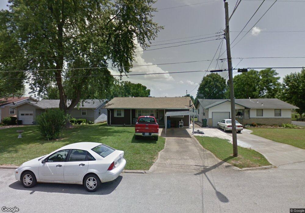
512 W Whiteside St Springfield, MO 65807
Mark Twain NeighborhoodEstimated Value: $136,000 - $187,000
3
Beds
1
Bath
1,212
Sq Ft
$137/Sq Ft
Est. Value
About This Home
This home is located at 512 W Whiteside St, Springfield, MO 65807 and is currently estimated at $166,201, approximately $137 per square foot. 512 W Whiteside St is a home located in Greene County with nearby schools including Mark Twain Elementary School, Jarrett Middle, and Parkview High School.
Ownership History
Date
Name
Owned For
Owner Type
Purchase Details
Closed on
Apr 14, 2011
Sold by
Mclain Clifford G and Mclain Dixiel
Bought by
M&M Real Estate Investments Xii Llc
Current Estimated Value
Purchase Details
Closed on
Jan 19, 2010
Sold by
U S Bank Na
Bought by
Mclain Clifford G and Mclain Dixie L
Home Financials for this Owner
Home Financials are based on the most recent Mortgage that was taken out on this home.
Original Mortgage
$50,000
Interest Rate
6.5%
Mortgage Type
New Conventional
Purchase Details
Closed on
Sep 16, 2009
Sold by
Davis Nancy L and Davis Stoney J
Bought by
Us Bank
Create a Home Valuation Report for This Property
The Home Valuation Report is an in-depth analysis detailing your home's value as well as a comparison with similar homes in the area
Home Values in the Area
Average Home Value in this Area
Purchase History
| Date | Buyer | Sale Price | Title Company |
|---|---|---|---|
| M&M Real Estate Investments Xii Llc | -- | None Available | |
| Mclain Clifford G | -- | Lincoln Land Title Inc | |
| Us Bank | $64,810 | Continental Title Company |
Source: Public Records
Mortgage History
| Date | Status | Borrower | Loan Amount |
|---|---|---|---|
| Previous Owner | Mclain Clifford G | $50,000 |
Source: Public Records
Tax History
| Year | Tax Paid | Tax Assessment Tax Assessment Total Assessment is a certain percentage of the fair market value that is determined by local assessors to be the total taxable value of land and additions on the property. | Land | Improvement |
|---|---|---|---|---|
| 2025 | $833 | $16,720 | $5,700 | $11,020 |
| 2024 | $744 | $13,870 | $3,760 | $10,110 |
| 2023 | $740 | $13,870 | $3,760 | $10,110 |
| 2022 | $782 | $14,320 | $3,760 | $10,560 |
| 2021 | $782 | $14,320 | $3,760 | $10,560 |
| 2020 | $788 | $13,790 | $3,760 | $10,030 |
| 2019 | $765 | $13,790 | $3,760 | $10,030 |
| 2018 | $720 | $12,980 | $3,760 | $9,220 |
| 2017 | $713 | $12,290 | $3,760 | $8,530 |
| 2016 | $674 | $12,290 | $3,760 | $8,530 |
| 2015 | $667 | $12,290 | $3,760 | $8,530 |
| 2014 | $659 | $12,040 | $3,760 | $8,280 |
Source: Public Records
Map
Nearby Homes
- 432 W Tracy St
- 306 W McGee St
- 308 E Lindberg St
- 220 E Berkeley St
- 309 E Berkeley St
- 1010 W Cherokee St
- 2012 S Roanoke Ave
- 535 E Whiteside St
- 1107 W Tracy St
- 1949 S Broadway Ave
- 1948 S Weaver Ave
- 2337 S Holland Ave
- 1733 S Lancaster Ave
- 1825 S Weaver Ave
- 540 E Glenwood St
- 2114 S Windsor Dr
- 1947 S Fort Ave
- 620 E Sunshine St
- 1419 W Whiteside St
- 611 W Portland St
- 508 W Whiteside St
- 518 W Whiteside St
- 502 W Whiteside St
- 526 W Whiteside St
- 515 W Whiteside St
- 519 W Whiteside St
- 509 W Whiteside St
- 2137 S Wedgewood Ave
- 2129 S Wedgewood Ave
- 507 W Silsby St
- 519 W Silsby St
- 501 W Silsby St
- 2125 S Wedgewood Ave
- 527 W Silsby St
- 2119 S Wedgewood Ave
- 2120 S Wedgewood Ave
- 533 W Silsby St
- 425 W Silsby St
- 2111 S Wedgewood Ave
- 601 W Silsby St
Your Personal Tour Guide
Ask me questions while you tour the home.