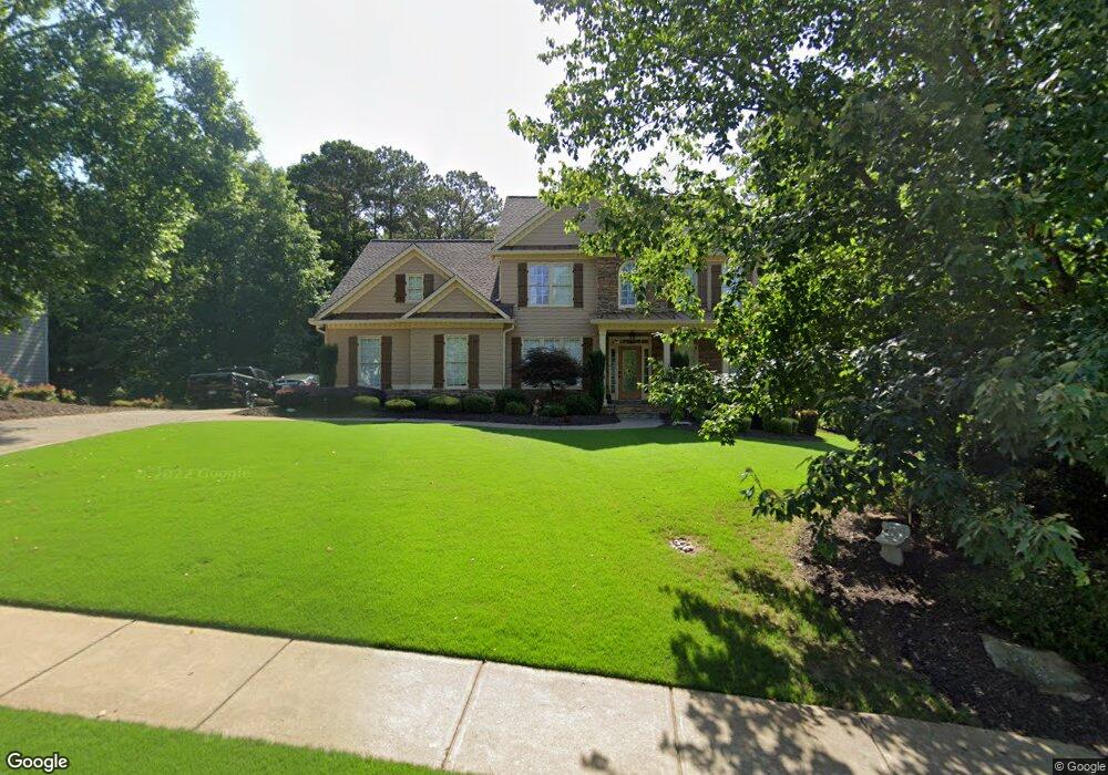
512 Waterside Ct Unit 3E Canton, GA 30114
Sutallee NeighborhoodEstimated Value: $749,000 - $792,447
5
Beds
4
Baths
4,470
Sq Ft
$172/Sq Ft
Est. Value
About This Home
This home is located at 512 Waterside Ct Unit 3E, Canton, GA 30114 and is currently estimated at $770,724, approximately $172 per square foot. 512 Waterside Ct Unit 3E is a home located in Cherokee County with nearby schools including Liberty Elementary School, Freedom Middle School, and Cherokee High School.
Ownership History
Date
Name
Owned For
Owner Type
Purchase Details
Closed on
Sep 21, 2001
Sold by
Legendary Homes Inc
Bought by
Hunt Darrell M and Hunt Sherry P
Current Estimated Value
Home Financials for this Owner
Home Financials are based on the most recent Mortgage that was taken out on this home.
Original Mortgage
$30,550
Outstanding Balance
$11,417
Interest Rate
6.42%
Mortgage Type
Unknown
Estimated Equity
$759,307
Create a Home Valuation Report for This Property
The Home Valuation Report is an in-depth analysis detailing your home's value as well as a comparison with similar homes in the area
Home Values in the Area
Average Home Value in this Area
Purchase History
| Date | Buyer | Sale Price | Title Company |
|---|---|---|---|
| Hunt Darrell M | $305,800 | -- |
Source: Public Records
Mortgage History
| Date | Status | Borrower | Loan Amount |
|---|---|---|---|
| Open | Hunt Darrell M | $30,550 | |
| Closed | Hunt Darrell M | $30,550 | |
| Open | Hunt Darrell M | $244,550 |
Source: Public Records
Tax History
| Year | Tax Paid | Tax Assessment Tax Assessment Total Assessment is a certain percentage of the fair market value that is determined by local assessors to be the total taxable value of land and additions on the property. | Land | Improvement |
|---|---|---|---|---|
| 2025 | $6,124 | $261,520 | $50,000 | $211,520 |
| 2024 | $5,866 | $249,800 | $46,000 | $203,800 |
| 2023 | $5,295 | $243,360 | $46,000 | $197,360 |
| 2022 | $5,088 | $210,000 | $36,000 | $174,000 |
| 2021 | $4,777 | $178,400 | $28,800 | $149,600 |
| 2020 | $4,545 | $168,240 | $28,800 | $139,440 |
| 2019 | $4,412 | $159,480 | $28,800 | $130,680 |
| 2018 | $4,240 | $150,960 | $27,200 | $123,760 |
| 2017 | $3,835 | $338,500 | $27,200 | $108,200 |
| 2016 | $3,679 | $321,700 | $27,200 | $101,480 |
| 2015 | $3,439 | $298,200 | $24,000 | $95,280 |
| 2014 | $3,346 | $289,700 | $24,000 | $91,880 |
Source: Public Records
Map
Nearby Homes
- 523 Waterside Ct
- 525 Waterside Ct
- 328 Lakebridge Crossing
- 1375 Bridgemill Ave
- 101 Cedar Woods Trail
- 3020 Woodbridge Ln
- 111 Stonegate Ln Unit 35
- 140 Stonegate Ln
- 235 Elmbrook Ln
- 227 Elmbrook Ln Unit 3L
- 9764 Bells Ferry Rd
- 601 Shelter Cove
- 511 Highwater Pass
- 5213 Millwood Dr Unit 4G
- 205 Gold Point Place
- 803 Rocky Ridge Ct
- 645 Mile Branch Rd
- 644 Gold Valley Pass
- 413 Arrowhead Trail Unit 4D
- 191 Brookwood Dr
- 514 Waterside Ct
- 510 Waterside Ct
- 1351 Bridge Mill Ave Unit 3D
- 1353 Bridge Mill Ave
- 1349 Bridge Mill Ave
- 305 Lakebridge Crossing Unit 3E
- 508 Waterside Ct
- 309 Lakebridge Crossing
- 307 Lakebridge Crossing
- 303 Lakebridge Crossing Unit 3E
- 507 Waters Dr
- 509 Waterside Ct Unit 3E
- 516 Waterside Ct Unit 3E
- 513 Waterside Ct
- 513 Waterside Ct
- 301 Lakebridge Crossing
- 1347 Bridge Mill Ave
- 506 Waterside Ct Unit 3E
- 505 Waterside Ct
- 1350 Bridge Mill Ave Unit 3D
Your Personal Tour Guide
Ask me questions while you tour the home.