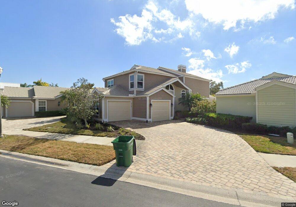
512 Westborough Ln Safety Harbor, FL 34695
Estimated Value: $642,339 - $687,000
3
Beds
3
Baths
2,681
Sq Ft
$250/Sq Ft
Est. Value
About This Home
This home is located at 512 Westborough Ln, Safety Harbor, FL 34695 and is currently estimated at $669,085, approximately $249 per square foot. 512 Westborough Ln is a home located in Pinellas County with nearby schools including Safety Harbor Elementary School, Countryside High School, and Safety Harbor Middle School.
Ownership History
Date
Name
Owned For
Owner Type
Purchase Details
Closed on
Oct 16, 2020
Sold by
Marshall James and Marshall Linda
Bought by
Marshall Family Revocable Living Trust
Current Estimated Value
Purchase Details
Closed on
May 31, 2016
Sold by
Swinney Robert S and Swinney Cheryl A
Bought by
Marshall James and Marshall Linda
Home Financials for this Owner
Home Financials are based on the most recent Mortgage that was taken out on this home.
Original Mortgage
$279,200
Outstanding Balance
$222,285
Interest Rate
3.58%
Mortgage Type
New Conventional
Estimated Equity
$446,800
Purchase Details
Closed on
Jun 23, 1997
Sold by
Salisbury Gary R
Bought by
Swinney Robert S and Swinney Cheryl A
Home Financials for this Owner
Home Financials are based on the most recent Mortgage that was taken out on this home.
Original Mortgage
$126,900
Interest Rate
7.97%
Mortgage Type
New Conventional
Create a Home Valuation Report for This Property
The Home Valuation Report is an in-depth analysis detailing your home's value as well as a comparison with similar homes in the area
Home Values in the Area
Average Home Value in this Area
Purchase History
| Date | Buyer | Sale Price | Title Company |
|---|---|---|---|
| Marshall Family Revocable Living Trust | -- | Attorney | |
| Marshall James | $349,000 | None Available | |
| Swinney Robert S | $141,000 | -- |
Source: Public Records
Mortgage History
| Date | Status | Borrower | Loan Amount |
|---|---|---|---|
| Open | Marshall James | $279,200 | |
| Previous Owner | Swinney Robert S | $125,205 | |
| Previous Owner | Swinney Robert S | $50,000 | |
| Previous Owner | Swinney Robert S | $126,900 |
Source: Public Records
Tax History Compared to Growth
Tax History
| Year | Tax Paid | Tax Assessment Tax Assessment Total Assessment is a certain percentage of the fair market value that is determined by local assessors to be the total taxable value of land and additions on the property. | Land | Improvement |
|---|---|---|---|---|
| 2024 | $2,835 | $211,077 | -- | -- |
| 2023 | $2,835 | $204,929 | $0 | $0 |
| 2022 | $2,749 | $198,960 | $0 | $0 |
| 2021 | $2,780 | $193,165 | $0 | $0 |
| 2020 | $2,771 | $190,498 | $0 | $0 |
| 2019 | $2,719 | $186,215 | $0 | $0 |
| 2018 | $2,678 | $182,743 | $0 | $0 |
| 2017 | $2,653 | $178,984 | $0 | $0 |
| 2016 | $2,534 | $170,459 | $0 | $0 |
| 2015 | $2,587 | $169,274 | $0 | $0 |
| 2014 | $2,573 | $167,931 | $0 | $0 |
Source: Public Records
Map
Nearby Homes
- 1209 Roxbury Dr
- 1205 Hounds Run
- 1103 Kensington Ct
- 720 Earls Ct
- 910 Kingscote Ct
- 1119 Huntington Ln
- 603 Baldwin Ave Unit B
- 1014 Bramblewood Ct
- 511 Longfellow Ct Unit D
- 1009 Wyndham Way
- 2368 Flanders Way Unit D
- 2363 Flanders Way Unit C
- 1111 Chatham Ct
- 612 Fairmont Ave Unit D
- 615 Fairmont Ave Unit C
- 647 Fairmont Ave Unit C
- 3321 Meander Ln
- 145 Avon Dr
- 2406 Dana Dr
- 50 Irwin St W
- 510 Westborough Ln
- 514 Westborough Ln
- 513 Haverhill Ln
- 511 Haverhill Ln
- 508 Westborough Ln
- 515 Haverhill Ln
- 509 Haverhill Ln
- 517 Westborough Ln
- 515 Westborough Ln
- 506 Westborough Ln
- 513 Westborough Ln
- 507 Haverhill Ln
- 511 Westborough Ln
- 514 Roxbury Dr
- 505 Haverhill Ln
- 509 Westborough Ln
- 512 Haverhill Ln
- 510 Haverhill Ln
- 514 Haverhill Ln
- 512 Roxbury Dr