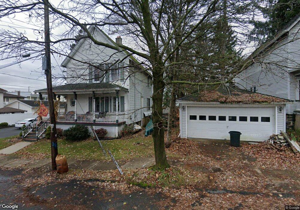
512 William St Scranton, PA 18510
Estimated Value: $198,140 - $251,000
3
Beds
2
Baths
1,700
Sq Ft
$130/Sq Ft
Est. Value
About This Home
This home is located at 512 William St, Scranton, PA 18510 and is currently estimated at $221,535, approximately $130 per square foot. 512 William St is a home located in Lackawanna County with nearby schools including Dunmore Elementary Center, St. Mary of Mount Carmel School, and Scranton Hebrew Day School.
Ownership History
Date
Name
Owned For
Owner Type
Purchase Details
Closed on
Jul 24, 2008
Sold by
Fleth George H and Fleth Florence H
Bought by
Caldwell Douglas R
Current Estimated Value
Home Financials for this Owner
Home Financials are based on the most recent Mortgage that was taken out on this home.
Original Mortgage
$122,612
Outstanding Balance
$80,216
Interest Rate
6.35%
Mortgage Type
FHA
Estimated Equity
$141,319
Create a Home Valuation Report for This Property
The Home Valuation Report is an in-depth analysis detailing your home's value as well as a comparison with similar homes in the area
Home Values in the Area
Average Home Value in this Area
Purchase History
| Date | Buyer | Sale Price | Title Company |
|---|---|---|---|
| Caldwell Douglas R | $123,600 | None Available |
Source: Public Records
Mortgage History
| Date | Status | Borrower | Loan Amount |
|---|---|---|---|
| Open | Caldwell Douglas R | $122,612 |
Source: Public Records
Tax History
| Year | Tax Paid | Tax Assessment Tax Assessment Total Assessment is a certain percentage of the fair market value that is determined by local assessors to be the total taxable value of land and additions on the property. | Land | Improvement |
|---|---|---|---|---|
| 2025 | $2,686 | $9,000 | $753 | $8,247 |
| 2024 | $2,296 | $9,000 | $753 | $8,247 |
| 2023 | $2,296 | $9,000 | $753 | $8,247 |
| 2022 | $2,154 | $9,000 | $753 | $8,247 |
| 2021 | $2,111 | $9,000 | $753 | $8,247 |
| 2020 | $2,111 | $9,000 | $753 | $8,247 |
| 2019 | $2,019 | $9,000 | $753 | $8,247 |
| 2018 | $1,986 | $9,000 | $753 | $8,247 |
| 2017 | $1,929 | $9,000 | $753 | $8,247 |
| 2016 | $905 | $9,000 | $753 | $8,247 |
| 2015 | -- | $9,000 | $753 | $8,247 |
| 2014 | -- | $9,000 | $753 | $8,247 |
Source: Public Records
Map
Nearby Homes
- 1050 Prescott Ave
- 1017 Prescott Ave
- 1406 Ash St
- 1042 Taylor Ave
- 2211 Ash St
- 1028 N Webster Ave
- 1018 N Webster Ave
- 917 Taylor Ave
- 627 S Blakely St
- 640 S 642 S Blakely St
- 810 Wheeler Ave
- 1014 1016 Quincy Ave
- 1947 Myrtle St
- 0 Colfax and Gibson Ave Unit GSBSC255175
- 1017 Quincy Ave
- 406 3rd St
- 1210 Monroe Ave
- 825 827 Quincy Ave Unit 825-827
- 113 E Pine St
- 819 Poplar St
- 518 William St
- 504 William St
- 1120 Ridge Ave
- 816 2nd St
- 827 2nd St
- 520 William St
- 520 Williams Unit Williams-mack
- 520 Williams
- 1112 Ridge
- 1112 Ridge Ave Unit 1
- 515 William St
- 515 William St
- 818 2nd St
- 517 William St
- 1115 Wheeler Ave Unit 1L
- 1115 Wheeler Ave
- 1115 Wheeler Ave Unit 1R
- 522 William St
- 1111 Wheeler Ave Unit 1113
- 1117 Ridge Ave
Your Personal Tour Guide
Ask me questions while you tour the home.