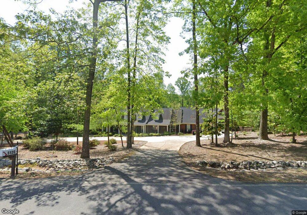
5120 W Price Rd Suwanee, GA 30024
Estimated Value: $977,000 - $1,368,000
4
Beds
4
Baths
6,133
Sq Ft
$205/Sq Ft
Est. Value
About This Home
This home is located at 5120 W Price Rd, Suwanee, GA 30024 and is currently estimated at $1,256,919, approximately $204 per square foot. 5120 W Price Rd is a home located in Gwinnett County with nearby schools including Riverside Elementary School, North Gwinnett Middle School, and North Gwinnett High School.
Ownership History
Date
Name
Owned For
Owner Type
Purchase Details
Closed on
Aug 26, 2022
Sold by
Smith Gary T
Bought by
Smith Gary Thomas and Smith Margaret Ferebee
Current Estimated Value
Purchase Details
Closed on
Mar 31, 2017
Sold by
Haman Ray T
Bought by
Smith Gary T and Smith Margaret T
Purchase Details
Closed on
Jun 20, 2003
Sold by
Ball Joe H and Ball Cynthia S
Bought by
Rose Michael and Rose Evelyn
Home Financials for this Owner
Home Financials are based on the most recent Mortgage that was taken out on this home.
Original Mortgage
$25,000
Interest Rate
5.29%
Mortgage Type
New Conventional
Create a Home Valuation Report for This Property
The Home Valuation Report is an in-depth analysis detailing your home's value as well as a comparison with similar homes in the area
Home Values in the Area
Average Home Value in this Area
Purchase History
| Date | Buyer | Sale Price | Title Company |
|---|---|---|---|
| Smith Gary Thomas | -- | -- | |
| Smith Gary T | $701,000 | -- | |
| Smith Gary T | -- | -- | |
| Rose Michael | $139,900 | -- |
Source: Public Records
Mortgage History
| Date | Status | Borrower | Loan Amount |
|---|---|---|---|
| Previous Owner | Rose Michael | $25,000 |
Source: Public Records
Tax History Compared to Growth
Tax History
| Year | Tax Paid | Tax Assessment Tax Assessment Total Assessment is a certain percentage of the fair market value that is determined by local assessors to be the total taxable value of land and additions on the property. | Land | Improvement |
|---|---|---|---|---|
| 2024 | $11,371 | $335,120 | $74,520 | $260,600 |
| 2023 | $11,371 | $335,120 | $74,520 | $260,600 |
| 2022 | $9,965 | $274,880 | $41,520 | $233,360 |
| 2021 | $10,362 | $274,880 | $41,520 | $233,360 |
| 2020 | $10,428 | $274,880 | $41,520 | $233,360 |
| 2019 | $8,886 | $242,560 | $41,000 | $201,560 |
| 2018 | $7,566 | $206,240 | $41,000 | $165,240 |
| 2016 | $4,817 | $152,960 | $49,920 | $103,040 |
| 2015 | $4,863 | $152,960 | $49,920 | $103,040 |
| 2014 | -- | $143,360 | $44,880 | $98,480 |
Source: Public Records
Map
Nearby Homes
- 5006 Suwanee Dam Rd
- 205 Finsbury Park Ct
- 5096 Akard Ct
- 5003 Pacific Dunes Dr
- 4863 Rosemoore Ct
- 5008 Bethpage Dr
- 4920 Puritan Dr Unit 1
- 4719 Terquay Ct
- 159 Level Creek Rd
- 5040 Puritan Dr
- 4865 Settles Point Rd
- 487 Skiles Ct
- 5047 Sara Creek Way Unit 2
- 5055 Puritan Dr
- 5177 Cabot Creek Dr
- 4651 Deep Creek Dr NE
- 570 White Stag Ct
- 5120 W Price Rd
- 5164 W Price Rd
- 5125 W Price Rd
- 5116 W Price Rd
- 5155 W Price Rd
- 5084 W Price Rd
- 5184 W Price Rd
- 5046 Wellisford Ct
- 5056 Wellisford Ct
- 5066 Wellisford Ct
- 5066 Wellisford Ct NW
- 5175 W Price Rd
- 5086 Wellisford Ct
- 5176 Wellisford Ct Unit 8
- 5186 Wellisford Ct Unit 8
- 5047 Wellisford Ct
- 5166 Wellisford Ct
- 5096 Wellisford Ct Unit VIII
- 5057 Wellisford Ct Unit 3
- 5106 Wellisford Ct