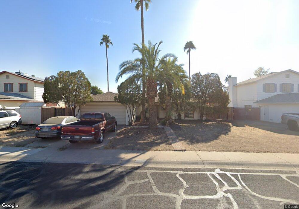
5121 W Shangri la Rd Glendale, AZ 85304
Estimated Value: $319,305 - $440,000
--
Bed
2
Baths
1,822
Sq Ft
$220/Sq Ft
Est. Value
About This Home
This home is located at 5121 W Shangri la Rd, Glendale, AZ 85304 and is currently estimated at $400,826, approximately $219 per square foot. 5121 W Shangri la Rd is a home located in Maricopa County with nearby schools including Desert Palms Elementary School, Ironwood High School, and Heritage Academy - Pointe.
Ownership History
Date
Name
Owned For
Owner Type
Purchase Details
Closed on
Sep 19, 2018
Sold by
Marcinko Wayne M
Bought by
Marcinko Wayne M and The Wayne M Marcinko Revocable
Current Estimated Value
Purchase Details
Closed on
Sep 15, 1998
Sold by
Marcinko Karen L
Bought by
Marcinko Wayne M
Home Financials for this Owner
Home Financials are based on the most recent Mortgage that was taken out on this home.
Original Mortgage
$80,750
Interest Rate
6.89%
Create a Home Valuation Report for This Property
The Home Valuation Report is an in-depth analysis detailing your home's value as well as a comparison with similar homes in the area
Home Values in the Area
Average Home Value in this Area
Purchase History
| Date | Buyer | Sale Price | Title Company |
|---|---|---|---|
| Marcinko Wayne M | -- | None Available | |
| Marcinko Wayne M | -- | Fidelity Title |
Source: Public Records
Mortgage History
| Date | Status | Borrower | Loan Amount |
|---|---|---|---|
| Closed | Marcinko Wayne M | $80,750 |
Source: Public Records
Tax History Compared to Growth
Tax History
| Year | Tax Paid | Tax Assessment Tax Assessment Total Assessment is a certain percentage of the fair market value that is determined by local assessors to be the total taxable value of land and additions on the property. | Land | Improvement |
|---|---|---|---|---|
| 2025 | $1,068 | $14,016 | -- | -- |
| 2024 | $1,090 | $13,349 | -- | -- |
| 2023 | $1,090 | $29,250 | $5,850 | $23,400 |
| 2022 | $1,080 | $22,470 | $4,490 | $17,980 |
| 2021 | $1,159 | $20,700 | $4,140 | $16,560 |
| 2020 | $1,177 | $19,300 | $3,860 | $15,440 |
| 2019 | $1,144 | $17,470 | $3,490 | $13,980 |
| 2018 | $1,117 | $16,210 | $3,240 | $12,970 |
| 2017 | $1,125 | $14,150 | $2,830 | $11,320 |
| 2016 | $1,118 | $13,400 | $2,680 | $10,720 |
| 2015 | $1,048 | $13,570 | $2,710 | $10,860 |
Source: Public Records
Map
Nearby Homes
- 11051 N 53rd Ave
- 5039 W Mercer Ln Unit 3
- 5214 W Cholla St
- 5131 W Christy Dr
- 11241 N 50th Ave
- 11402 N 50th Ave
- 5236 W Peoria Ave Unit 202
- 10608 N 53rd Cir
- 11639 N 52nd Ave
- 11640 N 51st Ave Unit 204
- 11640 N 51st Ave Unit 137
- 11640 N 51st Ave Unit 221
- 11640 N 51st Ave Unit 211
- 11640 N 51st Ave Unit 250
- 10803 N 55th Ave
- 5323 W North Ln
- 5407 W North Ln
- 4930 W Beryl Ave
- 11030 N 47th Ave
- 5174 W Laurel Ave
- 5127 W Shangri la Rd
- 5115 W Shangri la Rd
- 5122 W Mescal St
- 5128 W Mescal St
- 5116 W Mescal St
- 11203 N 52nd Ave
- 5201 W Shangri la Rd
- 11202 N 51st Dr
- 5134 W Mescal St
- 11209 N 52nd Ave
- 5207 W Shangri la Rd Unit 6
- 5202 W Shangri la Rd
- 11208 N 51st Dr
- 5140 W Mescal St
- 11027 N 51st Dr
- 5123 W Mescal St
- 5117 W Mescal St
- 11021 N 51st Dr
- 5129 W Mescal St
- 11201 N 51st Dr