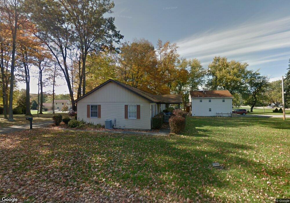
51215 State Route 14 East Palestine, OH 44413
Estimated Value: $124,000 - $185,000
2
Beds
2
Baths
968
Sq Ft
$157/Sq Ft
Est. Value
About This Home
This home is located at 51215 State Route 14, East Palestine, OH 44413 and is currently estimated at $152,151, approximately $157 per square foot. 51215 State Route 14 is a home located in Columbiana County with nearby schools including East Palestine Elementary School, East Palestine Middle School, and East Palestine High School.
Ownership History
Date
Name
Owned For
Owner Type
Purchase Details
Closed on
Oct 4, 2024
Sold by
Gremba Daniel J and Gremba Brenda L
Bought by
Gremba Brenda L
Current Estimated Value
Home Financials for this Owner
Home Financials are based on the most recent Mortgage that was taken out on this home.
Original Mortgage
$81,400
Outstanding Balance
$80,544
Interest Rate
6.35%
Mortgage Type
FHA
Estimated Equity
$71,607
Purchase Details
Closed on
Feb 9, 2017
Sold by
Kraus Luann and Gremba Brenda L
Bought by
Gremba Daniel J and Gremba Brenda L
Home Financials for this Owner
Home Financials are based on the most recent Mortgage that was taken out on this home.
Original Mortgage
$53,586
Interest Rate
4.4%
Mortgage Type
FHA
Purchase Details
Closed on
Mar 4, 1993
Sold by
Blum Lyle C and Or Betty
Bought by
Blum Lyle C
Create a Home Valuation Report for This Property
The Home Valuation Report is an in-depth analysis detailing your home's value as well as a comparison with similar homes in the area
Home Values in the Area
Average Home Value in this Area
Purchase History
| Date | Buyer | Sale Price | Title Company |
|---|---|---|---|
| Gremba Brenda L | -- | None Listed On Document | |
| Gremba Brenda L | -- | None Listed On Document | |
| Gremba Daniel J | -- | None Available | |
| Blum Lyle C | $5,500 | -- |
Source: Public Records
Mortgage History
| Date | Status | Borrower | Loan Amount |
|---|---|---|---|
| Open | Gremba Brenda L | $81,400 | |
| Closed | Gremba Brenda L | $81,400 | |
| Previous Owner | Gremba Daniel J | $53,586 |
Source: Public Records
Tax History Compared to Growth
Tax History
| Year | Tax Paid | Tax Assessment Tax Assessment Total Assessment is a certain percentage of the fair market value that is determined by local assessors to be the total taxable value of land and additions on the property. | Land | Improvement |
|---|---|---|---|---|
| 2024 | $1,444 | $44,140 | $6,650 | $37,490 |
| 2023 | $1,445 | $44,140 | $6,650 | $37,490 |
| 2022 | $1,444 | $44,140 | $6,650 | $37,490 |
| 2021 | $1,242 | $36,160 | $6,510 | $29,650 |
| 2020 | $1,242 | $36,160 | $6,510 | $29,650 |
| 2019 | $1,242 | $36,160 | $6,510 | $29,650 |
| 2018 | $1,167 | $32,870 | $5,920 | $26,950 |
| 2017 | $857 | $32,870 | $5,920 | $26,950 |
| 2016 | $875 | $33,600 | $6,090 | $27,510 |
| 2015 | $875 | $33,600 | $6,090 | $27,510 |
| 2014 | $873 | $33,600 | $6,090 | $27,510 |
Source: Public Records
Map
Nearby Homes
- 51028 Ohio 14
- 1141 Howell Ave
- 1367 N Market St
- 737 Moore Ln
- 3149 N Pleasant Dr
- 0 N Pleasant Dr
- 377 N Market St
- 295 E Martin St
- 681 Grandview Ave
- 288 W North Ave
- 745 E Martin St
- 201-203 W Clark St
- 581 W North Ave Unit 2
- 601 W North Ave
- 115 W Taggart St
- 395 W Clark St
- 2219 State Route 170
- 1468 Rauch Rd
- 385 Park Ave
- 51155 Chain School Rd
- 51245 State Route 14
- 3065 Hillcrest Cir
- 51263 State Route 14
- 3040 Hillcrest Cir
- 51153 State Route 14
- 3125 Hillcrest Cir
- 51154 State Route 14
- 3050 Hillcrest Cir
- 3060 Hillcrest Cir
- 51140 State Route 14
- 51131 State Route 14
- 3080 Hillcrest Cir
- 3112 Hillcrest Cir
- 51128 State Route 14
- 3092 Hillcrest Cir
- 51101 State Route 14
- 51088 State Route 14
- 51368 State Route 14
- 51064 State Route 14