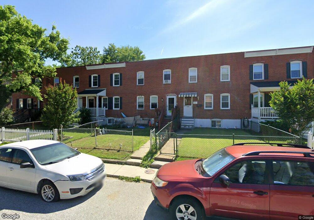
5124 Brookwood Rd Brooklyn, MD 21225
Estimated Value: $151,000 - $169,494
--
Bed
2
Baths
1,254
Sq Ft
$127/Sq Ft
Est. Value
About This Home
This home is located at 5124 Brookwood Rd, Brooklyn, MD 21225 and is currently estimated at $159,498, approximately $127 per square foot. 5124 Brookwood Rd is a home located in Anne Arundel County with nearby schools including Park Elementary School, Brooklyn Park Middle School, and North County High School.
Ownership History
Date
Name
Owned For
Owner Type
Purchase Details
Closed on
Feb 23, 2007
Sold by
Kemp Preston X
Bought by
Hall Mary
Current Estimated Value
Home Financials for this Owner
Home Financials are based on the most recent Mortgage that was taken out on this home.
Original Mortgage
$5,000
Outstanding Balance
$3,013
Interest Rate
6.27%
Mortgage Type
Stand Alone Second
Estimated Equity
$156,485
Purchase Details
Closed on
Feb 16, 2007
Sold by
Kemp Preston X
Bought by
Hall Mary
Home Financials for this Owner
Home Financials are based on the most recent Mortgage that was taken out on this home.
Original Mortgage
$5,000
Outstanding Balance
$3,013
Interest Rate
6.27%
Mortgage Type
Stand Alone Second
Estimated Equity
$156,485
Purchase Details
Closed on
May 11, 2005
Sold by
Mulligan Charles T
Bought by
Kemp Preston X
Home Financials for this Owner
Home Financials are based on the most recent Mortgage that was taken out on this home.
Original Mortgage
$64,000
Interest Rate
7.25%
Mortgage Type
Adjustable Rate Mortgage/ARM
Purchase Details
Closed on
Feb 14, 2005
Sold by
Brown Tehalia D
Bought by
Mulligan Charles T
Purchase Details
Closed on
Sep 19, 2001
Sold by
Holleman Ronald
Bought by
Brown Tehalia D
Purchase Details
Closed on
Jun 28, 2001
Sold by
Washington Mutual Bank
Bought by
Holleman Ronald and Holleman Lois
Purchase Details
Closed on
May 4, 2000
Sold by
Brown Donald
Bought by
Washington Mutual Bank
Purchase Details
Closed on
Mar 8, 1995
Sold by
Hales William M
Bought by
Brown Donald
Home Financials for this Owner
Home Financials are based on the most recent Mortgage that was taken out on this home.
Original Mortgage
$54,000
Interest Rate
9.09%
Purchase Details
Closed on
May 12, 1994
Sold by
Fowler Deborah R
Bought by
Hales William M
Home Financials for this Owner
Home Financials are based on the most recent Mortgage that was taken out on this home.
Original Mortgage
$27,200
Interest Rate
7.93%
Create a Home Valuation Report for This Property
The Home Valuation Report is an in-depth analysis detailing your home's value as well as a comparison with similar homes in the area
Home Values in the Area
Average Home Value in this Area
Purchase History
| Date | Buyer | Sale Price | Title Company |
|---|---|---|---|
| Hall Mary | $129,900 | -- | |
| Hall Mary | $129,900 | -- | |
| Kemp Preston X | $80,000 | -- | |
| Mulligan Charles T | $36,900 | -- | |
| Brown Tehalia D | $60,000 | -- | |
| Holleman Ronald | $27,000 | -- | |
| Washington Mutual Bank | $45,000 | -- | |
| Brown Donald | $72,000 | -- | |
| Hales William M | $29,805 | -- |
Source: Public Records
Mortgage History
| Date | Status | Borrower | Loan Amount |
|---|---|---|---|
| Open | Hall Mary | $5,000 | |
| Open | Hall Mary | $94,902 | |
| Closed | Hall Mary | $5,000 | |
| Closed | Hall Mary | $94,902 | |
| Previous Owner | Kemp Preston X | $64,000 | |
| Previous Owner | Kemp Preston X | $16,000 | |
| Previous Owner | Hales William M | $54,000 | |
| Previous Owner | Hales William M | $27,200 | |
| Closed | Hales William M | $15,458 |
Source: Public Records
Tax History Compared to Growth
Tax History
| Year | Tax Paid | Tax Assessment Tax Assessment Total Assessment is a certain percentage of the fair market value that is determined by local assessors to be the total taxable value of land and additions on the property. | Land | Improvement |
|---|---|---|---|---|
| 2025 | $1,508 | $129,300 | $20,000 | $109,300 |
| 2024 | $1,508 | $121,833 | $0 | $0 |
| 2023 | $1,453 | $114,367 | $0 | $0 |
| 2022 | $1,344 | $106,900 | $20,000 | $86,900 |
| 2021 | $2,646 | $103,133 | $0 | $0 |
| 2020 | $1,260 | $99,367 | $0 | $0 |
| 2019 | $1,241 | $95,600 | $20,000 | $75,600 |
| 2018 | $969 | $95,600 | $20,000 | $75,600 |
| 2017 | $1,185 | $95,600 | $0 | $0 |
| 2016 | -- | $97,500 | $0 | $0 |
| 2015 | -- | $97,500 | $0 | $0 |
| 2014 | -- | $97,500 | $0 | $0 |
Source: Public Records
Map
Nearby Homes
- 5201 Brookwood Rd
- 5210 Brookwood Rd
- 5300 Brookwood Rd
- 25 Ballman Ct
- 5103 Ballman Ave
- 4931 Brookwood Rd
- 5101 Ballman Ave
- 4952 Brookwood Rd
- 4946 Brookwood Rd
- 458 Seward Ave
- 5206 Patrick Henry Dr
- 907 Victory Ave
- 5226 Patrick Henry Dr
- 923 1st St
- 221 Townsend Ave
- 444 Seward Ave
- 942 1st St
- 915 1st St
- 222 Townsend Ave
- 912 1st St
- 5126 Brookwood Rd
- 5122 Brookwood Rd
- 5120 Brookwood Rd
- 5128 Brookwood Rd
- 5130 Brookwood Rd
- 5118 Brookwood Rd
- 5116 Brookwood Rd
- 5200 Brookwood Rd
- 5114 Brookwood Rd
- 227 Southerly Rd
- 5202 Brookwood Rd
- 5112 Brookwood Rd
- 5204 Brookwood Rd
- 5110 Brookwood Rd
- 225 Southerly Rd
- 5206 Brookwood Rd
- 5108 Brookwood Rd
- 223 Southerly Rd
- 5208 Brookwood Rd
- 5106 Brookwood Rd