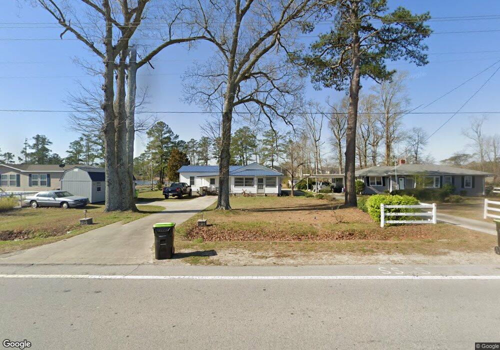
5125 Us Highway 17 N Vanceboro, NC 28586
Estimated Value: $141,000 - $215,695
2
Beds
2
Baths
1,310
Sq Ft
$127/Sq Ft
Est. Value
About This Home
This home is located at 5125 Us Highway 17 N, Vanceboro, NC 28586 and is currently estimated at $166,924, approximately $127 per square foot. 5125 Us Highway 17 N is a home located in Craven County with nearby schools including Bridgeton Elementary School, West Craven Middle School, and West Craven High School.
Ownership History
Date
Name
Owned For
Owner Type
Purchase Details
Closed on
Oct 25, 2024
Sold by
Schmidt Teresa
Bought by
Mallette Randall
Current Estimated Value
Home Financials for this Owner
Home Financials are based on the most recent Mortgage that was taken out on this home.
Original Mortgage
$177,749
Outstanding Balance
$175,787
Interest Rate
6.09%
Mortgage Type
VA
Estimated Equity
-$8,863
Purchase Details
Closed on
Jul 30, 2012
Sold by
Simpkins Fountain E
Bought by
Simpkins Gregory T
Create a Home Valuation Report for This Property
The Home Valuation Report is an in-depth analysis detailing your home's value as well as a comparison with similar homes in the area
Home Values in the Area
Average Home Value in this Area
Purchase History
| Date | Buyer | Sale Price | Title Company |
|---|---|---|---|
| Mallette Randall | -- | None Listed On Document | |
| Simpkins Gregory T | -- | None Available |
Source: Public Records
Mortgage History
| Date | Status | Borrower | Loan Amount |
|---|---|---|---|
| Open | Mallette Randall | $177,749 |
Source: Public Records
Tax History Compared to Growth
Tax History
| Year | Tax Paid | Tax Assessment Tax Assessment Total Assessment is a certain percentage of the fair market value that is determined by local assessors to be the total taxable value of land and additions on the property. | Land | Improvement |
|---|---|---|---|---|
| 2025 | $746 | $145,060 | $18,000 | $127,060 |
| 2024 | $746 | $145,060 | $18,000 | $127,060 |
| 2023 | $614 | $119,090 | $18,000 | $101,090 |
| 2022 | $317 | $43,850 | $12,000 | $31,850 |
| 2021 | $317 | $43,850 | $12,000 | $31,850 |
| 2020 | $313 | $43,850 | $12,000 | $31,850 |
| 2019 | $313 | $43,850 | $12,000 | $31,850 |
| 2018 | $284 | $43,850 | $12,000 | $31,850 |
| 2017 | $284 | $43,850 | $12,000 | $31,850 |
| 2016 | $284 | $50,070 | $12,000 | $38,070 |
| 2015 | $283 | $50,070 | $12,000 | $38,070 |
| 2014 | $283 | $50,070 | $12,000 | $38,070 |
Source: Public Records
Map
Nearby Homes
- 132 Neal Blvd
- 329 Tina Mae Dr
- 345 Tina Mae Dr
- 930 Willis Neck Rd
- 1-4 Great Swamp Rd
- 2651 Old Brick Rd
- 370 Willis Neck Rd
- 310 Summerfield
- 0 Buck Unit 100519114
- 165 High School Rd
- 4135 River Rd
- 105 Fernie Ln
- 405 Antioch Lakes Rd
- 100 Tyson
- 104 Tyson
- 102 Tyson
- 406 Antioch Lakes Rd
- 104 Hollie Field Ln
- 155 Webster Ln
- 117 Trellis Ln