Estimated Value: $203,000 - $544,000
--
Bed
--
Bath
--
Sq Ft
5,227
Sq Ft Lot
About This Home
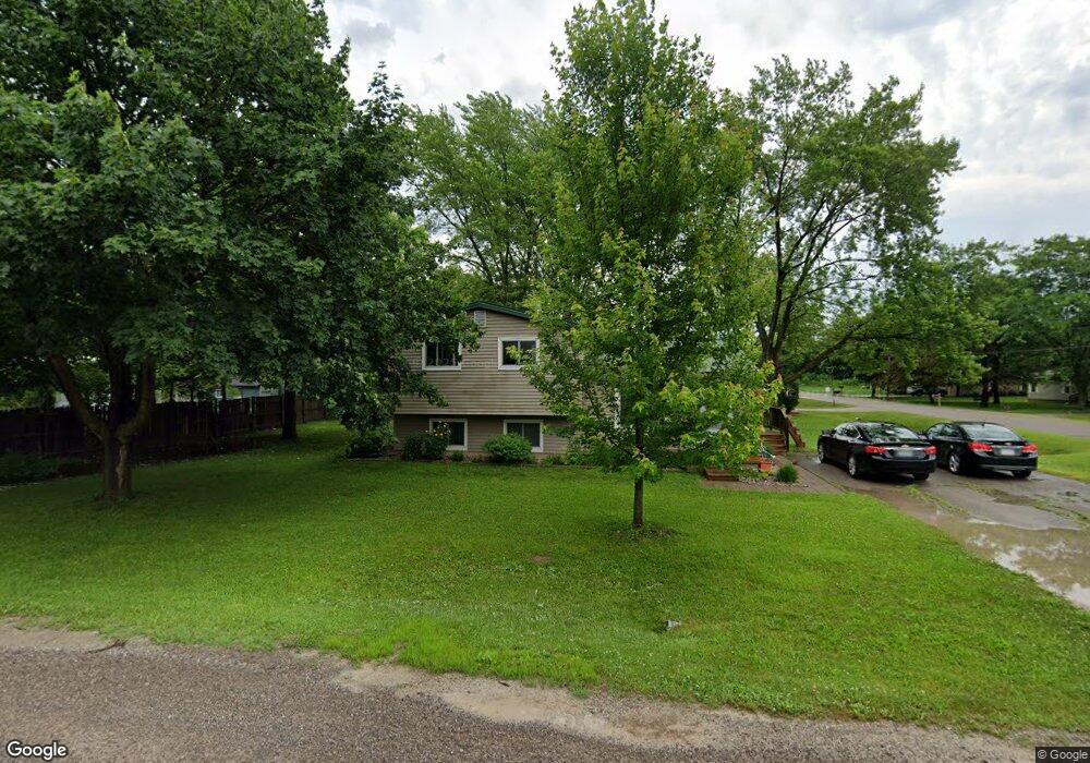
This home is located at 5127 Frank Ave, Flint, MI 48507 and is currently estimated at $373,500. 5127 Frank Ave is a home located in Genesee County with nearby schools including Anderson Elementary School, McGrath Elementary School, and Grand Blanc West Middle School.
Ownership History
Date
Name
Owned For
Owner Type
Purchase Details
Closed on
Nov 5, 2014
Sold by
Daig Robert L and Daig Stephanie
Bought by
U S Bank National Association
Current Estimated Value
Purchase Details
Closed on
Jan 14, 2004
Sold by
Daig Robert L and Daig Stephanie
Bought by
Daig Ii Robert L and Daig Stephanie
Purchase Details
Closed on
Dec 10, 1999
Sold by
Starzyk Judith A
Bought by
Daig Ii Robert L
Home Financials for this Owner
Home Financials are based on the most recent Mortgage that was taken out on this home.
Original Mortgage
$91,200
Interest Rate
7.87%
Mortgage Type
Purchase Money Mortgage
Create a Home Valuation Report for This Property
The Home Valuation Report is an in-depth analysis detailing your home's value as well as a comparison with similar homes in the area
Home Values in the Area
Average Home Value in this Area
Purchase History
| Date | Buyer | Sale Price | Title Company |
|---|---|---|---|
| U S Bank National Association | $69,000 | None Available | |
| Daig Ii Robert L | -- | Titlequest Agency | |
| Daig Ii Robert L | $96,000 | First American Title Ins Co |
Source: Public Records
Mortgage History
| Date | Status | Borrower | Loan Amount |
|---|---|---|---|
| Previous Owner | Daig Ii Robert L | $91,200 |
Source: Public Records
Tax History Compared to Growth
Tax History
| Year | Tax Paid | Tax Assessment Tax Assessment Total Assessment is a certain percentage of the fair market value that is determined by local assessors to be the total taxable value of land and additions on the property. | Land | Improvement |
|---|---|---|---|---|
| 2025 | $199 | $10,100 | $0 | $0 |
| 2024 | $124 | $9,700 | $0 | $0 |
| 2023 | $118 | $4,700 | $0 | $0 |
| 2022 | $180 | $4,500 | $0 | $0 |
| 2021 | $177 | $4,500 | $0 | $0 |
| 2020 | $110 | $4,300 | $0 | $0 |
| 2019 | $110 | $4,300 | $0 | $0 |
| 2018 | $187 | $4,500 | $0 | $0 |
| 2017 | $173 | $4,500 | $0 | $0 |
| 2016 | $177 | $4,600 | $0 | $0 |
| 2015 | $253 | $4,600 | $0 | $0 |
| 2012 | -- | $4,600 | $4,600 | $0 |
Source: Public Records
Map
Nearby Homes
- 2374 Bradford Dr
- 0 Helen Ave Unit 20251047188
- 00 E Maple Ave
- 00 Lincoln Manor Dr
- 2237 Lincoln Manor Dr
- 2263 E Maple Ave
- Lot C Chapin St
- Lot B Chapin St
- Lot A Chapin St
- 3077 Kettering Heights
- 00 Sloan Heights
- 00 Durant Heights
- 2346 Rollins St
- 2175 Rollins St
- 2040 E Maple Ave
- 5023 Spring Well Ln
- 1234 Fisher Heights
- 0 Jolson Ave Unit 50049319
- VL Jolson Ave
- 2144 Webber Ave
- 5127 Frank Ave
- 2390 Nichols Ave
- 2403 Morton Ave
- 2369 Morton Ave
- 2402 Nichols Ave
- 2376 Nichols Ave Unit G
- 2376 Nichols Ave
- 2367 Morton Ave
- 2402 Morton Ave Unit Bldg-Unit
- 2402 Morton Ave
- 2402 Morton Ave
- 2378 Morton Ave
- 2418 Nichols Ave
- 2418 Nichols Ave
- 2391 Nichols Ave
- 2417 Morton Ave
- 2361 Morton Ave
- 2401 Nichols Ave
- 2368 Morton Ave
- 2373 Helen Ave