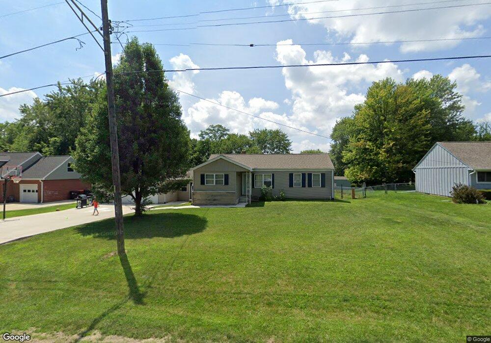
5127 N Sherwood Ave Peoria, IL 61614
North Peoria NeighborhoodEstimated Value: $187,000 - $233,000
2
Beds
2
Baths
1,850
Sq Ft
$108/Sq Ft
Est. Value
About This Home
This home is located at 5127 N Sherwood Ave, Peoria, IL 61614 and is currently estimated at $200,689, approximately $108 per square foot. 5127 N Sherwood Ave is a home located in Peoria County with nearby schools including Kellar Primary School, Liberty Leadership Middle School, and Richwoods High School.
Ownership History
Date
Name
Owned For
Owner Type
Purchase Details
Closed on
Mar 13, 2020
Sold by
Robb Daniel J
Bought by
Robb Daniah N
Current Estimated Value
Home Financials for this Owner
Home Financials are based on the most recent Mortgage that was taken out on this home.
Original Mortgage
$85,000
Interest Rate
3.3%
Mortgage Type
New Conventional
Purchase Details
Closed on
May 22, 2017
Sold by
Issler Terry A
Bought by
Robb Daniel J and Robb Daniah N
Purchase Details
Closed on
Jul 31, 2007
Bought by
Robb Investments Llc
Create a Home Valuation Report for This Property
The Home Valuation Report is an in-depth analysis detailing your home's value as well as a comparison with similar homes in the area
Home Values in the Area
Average Home Value in this Area
Purchase History
| Date | Buyer | Sale Price | Title Company |
|---|---|---|---|
| Robb Daniah N | -- | Mccarthy Law Firm | |
| Robb Daniel J | -- | Attorney Only | |
| Robb Investments Llc | $143,000 | -- |
Source: Public Records
Mortgage History
| Date | Status | Borrower | Loan Amount |
|---|---|---|---|
| Previous Owner | Robb Daniah N | $85,000 |
Source: Public Records
Tax History Compared to Growth
Tax History
| Year | Tax Paid | Tax Assessment Tax Assessment Total Assessment is a certain percentage of the fair market value that is determined by local assessors to be the total taxable value of land and additions on the property. | Land | Improvement |
|---|---|---|---|---|
| 2024 | $4,596 | $56,810 | $8,040 | $48,770 |
| 2023 | $4,339 | $52,120 | $7,380 | $44,740 |
| 2022 | $3,860 | $46,020 | $6,800 | $39,220 |
| 2021 | $3,761 | $43,830 | $6,480 | $37,350 |
| 2020 | $3,748 | $43,400 | $6,420 | $36,980 |
| 2019 | $3,814 | $44,280 | $6,550 | $37,730 |
| 2018 | $3,705 | $44,040 | $6,500 | $37,540 |
| 2017 | $4,289 | $44,490 | $6,570 | $37,920 |
| 2016 | $4,170 | $44,490 | $6,570 | $37,920 |
| 2015 | $3,813 | $43,620 | $6,440 | $37,180 |
| 2014 | $3,813 | $41,420 | $6,110 | $35,310 |
| 2013 | -- | $41,920 | $6,180 | $35,740 |
Source: Public Records
Map
Nearby Homes
- 1012 W Shenandoah Dr
- 1412 W Glen Ave
- 934 W Austin Dr
- 5501 N Holly Hedges Ct
- 719 W Shenandoah Dr
- W Lake Pointe Terrace
- 1123 W Millford Ln
- 5505 N Sheridan Rd
- 1114 W Oakglen Dr
- 1910 W Sunnyview Dr
- 1521 W Daytona Dr
- 5918 N Roxbury Ln
- 1914 W White Oak Dr
- 5213 N Merrimac Ave
- 5317 N Woodview Ave
- 4600 N University St
- 5110 N Martha St
- 5710 N Western Ave
- 5108 N Woodview Ave
- 4808 N Glen Ct
- 5119 N Sherwood Ave
- 5205 N Sherwood Ave
- 5115 N Sherwood Ave
- 5211 N Sherwood Ave
- 5126 N University St
- 5120 N University St
- 5107 N Sherwood Ave
- 5126 N Sherwood Ave
- 5210 N University St
- 5114 N University St
- 5120 N Sherwood Ave
- 5210 N Sherwood Ave
- 1207 W Shenandoah Dr
- 5106 N Sherwood Ave
- 5108 N University St
- 5101 N Sherwood Ave
- 5302 N University St
- 1307 W Sunnyview Dr
- 5304 N Sherwood Ave
- 5121 N Isabell Ave