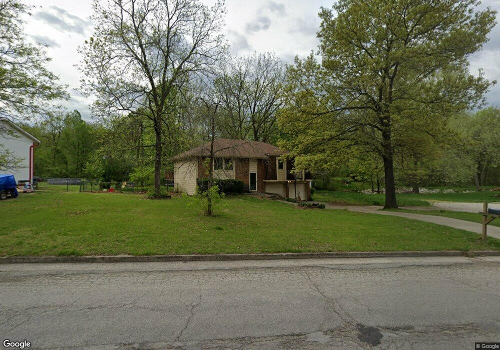
5127 Scruggs Station Rd Jefferson City, MO 65109
Estimated Value: $200,000 - $290,000
3
Beds
2
Baths
1,240
Sq Ft
$187/Sq Ft
Est. Value
About This Home
This home is located at 5127 Scruggs Station Rd, Jefferson City, MO 65109 and is currently estimated at $231,742, approximately $186 per square foot. 5127 Scruggs Station Rd is a home located in Cole County with nearby schools including Clarence Lawson Elementary School, Thomas Jefferson Middle School, and Capital City High School.
Ownership History
Date
Name
Owned For
Owner Type
Purchase Details
Closed on
Jan 30, 2023
Sold by
Knotts Donald P
Bought by
Knotts Stephanie Denise
Current Estimated Value
Home Financials for this Owner
Home Financials are based on the most recent Mortgage that was taken out on this home.
Original Mortgage
$24,000
Outstanding Balance
$22,106
Interest Rate
5.17%
Mortgage Type
Credit Line Revolving
Estimated Equity
$209,636
Purchase Details
Closed on
Jul 3, 2019
Sold by
Knotts Stephanie D and Knotts Donald P
Bought by
Knotts Denise
Home Financials for this Owner
Home Financials are based on the most recent Mortgage that was taken out on this home.
Original Mortgage
$12,000
Interest Rate
3.82%
Mortgage Type
Balloon
Create a Home Valuation Report for This Property
The Home Valuation Report is an in-depth analysis detailing your home's value as well as a comparison with similar homes in the area
Home Values in the Area
Average Home Value in this Area
Purchase History
| Date | Buyer | Sale Price | Title Company |
|---|---|---|---|
| Knotts Stephanie Denise | -- | Monarch Title Company Inc | |
| Knotts Denise | -- | -- |
Source: Public Records
Mortgage History
| Date | Status | Borrower | Loan Amount |
|---|---|---|---|
| Open | Knotts Stephanie Denise | $24,000 | |
| Previous Owner | Knotts Denise | $12,000 |
Source: Public Records
Tax History Compared to Growth
Tax History
| Year | Tax Paid | Tax Assessment Tax Assessment Total Assessment is a certain percentage of the fair market value that is determined by local assessors to be the total taxable value of land and additions on the property. | Land | Improvement |
|---|---|---|---|---|
| 2025 | $1,222 | $22,760 | $2,660 | $20,100 |
| 2024 | $1,222 | $20,440 | $0 | $20,440 |
| 2023 | $1,222 | $20,440 | $0 | $20,440 |
| 2022 | $1,226 | $20,440 | $0 | $20,440 |
| 2021 | $1,233 | $20,440 | $0 | $20,440 |
| 2020 | $1,249 | $23,807 | $2,660 | $21,147 |
| 2019 | $1,215 | $22,078 | $2,660 | $19,418 |
| 2018 | $1,156 | $21,223 | $2,660 | $18,563 |
| 2017 | $1,128 | $20,444 | $2,660 | $17,784 |
| 2016 | -- | $20,444 | $2,660 | $17,784 |
| 2015 | $919 | $0 | $0 | $0 |
| 2014 | $919 | $20,444 | $2,660 | $17,784 |
Source: Public Records
Map
Nearby Homes
- 5121 S Brooks Dr
- 5117 S Brooks Dr
- 1628 Westview Dr
- 1616 Westview Dr
- 4911 Lucia Dr
- 5405 Collier Ln
- 5203 Starlite Ct
- 5417 Collier Ln
- 5416 S Brooks Dr
- 1600 Northport Dr
- 1910 Eliana Dr
- 4817 Carly Dr
- 5318 Thornridge Dr
- 5314 Thornridge Dr
- 1333 Grandview Dr
- 1323 Grandview Dr
- 2001 Buschman Ln
- 1317 Grandview Dr
- 5506 Kenview Dr
- 5418 Thornridge Dr
- 5123 Scruggs Station Rd
- 5119 Scruggs Station Rd
- 5128 Scruggs Station Rd
- 5201 Scruggs Station Rd
- 5124 Scruggs Station Rd
- 5101 S Brooks Dr
- 5115 Scruggs Station Rd
- 5122 Scruggs Station Rd
- 5120 Scruggs Station Rd
- 5105 S Brooks Dr
- 5125 Shady Ln
- 5129 Shady Ln
- 5113 Scruggs Station Rd
- 5118 Scruggs Station Rd
- 5207 Scruggs Station Rd
- 5123 Shady Ln
- 5107 S Brooks Dr
- 5121 Shady Ln
- 5116 Scruggs Station Rd
- 5210 Scruggs Station Rd