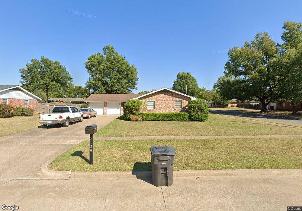
5128 Parsons Dr Bartlesville, OK 74006
Estimated Value: $166,708 - $220,000
3
Beds
2
Baths
1,352
Sq Ft
$147/Sq Ft
Est. Value
About This Home
This home is located at 5128 Parsons Dr, Bartlesville, OK 74006 and is currently estimated at $199,177, approximately $147 per square foot. 5128 Parsons Dr is a home located in Washington County with nearby schools including Ranch Heights Elementary School, Madison Middle School, and Bartlesville High School.
Ownership History
Date
Name
Owned For
Owner Type
Purchase Details
Closed on
Sep 24, 2018
Sold by
J & D Keleher Properties Llc
Bought by
Lorton Michael and Lorton Maria
Current Estimated Value
Purchase Details
Closed on
Oct 9, 2007
Sold by
Toups Lois K
Bought by
Keleher Daniel J and Keleher Joyce L
Purchase Details
Closed on
Jul 29, 1997
Sold by
Perry Margaret Ann
Purchase Details
Closed on
Sep 9, 1996
Sold by
Perry Mary J
Purchase Details
Closed on
Nov 24, 1993
Sold by
Norvell David L
Create a Home Valuation Report for This Property
The Home Valuation Report is an in-depth analysis detailing your home's value as well as a comparison with similar homes in the area
Home Values in the Area
Average Home Value in this Area
Purchase History
| Date | Buyer | Sale Price | Title Company |
|---|---|---|---|
| Lorton Michael | -- | None Available | |
| Keleher Daniel J | $80,000 | None Available | |
| -- | $42,000 | -- | |
| -- | -- | -- | |
| -- | $38,500 | -- |
Source: Public Records
Tax History Compared to Growth
Tax History
| Year | Tax Paid | Tax Assessment Tax Assessment Total Assessment is a certain percentage of the fair market value that is determined by local assessors to be the total taxable value of land and additions on the property. | Land | Improvement |
|---|---|---|---|---|
| 2025 | $1,302 | $12,196 | $1,210 | $10,986 |
| 2024 | $1,302 | $11,841 | $1,210 | $10,631 |
| 2023 | $1,302 | $11,496 | $1,210 | $10,286 |
| 2022 | $1,257 | $11,496 | $1,210 | $10,286 |
| 2021 | $1,232 | $11,496 | $1,210 | $10,286 |
| 2020 | $1,231 | $11,252 | $1,210 | $10,042 |
| 2019 | $1,192 | $10,924 | $1,210 | $9,714 |
| 2018 | $1,456 | $12,178 | $1,210 | $10,968 |
| 2017 | $1,490 | $12,178 | $1,210 | $10,968 |
| 2016 | $1,398 | $12,178 | $1,210 | $10,968 |
| 2015 | $1,352 | $11,636 | $1,210 | $10,426 |
| 2014 | $1,307 | $11,110 | $1,210 | $9,900 |
Source: Public Records
Map
Nearby Homes
- 1425 S Madison Blvd
- 1500 Harris Dr
- 1354 Harris Dr
- 1521 Lariat Dr
- 1435 Lariat Dr
- 5217 Nowata Rd Unit 203C
- 5217 Nowata Rd Unit C204
- 5269 Nowata Rd Unit O102
- 5229 Nowata Rd Unit F101
- 1267 Guinn Ln
- 1250 Macklyn Ln
- 5239 Nowata Rd Unit H102
- 1264 Guinn Ln
- 1242 May Ln
- 1258 Guinn Ln
- 1724 SE East Dr
- 1412 Meadow Ln
- 1222 Lariat Dr
- 1206 Saddle Ln
- 4910 Rolling Meadows Rd