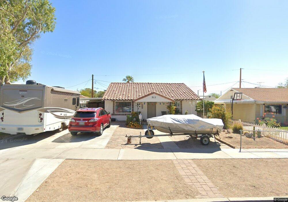
513 5th St Boulder City, NV 89005
Estimated Value: $320,203 - $381,000
2
Beds
1
Bath
924
Sq Ft
$386/Sq Ft
Est. Value
About This Home
This home is located at 513 5th St, Boulder City, NV 89005 and is currently estimated at $356,301, approximately $385 per square foot. 513 5th St is a home located in Clark County with nearby schools including Andrew Mitchell Elementary School, Martha P. King Elementary School, and Elton M. & Madelaine E. Garrett Junior High School.
Ownership History
Date
Name
Owned For
Owner Type
Purchase Details
Closed on
Mar 21, 2025
Sold by
Kusak Claudia
Bought by
Kusak Daniel J
Current Estimated Value
Home Financials for this Owner
Home Financials are based on the most recent Mortgage that was taken out on this home.
Original Mortgage
$60,000
Outstanding Balance
$59,693
Interest Rate
6.87%
Mortgage Type
New Conventional
Estimated Equity
$296,608
Create a Home Valuation Report for This Property
The Home Valuation Report is an in-depth analysis detailing your home's value as well as a comparison with similar homes in the area
Home Values in the Area
Average Home Value in this Area
Purchase History
| Date | Buyer | Sale Price | Title Company |
|---|---|---|---|
| Kusak Daniel J | -- | Equity Title |
Source: Public Records
Mortgage History
| Date | Status | Borrower | Loan Amount |
|---|---|---|---|
| Open | Kusak Daniel J | $60,000 |
Source: Public Records
Tax History Compared to Growth
Tax History
| Year | Tax Paid | Tax Assessment Tax Assessment Total Assessment is a certain percentage of the fair market value that is determined by local assessors to be the total taxable value of land and additions on the property. | Land | Improvement |
|---|---|---|---|---|
| 2025 | $1,001 | $57,370 | $44,100 | $13,270 |
| 2024 | $927 | $57,370 | $44,100 | $13,270 |
| 2023 | $927 | $45,053 | $33,075 | $11,978 |
| 2022 | $858 | $43,948 | $33,250 | $10,698 |
| 2021 | $795 | $40,385 | $30,450 | $9,935 |
| 2020 | $738 | $38,355 | $28,700 | $9,655 |
| 2019 | $692 | $35,572 | $26,250 | $9,322 |
| 2018 | $660 | $31,505 | $22,750 | $8,755 |
| 2017 | $775 | $29,675 | $21,000 | $8,675 |
| 2016 | $617 | $24,221 | $15,750 | $8,471 |
| 2015 | $616 | $23,174 | $14,963 | $8,211 |
| 2014 | $597 | $22,697 | $14,963 | $7,734 |
Source: Public Records
Map
Nearby Homes
- 517 5th St
- 524 5th St
- 531 New Mexico St
- 557 6th St
- 617 6th St
- 633 5th St
- 1104 Endora Way
- 573 7th St
- 639 I Ave
- 1095 Endora Way
- 1115 Endora Way
- 627 Don Vincente Dr
- 624 Avenue H
- 620 Avenue H
- 511 Northridge Dr
- 1201 I
- Windsor Plan at Heritage Peak
- Somerset Plan at Heritage Peak
- 394 Arizona St
- 632 Paloma Dr