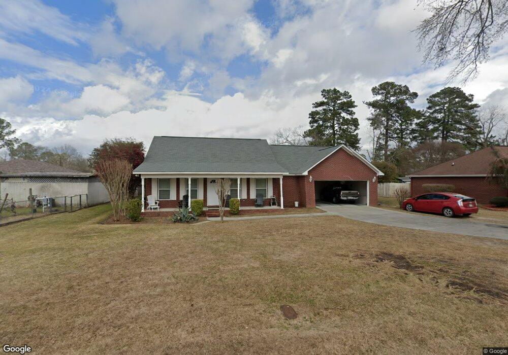
513 Earl Ave Claxton, GA 30417
Estimated Value: $207,000 - $248,899
3
Beds
3
Baths
1,907
Sq Ft
$121/Sq Ft
Est. Value
About This Home
This home is located at 513 Earl Ave, Claxton, GA 30417 and is currently estimated at $230,975, approximately $121 per square foot. 513 Earl Ave is a home located in Evans County with nearby schools including Claxton Elementary School, Claxton Middle School, and Claxton High School.
Ownership History
Date
Name
Owned For
Owner Type
Purchase Details
Closed on
May 4, 2013
Sold by
Howard Robert D
Bought by
Howard Robert D and Howard Melanie
Current Estimated Value
Purchase Details
Closed on
May 22, 2007
Sold by
Scott Jesse B
Bought by
Howard Robert D and Howard Gisela
Home Financials for this Owner
Home Financials are based on the most recent Mortgage that was taken out on this home.
Original Mortgage
$160,550
Interest Rate
6.16%
Purchase Details
Closed on
Apr 29, 2005
Sold by
Sapp Michael C
Bought by
Scott Jesse B and Scott April P
Home Financials for this Owner
Home Financials are based on the most recent Mortgage that was taken out on this home.
Original Mortgage
$132,900
Interest Rate
5.88%
Create a Home Valuation Report for This Property
The Home Valuation Report is an in-depth analysis detailing your home's value as well as a comparison with similar homes in the area
Home Values in the Area
Average Home Value in this Area
Purchase History
| Date | Buyer | Sale Price | Title Company |
|---|---|---|---|
| Howard Robert D | -- | -- | |
| Howard Robert D | $169,000 | -- | |
| Scott Jesse B | $139,900 | -- |
Source: Public Records
Mortgage History
| Date | Status | Borrower | Loan Amount |
|---|---|---|---|
| Previous Owner | Howard Robert D | $160,550 | |
| Previous Owner | Scott Jesse B | $132,900 |
Source: Public Records
Tax History Compared to Growth
Tax History
| Year | Tax Paid | Tax Assessment Tax Assessment Total Assessment is a certain percentage of the fair market value that is determined by local assessors to be the total taxable value of land and additions on the property. | Land | Improvement |
|---|---|---|---|---|
| 2025 | $2,441 | $90,080 | $4,560 | $85,520 |
| 2024 | $2,491 | $101,440 | $4,560 | $96,880 |
| 2023 | $2,491 | $62,440 | $3,600 | $58,840 |
| 2022 | $2,263 | $62,440 | $3,600 | $58,840 |
| 2021 | $1,830 | $62,440 | $3,600 | $58,840 |
| 2020 | $1,837 | $62,440 | $3,600 | $58,840 |
| 2019 | $1,796 | $62,440 | $3,600 | $58,840 |
| 2018 | $1,760 | $61,040 | $3,600 | $57,440 |
| 2017 | $1,745 | $62,440 | $3,600 | $58,840 |
| 2016 | $1,589 | $56,280 | $3,600 | $52,680 |
| 2015 | -- | $58,120 | $3,600 | $54,520 |
| 2014 | -- | $58,120 | $3,600 | $54,520 |
| 2013 | -- | $59,360 | $3,600 | $55,760 |
Source: Public Records
Map
Nearby Homes
- 606 Park Ave
- 9 Honeysuckle Dr
- 7 Honeysuckle Way
- 7 Honeysuckle Dr
- 10 Honeysuckle Dr
- 3 Honeysuckle Dr
- 19 Wysteria Ln
- 3 Wysteria Ln
- 12 Wisteria Ln
- 12 Wysteria Ln
- 511 W Smith St
- 610 W Liberty St
- 201 New Dr
- 712 Rosedale Ave
- 3 S Spring St
- 6 N Spring St
- 107 E Liberty St
- 12 S Duval St
- 308 Old Metter Rd
- 0 Turnpike Rd Unit SA339603