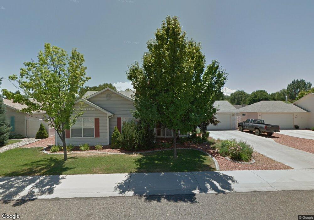
513 Hazel Cir Fruita, CO 81521
Estimated Value: $402,528 - $433,000
3
Beds
2
Baths
1,396
Sq Ft
$301/Sq Ft
Est. Value
About This Home
This home is located at 513 Hazel Cir, Fruita, CO 81521 and is currently estimated at $420,632, approximately $301 per square foot. 513 Hazel Cir is a home located in Mesa County with nearby schools including Monument Ridge Elementary School, Fruita Middle School, and Fruita 8/9 School.
Ownership History
Date
Name
Owned For
Owner Type
Purchase Details
Closed on
Aug 21, 1998
Sold by
Dkh & Brh Inc
Bought by
Smith Gary and Smith Giselle D
Current Estimated Value
Home Financials for this Owner
Home Financials are based on the most recent Mortgage that was taken out on this home.
Original Mortgage
$88,900
Outstanding Balance
$18,514
Interest Rate
6.9%
Estimated Equity
$402,118
Purchase Details
Closed on
Jun 21, 1996
Sold by
Wildwood Development Inc/27 Parcels
Bought by
Smith Giselle D
Purchase Details
Closed on
May 20, 1996
Bought by
Smith Giselle D
Create a Home Valuation Report for This Property
The Home Valuation Report is an in-depth analysis detailing your home's value as well as a comparison with similar homes in the area
Home Values in the Area
Average Home Value in this Area
Purchase History
| Date | Buyer | Sale Price | Title Company |
|---|---|---|---|
| Smith Gary | $98,900 | -- | |
| Smith Giselle D | $108,000 | -- | |
| Smith Giselle D | -- | -- |
Source: Public Records
Mortgage History
| Date | Status | Borrower | Loan Amount |
|---|---|---|---|
| Open | Smith Gary | $88,900 |
Source: Public Records
Tax History Compared to Growth
Tax History
| Year | Tax Paid | Tax Assessment Tax Assessment Total Assessment is a certain percentage of the fair market value that is determined by local assessors to be the total taxable value of land and additions on the property. | Land | Improvement |
|---|---|---|---|---|
| 2024 | $1,547 | $18,970 | $5,500 | $13,470 |
| 2023 | $1,547 | $18,970 | $5,500 | $13,470 |
| 2022 | $1,470 | $17,730 | $4,170 | $13,560 |
| 2021 | $1,480 | $18,240 | $4,290 | $13,950 |
| 2020 | $1,364 | $17,140 | $4,220 | $12,920 |
| 2019 | $1,300 | $17,140 | $4,220 | $12,920 |
| 2018 | $1,146 | $13,940 | $3,780 | $10,160 |
| 2017 | $974 | $13,940 | $3,780 | $10,160 |
| 2016 | $974 | $13,680 | $3,980 | $9,700 |
| 2015 | $986 | $13,680 | $3,980 | $9,700 |
| 2014 | $796 | $11,110 | $3,980 | $7,130 |
Source: Public Records
Map
Nearby Homes
- 220 Sunset Ct
- 698 Pear Dr
- 175 Ponderosa Dr
- 878 Darcy Jo Ln
- 791 Yew St
- 986 St Peppin Dr
- 203 Elderberry Dr
- 1166 17 1 2 Rd
- 951 Vintners Ct
- 825 E Ottley Ave Unit E 3
- 825 E Ottley Ave Unit F1
- 825 E Ottley Ave Unit B2
- 825 E Ottley Ave Unit B5
- 334 W Applewood Dr
- 1105 Sprocket Ct
- 370 Toms Canyon Dr
- 362 Toms Canyon Dr
- 409 W Applewood Dr
- 1111 Sprocket Ct
- 335 Crystal Ct