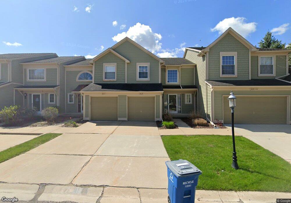
513 Liberty Pointe Dr Unit 99 Ann Arbor, MI 48103
Liberty Glen NeighborhoodEstimated Value: $315,000 - $341,000
2
Beds
2
Baths
1,378
Sq Ft
$238/Sq Ft
Est. Value
About This Home
This home is located at 513 Liberty Pointe Dr Unit 99, Ann Arbor, MI 48103 and is currently estimated at $328,056, approximately $238 per square foot. 513 Liberty Pointe Dr Unit 99 is a home located in Washtenaw County with nearby schools including Lakewood Elementary School, Forsythe Middle School, and Skyline High School.
Ownership History
Date
Name
Owned For
Owner Type
Purchase Details
Closed on
Jun 18, 2004
Sold by
Dasse Kathy and Diener Kathy M
Bought by
Frye Deena
Current Estimated Value
Home Financials for this Owner
Home Financials are based on the most recent Mortgage that was taken out on this home.
Original Mortgage
$167,310
Interest Rate
6.46%
Mortgage Type
Purchase Money Mortgage
Create a Home Valuation Report for This Property
The Home Valuation Report is an in-depth analysis detailing your home's value as well as a comparison with similar homes in the area
Home Values in the Area
Average Home Value in this Area
Purchase History
| Date | Buyer | Sale Price | Title Company |
|---|---|---|---|
| Frye Deena | $185,900 | Metropolitan Title Company |
Source: Public Records
Mortgage History
| Date | Status | Borrower | Loan Amount |
|---|---|---|---|
| Closed | Frye Deena | $167,310 |
Source: Public Records
Tax History Compared to Growth
Tax History
| Year | Tax Paid | Tax Assessment Tax Assessment Total Assessment is a certain percentage of the fair market value that is determined by local assessors to be the total taxable value of land and additions on the property. | Land | Improvement |
|---|---|---|---|---|
| 2025 | $4,419 | $162,300 | $0 | $0 |
| 2024 | $4,115 | $162,300 | $0 | $0 |
| 2023 | $3,794 | $155,000 | $0 | $0 |
| 2022 | $4,134 | $142,900 | $0 | $0 |
| 2021 | $4,037 | $136,300 | $0 | $0 |
| 2020 | $3,955 | $134,500 | $0 | $0 |
| 2019 | $3,764 | $124,600 | $124,600 | $0 |
| 2018 | $3,711 | $116,100 | $0 | $0 |
| 2017 | $3,610 | $110,500 | $0 | $0 |
| 2016 | $3,075 | $72,197 | $0 | $0 |
| 2015 | $3,317 | $71,982 | $0 | $0 |
| 2014 | $3,317 | $69,734 | $0 | $0 |
| 2013 | -- | $69,734 | $0 | $0 |
Source: Public Records
Map
Nearby Homes
- 609 Liberty Pointe Dr Unit 45
- 2564 W Towne St
- 324 Highlake Ave
- 570 S Maple Rd
- 922 W Summerfield Glen Cir Unit 110
- 2509 W Liberty St
- 1008 W Summerfield Glen Cir
- 3177 Sunnywood Dr
- 1053 Bluestem Ln
- 2149 Fair St
- 3224 Lakewood Dr
- 2052 Liberty Heights
- 1235 S Maple Rd Unit 101
- 1235 S Maple Rd Unit 202
- 1225 S Maple Rd Unit 307
- 2107 Jackson Ave
- 1265 S Maple Rd Unit 207
- 105 Pleasant Place
- 115 Longman Ln
- 2120 Pauline Blvd Unit 305
- 511 Liberty Pointe Dr Unit 98
- 515 Liberty Pointe Dr
- 503 Liberty Pointe Dr
- 509 Liberty Pointe Dr Unit 97
- 507 Liberty Pointe Dr Unit 96
- 505 Liberty Pointe Dr Unit 95
- 549 Liberty Pointe Dr
- 493 Liberty Pointe Dr
- 551 Liberty Pointe Dr
- 491 Liberty Pointe Dr
- 495 Liberty Pointe Dr
- 495 Liberty Pointe Dr Unit 93
- 545 Liberty Pointe Dr
- 489 Liberty Pointe Dr
- 543 Liberty Pointe Dr
- 485 Liberty Pointe Dr
- 485 Liberty Pointe Dr Unit 88
- 483 Liberty Pointe Dr
- 539 Liberty Pointe Dr
- 525 Liberty Pointe Dr