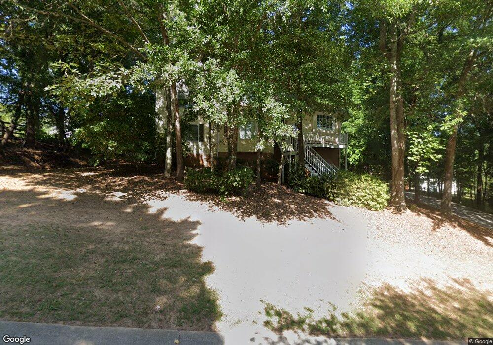
513 Matthew Dr Unit 62 Canton, GA 30114
Estimated Value: $390,173 - $392,000
4
Beds
3
Baths
2,136
Sq Ft
$183/Sq Ft
Est. Value
About This Home
This home is located at 513 Matthew Dr Unit 62, Canton, GA 30114 and is currently estimated at $391,087, approximately $183 per square foot. 513 Matthew Dr Unit 62 is a home located in Cherokee County with nearby schools including Avery Elementary School, Creekland Middle School, and Creekview High School.
Ownership History
Date
Name
Owned For
Owner Type
Purchase Details
Closed on
Jun 30, 2021
Sold by
Marsan Susi B
Bought by
Mch Sfr Property Owner 1 Llc
Current Estimated Value
Purchase Details
Closed on
Jul 26, 2000
Sold by
Fleck Elliot R and Fleck Bibi F
Bought by
Marsan Joseph G and Marsan Susi B
Home Financials for this Owner
Home Financials are based on the most recent Mortgage that was taken out on this home.
Original Mortgage
$143,925
Interest Rate
8.23%
Mortgage Type
New Conventional
Purchase Details
Closed on
Dec 20, 1996
Sold by
Turner Jimmy and Gravley Max
Bought by
Fleck Elliott Bibi
Purchase Details
Closed on
Jan 11, 1996
Sold by
Turner Jimmy
Bought by
Turner Jimmy and Gravley Max
Create a Home Valuation Report for This Property
The Home Valuation Report is an in-depth analysis detailing your home's value as well as a comparison with similar homes in the area
Home Values in the Area
Average Home Value in this Area
Purchase History
We collect this data history from publicly available records. To have your information removed, we recommend requesting removal directly through your county’s website.
| Date | Buyer | Sale Price | Title Company |
|---|---|---|---|
| Mch Sfr Property Owner 1 Llc | $321,000 | -- | |
| Marsan Joseph G | $151,500 | -- | |
| Fleck Elliott Bibi | $122,700 | -- | |
| Turner Jimmy | $24,900 | -- |
Source: Public Records
Mortgage History
We collect this data history from publicly available records. To have your information removed, we recommend requesting removal directly through your county’s website.
| Date | Status | Borrower | Loan Amount |
|---|---|---|---|
| Previous Owner | Marsan Joseph G | $143,925 | |
| Closed | Turner Jimmy | $0 |
Source: Public Records
Tax History
| Year | Tax Paid | Tax Assessment Tax Assessment Total Assessment is a certain percentage of the fair market value that is determined by local assessors to be the total taxable value of land and additions on the property. | Land | Improvement |
|---|---|---|---|---|
| 2025 | $4,157 | $144,487 | $29,099 | $115,388 |
| 2024 | $4,136 | $144,487 | $29,099 | $115,388 |
| 2023 | $4,136 | $144,487 | $29,099 | $115,388 |
| 2022 | $3,404 | $118,600 | $26,000 | $92,600 |
| 2021 | $376 | $99,560 | $18,000 | $81,560 |
| 2020 | $375 | $91,960 | $16,000 | $75,960 |
| 2019 | $2,480 | $86,200 | $16,000 | $70,200 |
| 2018 | $2,430 | $83,840 | $16,000 | $67,840 |
| 2017 | $1,826 | $191,800 | $14,000 | $62,720 |
| 2016 | $1,826 | $187,200 | $14,000 | $60,880 |
| 2015 | $1,607 | $161,200 | $14,000 | $50,480 |
| 2014 | $1,716 | $138,400 | $10,800 | $44,560 |
Source: Public Records
Map
Nearby Homes
- 305 Pamela Place
- 5916 Governors Walk Dr
- 3365 Confederate Point
- 6086 Governors Walk Dr
- 618 Old Doss Dr
- 0 Governors Walk Dr Unit 7294252
- 0 Reed St Unit 7646438
- 406 Mountain Point
- 202 Brooke Place Unit 1
- 408 Rockview Dr
- 297 Breeze Hill Ln
- 231 Breeze Hill Ln
- 530 River Estates Pkwy Unit 2B
- - Bluffs Pkwy
- 177 Weaver Cir
- 702 Windsor Estates Way
- 523 Cherokee Overlook Ct
- 216 Riverstone Place
- 234 Riverstone Place
- 208 N Ridgeview Ct
- 513 Matthew Dr
- 513 Matthew Dr Unit 513
- 302 Pamela Place
- 300 Pamela Place
- 515 Matthew Dr
- 203 Lauren Ln
- 304 Pamela Place Unit 1
- 524 Matthew Dr Unit 1
- 522 Matthew Dr Unit 1
- 526 Matthew Dr Unit 1
- 520 Matthew Dr
- 205 Lauren Ln
- 306 Pamela Place Unit 1
- 528 Matthew Dr
- 518 Matthew Dr
- 301 Pamela Place Unit 1
- 303 Pamela Place
- 303 Pamela Place Unit 303
- 303 Pamela Place
- 207 Lauren Ln
Your Personal Tour Guide
Ask me questions while you tour the home.