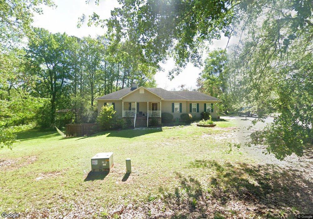
513 Mulberry St Thomaston, GA 30286
Estimated Value: $232,143 - $255,000
4
Beds
2
Baths
1,866
Sq Ft
$130/Sq Ft
Est. Value
About This Home
This home is located at 513 Mulberry St, Thomaston, GA 30286 and is currently estimated at $242,286, approximately $129 per square foot. 513 Mulberry St is a home located in Upson County with nearby schools including Upson-Lee South Elementary School, Upson-Lee North Elementary School, and Upson-Lee Middle School.
Ownership History
Date
Name
Owned For
Owner Type
Purchase Details
Closed on
Jul 28, 2017
Sold by
Young Joell Anne
Bought by
Hand Tyler
Current Estimated Value
Home Financials for this Owner
Home Financials are based on the most recent Mortgage that was taken out on this home.
Original Mortgage
$100,152
Outstanding Balance
$84,476
Interest Rate
4.37%
Mortgage Type
FHA
Estimated Equity
$157,810
Purchase Details
Closed on
Jun 1, 2015
Sold by
Young Christopher Tucker
Bought by
Young Joell Anne
Create a Home Valuation Report for This Property
The Home Valuation Report is an in-depth analysis detailing your home's value as well as a comparison with similar homes in the area
Home Values in the Area
Average Home Value in this Area
Purchase History
| Date | Buyer | Sale Price | Title Company |
|---|---|---|---|
| Hand Tyler | $102,000 | -- | |
| Young Joell Anne | -- | -- |
Source: Public Records
Mortgage History
| Date | Status | Borrower | Loan Amount |
|---|---|---|---|
| Open | Hand Tyler | $100,152 |
Source: Public Records
Tax History Compared to Growth
Tax History
| Year | Tax Paid | Tax Assessment Tax Assessment Total Assessment is a certain percentage of the fair market value that is determined by local assessors to be the total taxable value of land and additions on the property. | Land | Improvement |
|---|---|---|---|---|
| 2024 | $1,900 | $72,497 | $12,480 | $60,017 |
| 2023 | $1,904 | $74,136 | $16,000 | $58,136 |
| 2022 | $1,736 | $62,600 | $16,000 | $46,600 |
| 2021 | $1,417 | $53,770 | $16,000 | $37,770 |
| 2020 | $1,322 | $46,868 | $12,800 | $34,068 |
| 2019 | $1,161 | $37,888 | $8,000 | $29,888 |
| 2018 | $1,162 | $37,888 | $8,000 | $29,888 |
| 2017 | $939 | $27,938 | $6,400 | $21,538 |
| 2016 | $933 | $27,306 | $6,400 | $20,906 |
| 2015 | $846 | $26,750 | $6,400 | $20,350 |
| 2014 | -- | $26,750 | $6,400 | $20,350 |
Source: Public Records
Map
Nearby Homes
- 524 Sunnyland Dr
- 556 Sunnyland Dr
- 216 E Moores Crossing Rd
- 0 W Moores Crossing Rd Unit 10605207
- 2615 Barnesville Hwy
- 2724 Barnesville St
- 1205 Shady Ln
- 115 Hillside Dr
- 657 Tom McKinley Rd
- 101 Pineview Dr
- 201 Creekside Manor Dr
- 508 Heath Dr
- 505 Heath Dr
- LOT 193 Morningside Ct
- LOT 195 Morningside Ct
- LOT 194 Morningside Ct
- 3006 Barnesville Hwy
- 307 Pardue Dr
- 458 E St
- 114 C St NE
- 517 Mulberry St
- 516 Dogwood Dr
- 512 Dogwood Dr
- 501 Shady Dr
- 512 Mulberry St
- 518 Dogwood Dr
- 510 Dogwood Dr
- 103 Kudzu St
- 507 Mulberry St
- 0 Dogwood Dr Unit 20174216
- 0 Dogwood Dr Unit 20174206
- 0 Dogwood Dr Unit 20174202
- 0 Dogwood Dr Unit 20019404
- 0 Dogwood Dr Unit 20012013
- 0 Mulberry St Unit LOT 5 & 6 20019381
- 0 Mulberry St Unit 20174196
- 0 Mulberry St Unit 20174187
- 520 Dogwood Dr
- 519 Mulberry St
- 517 Dogwood Dr