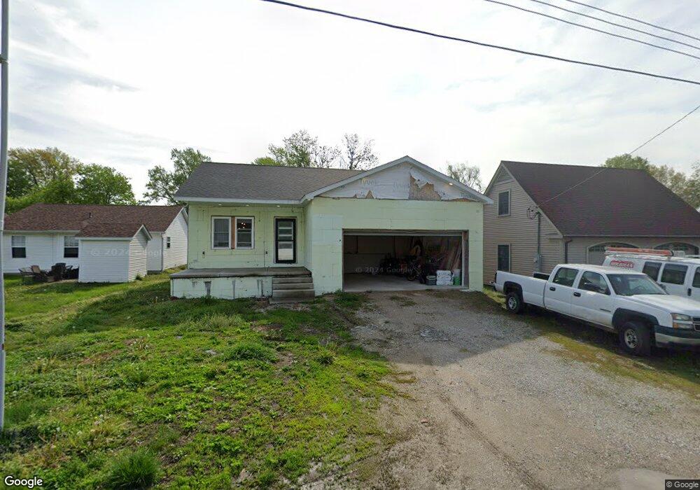
513 N 9th St Auburn, IL 62615
Estimated Value: $176,000 - $252,231
--
Bed
--
Bath
--
Sq Ft
7,492
Sq Ft Lot
About This Home
This home is located at 513 N 9th St, Auburn, IL 62615 and is currently estimated at $214,116. 513 N 9th St is a home with nearby schools including Auburn Elementary School, Auburn Middle School, and Auburn Junior High School.
Ownership History
Date
Name
Owned For
Owner Type
Purchase Details
Closed on
Dec 9, 2020
Sold by
Frances Maley and Frances Mary
Bought by
Crain Jarid A
Current Estimated Value
Home Financials for this Owner
Home Financials are based on the most recent Mortgage that was taken out on this home.
Original Mortgage
$120,000
Interest Rate
4.25%
Mortgage Type
Construction
Purchase Details
Closed on
Mar 27, 2000
Purchase Details
Closed on
Sep 14, 1999
Create a Home Valuation Report for This Property
The Home Valuation Report is an in-depth analysis detailing your home's value as well as a comparison with similar homes in the area
Home Values in the Area
Average Home Value in this Area
Purchase History
| Date | Buyer | Sale Price | Title Company |
|---|---|---|---|
| Crain Jarid A | $8,000 | Prairie Land Title | |
| -- | -- | -- | |
| -- | $16,500 | -- |
Source: Public Records
Mortgage History
| Date | Status | Borrower | Loan Amount |
|---|---|---|---|
| Closed | Crain Jarid A | $120,000 |
Source: Public Records
Tax History Compared to Growth
Tax History
| Year | Tax Paid | Tax Assessment Tax Assessment Total Assessment is a certain percentage of the fair market value that is determined by local assessors to be the total taxable value of land and additions on the property. | Land | Improvement |
|---|---|---|---|---|
| 2024 | $4,722 | $81,391 | $4,846 | $76,545 |
| 2023 | $272 | $4,432 | $4,432 | $0 |
| 2022 | $255 | $4,196 | $4,196 | $0 |
| 2021 | $249 | $4,030 | $4,030 | $0 |
| 2020 | $249 | $4,016 | $4,016 | $0 |
| 2019 | $243 | $3,917 | $3,917 | $0 |
| 2018 | $239 | $3,836 | $3,836 | $0 |
| 2017 | $240 | $3,694 | $3,694 | $0 |
| 2016 | $231 | $3,671 | $3,671 | $0 |
| 2015 | $234 | $3,628 | $3,628 | $0 |
| 2014 | $234 | $3,684 | $3,684 | $0 |
| 2013 | $213 | $3,563 | $3,563 | $0 |
Source: Public Records
Map
Nearby Homes
- 446 N 7th St Unit 1
- 1224 Commanche Rd Unit 1
- 0 Illinois 104
- 158 E Monroe St
- 109 N Violet Dr Unit 1
- 3926 Circle Dr Unit 1
- 207 W Elm St
- 10553 S Main St Unit 1
- 6716 Tower Heights Rd
- 108 Kodiak Dr
- 233 W South St Unit 1
- 0 Withers Rd
- 34 Buckingham Rd Unit 1
- 0 State Route 4
- 131 E Olive St
- 1 Henrietta
- 530 S Grand Ave
- 26 Circle
- 448 Wintergreen Dr
- 852 Oxford Dr Unit 1
- 452 N 8th St
- 444 N 8th St Unit 1
- 440 N 8th St Unit 1
- 454 N 8th St
- 445 N 8th St Unit 1
- 434 N 8th St
- 520 N 9th St
- 902 W Maple Ave Unit 1
- 455 N 8th St Unit 1
- 830 W North St Unit 1
- 439 N 8th St
- 428 N 8th St Unit 1
- 435 N 8th St Unit 1
- 905 W North St Unit 1
- 912 W Maple Ave Unit 1
- 730 W North St
- 427 N 8th St Unit 1
- 902 W North St Unit 1
- 422 N 8th St
- 906 W North St Unit 1