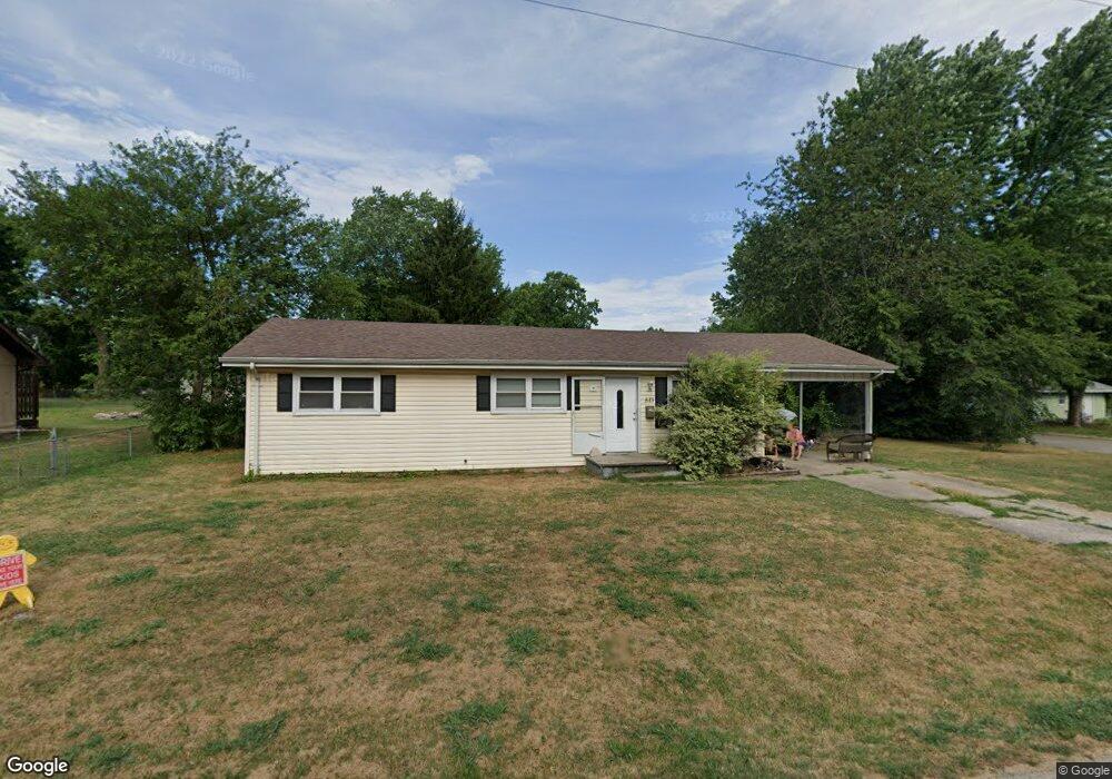
513 N West Ave Republic, MO 65738
Estimated Value: $109,000 - $186,000
3
Beds
1
Bath
1,056
Sq Ft
$152/Sq Ft
Est. Value
About This Home
This home is located at 513 N West Ave, Republic, MO 65738 and is currently estimated at $160,097, approximately $151 per square foot. 513 N West Ave is a home located in Greene County with nearby schools including Schofield Elementary School, Republic Middle School, and Republic High School.
Ownership History
Date
Name
Owned For
Owner Type
Purchase Details
Closed on
Sep 9, 2010
Sold by
Federal National Mortgage Association
Bought by
Mottl Daniel
Current Estimated Value
Purchase Details
Closed on
May 24, 2010
Sold by
Shaw Sara R and Shaw Jamie J
Bought by
Fannie Mae
Purchase Details
Closed on
Jun 29, 2007
Sold by
Thompson Sarah and Thompson Chad
Bought by
Shaw Sara R
Home Financials for this Owner
Home Financials are based on the most recent Mortgage that was taken out on this home.
Original Mortgage
$87,900
Interest Rate
6.37%
Mortgage Type
New Conventional
Purchase Details
Closed on
Feb 8, 2007
Sold by
Us Bank National Assn
Bought by
Thompson Sarah
Home Financials for this Owner
Home Financials are based on the most recent Mortgage that was taken out on this home.
Original Mortgage
$47,900
Interest Rate
6.21%
Mortgage Type
New Conventional
Purchase Details
Closed on
Dec 6, 2006
Sold by
Mahoney Lorraine
Bought by
U S Bank N A
Create a Home Valuation Report for This Property
The Home Valuation Report is an in-depth analysis detailing your home's value as well as a comparison with similar homes in the area
Home Values in the Area
Average Home Value in this Area
Purchase History
| Date | Buyer | Sale Price | Title Company |
|---|---|---|---|
| Mottl Daniel | -- | None Available | |
| Fannie Mae | $75,278 | None Available | |
| Shaw Sara R | -- | None Available | |
| Thompson Sarah | $47,900 | None Available | |
| U S Bank N A | $39,783 | None Available |
Source: Public Records
Mortgage History
| Date | Status | Borrower | Loan Amount |
|---|---|---|---|
| Previous Owner | Shaw Sara R | $87,900 | |
| Previous Owner | Thompson Sarah | $47,900 |
Source: Public Records
Tax History Compared to Growth
Tax History
| Year | Tax Paid | Tax Assessment Tax Assessment Total Assessment is a certain percentage of the fair market value that is determined by local assessors to be the total taxable value of land and additions on the property. | Land | Improvement |
|---|---|---|---|---|
| 2025 | $1,000 | $20,410 | $5,700 | $14,710 |
| 2024 | $1,000 | $17,900 | $4,750 | $13,150 |
| 2023 | $981 | $17,900 | $4,750 | $13,150 |
| 2022 | $887 | $16,110 | $4,750 | $11,360 |
| 2021 | $882 | $16,110 | $4,750 | $11,360 |
| 2020 | $743 | $13,360 | $4,750 | $8,610 |
| 2019 | $740 | $13,360 | $4,750 | $8,610 |
| 2018 | $622 | $10,850 | $3,800 | $7,050 |
| 2017 | $617 | $10,300 | $3,800 | $6,500 |
| 2016 | $592 | $10,300 | $3,800 | $6,500 |
| 2015 | $590 | $10,300 | $3,800 | $6,500 |
| 2014 | $594 | $10,280 | $3,800 | $6,480 |
Source: Public Records
Map
Nearby Homes
- 532 N College Ave
- 626 N Phelps Ave
- 520 N College Ave
- 645 N College Ave
- 707 N College Ave
- 533 N Main St
- 135 N Bonnie Ave
- 1213 N London Place
- 347 W Elm St
- 1128 N Blackstone Ave
- 1169 N Blackstone Ave
- 923 N Travis Ave
- 285 E Garnet Dr
- 207 W Broad St
- 401 Ethan Ave
- 00 N Boston Ln
- 0 Highway 60 Unit 60308100
- 0 Highway 60 Unit 60308095
- 530 Ashley St
- 217 E Ritter St
- 507 N West Ave
- 416 W Logan St
- 521 N West Ave
- 518 North W
- 420 W Logan St
- 522 N Forest Ln
- 503 N West Ave
- 518 N West Ave
- 527 N West Ave
- 424 W Logan St
- 526 N Forest Ln
- 531 N West Ave
- 522 N West Ave
- 0 State Highway 174 Unit 11210458
- Tbd State Highway 174
- 1324 State Highway 174
- W State Highway 174
- 0 State Highway 174
- 000 State Highway 174
- 532 N Forest Ln