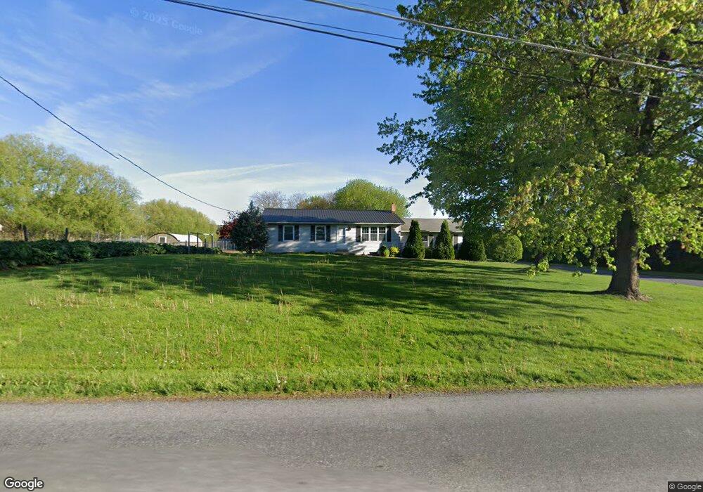
513 Todd Rd Honey Brook, PA 19344
Estimated Value: $358,000 - $427,464
3
Beds
1
Bath
1,120
Sq Ft
$338/Sq Ft
Est. Value
About This Home
This home is located at 513 Todd Rd, Honey Brook, PA 19344 and is currently estimated at $378,366, approximately $337 per square foot. 513 Todd Rd is a home located in Chester County with nearby schools including Honey Brook Elementary Center, Twin Valley Middle School, and Twin Valley High School.
Ownership History
Date
Name
Owned For
Owner Type
Purchase Details
Closed on
Dec 15, 2006
Sold by
Stoltzfus Daniel U and Stoltzfus Rebecca S
Bought by
Stoltzfus David S and Stoltzfus Anna S
Current Estimated Value
Home Financials for this Owner
Home Financials are based on the most recent Mortgage that was taken out on this home.
Original Mortgage
$196,000
Outstanding Balance
$117,184
Interest Rate
6.31%
Mortgage Type
Purchase Money Mortgage
Estimated Equity
$261,182
Create a Home Valuation Report for This Property
The Home Valuation Report is an in-depth analysis detailing your home's value as well as a comparison with similar homes in the area
Home Values in the Area
Average Home Value in this Area
Purchase History
| Date | Buyer | Sale Price | Title Company |
|---|---|---|---|
| Stoltzfus David S | $245,000 | None Available |
Source: Public Records
Mortgage History
| Date | Status | Borrower | Loan Amount |
|---|---|---|---|
| Open | Stoltzfus David S | $196,000 |
Source: Public Records
Tax History Compared to Growth
Tax History
| Year | Tax Paid | Tax Assessment Tax Assessment Total Assessment is a certain percentage of the fair market value that is determined by local assessors to be the total taxable value of land and additions on the property. | Land | Improvement |
|---|---|---|---|---|
| 2025 | $5,717 | $259,310 | $69,470 | $189,840 |
| 2024 | $5,717 | $148,900 | $69,470 | $79,430 |
| 2023 | $4,383 | $116,820 | $69,470 | $47,350 |
| 2022 | $4,335 | $116,820 | $69,470 | $47,350 |
| 2021 | $4,208 | $116,820 | $69,470 | $47,350 |
| 2020 | $4,187 | $116,820 | $69,470 | $47,350 |
| 2019 | $4,062 | $116,820 | $69,470 | $47,350 |
| 2018 | $4,062 | $116,820 | $69,470 | $47,350 |
| 2017 | $3,966 | $116,820 | $69,470 | $47,350 |
| 2016 | $3,118 | $116,820 | $69,470 | $47,350 |
| 2015 | $3,118 | $116,820 | $69,470 | $47,350 |
| 2014 | $3,118 | $116,820 | $69,470 | $47,350 |
Source: Public Records
Map
Nearby Homes
- 123 Nevin Dr
- 50 Nevin Dr
- 0 Westbrook Dr
- 0 Westbrook Dr
- 0 Westbrook Dr
- 0 Westbrook Dr
- 70 Waynebrook Dr
- 260 Pequea Ave
- 22 Vintage Ln
- 12 Vintage Ln
- 190 Petrelia Dr
- 407 Cahill Cir Unit 4
- 35 Wagon Way
- 856 Reservoir Rd
- 159 Augusta Dr
- 650 Dampman Rd
- 650 Broad St
- 112 Maxwell Hill Rd
- 1022 Elwood St
- 230 Rock Rd
- 483 Todd Rd
- 540 Todd Rd
- 1063 Twin County Rd
- 2002 Twin County Rd
- 1064 Twin County Rd
- 1013 Twin County Rd
- 500 Todd Rd
- 380 Wawassan Dr
- 1094 Township Rd
- 1040 Twin County Rd
- 1038 Twin County Rd
- 1032 Twin County Rd
- 400 Wawassan Dr
- 430 Wawassan Dr
- 681 James St
- 2210 Conestoga Ave
- 235 Maple St
- 690 James St
- 460 Wawassan Dr
- 159 Nevin Dr