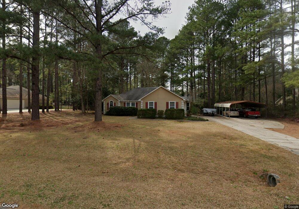
513 Whistlestop Cir Statesboro, GA 30461
Estimated Value: $242,533 - $266,000
3
Beds
2
Baths
1,411
Sq Ft
$180/Sq Ft
Est. Value
About This Home
This home is located at 513 Whistlestop Cir, Statesboro, GA 30461 and is currently estimated at $253,633, approximately $179 per square foot. 513 Whistlestop Cir is a home located in Bulloch County with nearby schools including Sallie Zetterower Elementary School, Statesboro High School, and Langston Chapel Middle School.
Ownership History
Date
Name
Owned For
Owner Type
Purchase Details
Closed on
Mar 23, 2005
Sold by
Borowski Donald W
Bought by
Busby Rubert D
Current Estimated Value
Home Financials for this Owner
Home Financials are based on the most recent Mortgage that was taken out on this home.
Original Mortgage
$126,155
Outstanding Balance
$64,000
Interest Rate
5.62%
Mortgage Type
VA
Estimated Equity
$189,633
Purchase Details
Closed on
Dec 1, 2001
Bought by
Borowski Donald W
Purchase Details
Closed on
Mar 1, 1993
Bought by
Martin Debra H
Create a Home Valuation Report for This Property
The Home Valuation Report is an in-depth analysis detailing your home's value as well as a comparison with similar homes in the area
Home Values in the Area
Average Home Value in this Area
Purchase History
| Date | Buyer | Sale Price | Title Company |
|---|---|---|---|
| Busby Rubert D | $123,500 | -- | |
| Borowski Donald W | -- | -- | |
| Martin Debra H | -- | -- |
Source: Public Records
Mortgage History
| Date | Status | Borrower | Loan Amount |
|---|---|---|---|
| Open | Busby Rubert D | $126,155 |
Source: Public Records
Tax History Compared to Growth
Tax History
| Year | Tax Paid | Tax Assessment Tax Assessment Total Assessment is a certain percentage of the fair market value that is determined by local assessors to be the total taxable value of land and additions on the property. | Land | Improvement |
|---|---|---|---|---|
| 2024 | $1,658 | $73,040 | $14,000 | $59,040 |
| 2023 | $1,594 | $64,328 | $10,000 | $54,328 |
| 2022 | $1,270 | $55,906 | $9,320 | $46,586 |
| 2021 | $1,198 | $51,518 | $9,320 | $42,198 |
| 2020 | $1,118 | $47,514 | $9,320 | $38,194 |
| 2019 | $1,110 | $46,939 | $8,600 | $38,339 |
| 2018 | $1,050 | $42,748 | $8,600 | $34,148 |
| 2017 | $1,030 | $41,467 | $8,600 | $32,867 |
| 2016 | $1,020 | $40,048 | $8,600 | $31,448 |
| 2015 | $988 | $39,120 | $8,600 | $30,520 |
| 2014 | $928 | $39,120 | $8,600 | $30,520 |
Source: Public Records
Map
Nearby Homes
- 252 Hagin Ln
- 114 Lincoln St
- 406 Jacob Ct
- 106 Lincoln St
- 314 Longwood Dr
- 402 Jacob Ct
- 401 Jacob Ct
- 0 George Moore Rd Unit SA333925
- 0 George Moore Rd Unit 10559523
- 207 N Jackson Rd
- 117 Circle Dr
- 4026 Denton Loop
- 239 Circle Dr
- 2.055 ACRES S and S Railroad Bed Rd
- 1139 Bartlett Dr
- 1016 Johnson Dr
- 1143 Bartlett Dr
- 410 Cardinal Dr
- 10544 Burkhalter Rd
- 6302 C T Place
- 511 Whistlestop Cir
- 515 Whistlestop Cir
- 517 Whistlestop Cir
- 519 Whistlestop Cir
- 512 Whistlestop Cir
- 510 Whistlestop Cir
- 509 Whistlestop Cir
- 521 Whistlestop Cir
- 508 Whistlestop Cir
- 514 Whistlestop Cir
- 516 Whistlestop Cir
- 518 Whistlestop Cir
- 522 Whistlestop Cir
- 523 Whistlestop Cir
- 507 Whistlestop Cir
- 520 Whistlestop Cir
- 506 Whistlestop Cir
- 526 Whistlestop Cir
- 524 Whistlestop Cir
- 525 Whistlestop Cir