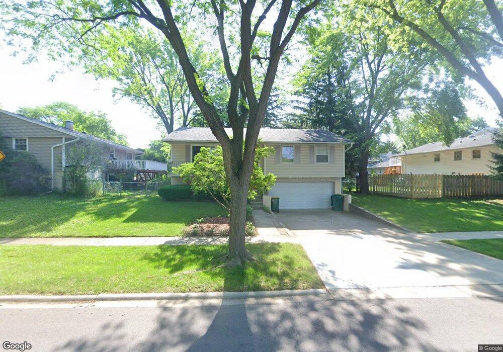
513 White Pine Rd Buffalo Grove, IL 60089
South Buffalo Grove NeighborhoodEstimated Value: $394,000 - $450,000
3
Beds
2
Baths
1,120
Sq Ft
$366/Sq Ft
Est. Value
About This Home
This home is located at 513 White Pine Rd, Buffalo Grove, IL 60089 and is currently estimated at $409,994, approximately $366 per square foot. 513 White Pine Rd is a home located in Cook County with nearby schools including Henry W Longfellow Elementary School, Cooper Middle School, and Buffalo Grove High School.
Ownership History
Date
Name
Owned For
Owner Type
Purchase Details
Closed on
Apr 14, 2018
Sold by
Guminskiy Tatyana
Bought by
Guminskiy Tatyana and Guminskiy Steven
Current Estimated Value
Purchase Details
Closed on
Jun 13, 2007
Sold by
Guminskiy Tatyana and Guminskiy Vadim
Bought by
Guminskiy Tatyana
Purchase Details
Closed on
Jan 31, 1994
Sold by
Konwent Vincent J and Konwent Bernice
Bought by
Tatyana Guminsky Vadim and Tatyana Guminskaya
Home Financials for this Owner
Home Financials are based on the most recent Mortgage that was taken out on this home.
Original Mortgage
$132,000
Interest Rate
7.31%
Mortgage Type
FHA
Create a Home Valuation Report for This Property
The Home Valuation Report is an in-depth analysis detailing your home's value as well as a comparison with similar homes in the area
Home Values in the Area
Average Home Value in this Area
Purchase History
| Date | Buyer | Sale Price | Title Company |
|---|---|---|---|
| Guminskiy Tatyana | -- | None Available | |
| Guminskiy Tatyana | -- | None Available | |
| Tatyana Guminsky Vadim | $110,000 | -- |
Source: Public Records
Mortgage History
| Date | Status | Borrower | Loan Amount |
|---|---|---|---|
| Closed | Tatyana Guminsky Vadim | $132,000 |
Source: Public Records
Tax History Compared to Growth
Tax History
| Year | Tax Paid | Tax Assessment Tax Assessment Total Assessment is a certain percentage of the fair market value that is determined by local assessors to be the total taxable value of land and additions on the property. | Land | Improvement |
|---|---|---|---|---|
| 2024 | $4,419 | $31,000 | $8,652 | $22,348 |
| 2023 | $4,386 | $31,000 | $8,652 | $22,348 |
| 2022 | $4,386 | $31,000 | $8,652 | $22,348 |
| 2021 | $4,900 | $24,775 | $6,128 | $18,647 |
| 2020 | $4,442 | $24,775 | $6,128 | $18,647 |
| 2019 | $4,422 | $27,559 | $6,128 | $21,431 |
| 2018 | $4,691 | $20,491 | $5,407 | $15,084 |
| 2017 | $5,786 | $20,491 | $5,407 | $15,084 |
| 2016 | $5,651 | $20,491 | $5,407 | $15,084 |
| 2015 | $5,511 | $18,846 | $4,686 | $14,160 |
| 2014 | $5,438 | $18,846 | $4,686 | $14,160 |
| 2013 | $5,009 | $18,846 | $4,686 | $14,160 |
Source: Public Records
Map
Nearby Homes
- 535 Estate Dr
- 410 Chatham Cir
- 665 Thornwood Dr
- 571 Estate Dr
- 455 Mayfair Ln
- 859 Beechwood Rd
- 813 Stradford Cir Unit 21B2
- 310 Rosewood Ave
- 820 Weidner Rd Unit 4013
- 820 Weidner Rd Unit 409
- 921 Bernard Dr
- 720 Weidner Rd Unit 302
- 3451 N Carriageway Dr Unit 503
- 234 Mohawk Trail
- 443 Diane Dr
- 561 Park View Terrace Unit 153
- 3300 N Carriageway Dr Unit 317
- 183 Saint Marys Pkwy
- 12 Oak Creek Dr Unit 2212
- 25 Crestview Terrace
- 657 Elmwood Dr Unit 6
- 529 White Pine Rd
- 643 Elmwood Dr
- 646 Hawthorne Rd
- 636 Hawthorne Rd
- 639 Elmwood Dr
- 514 White Pine Rd
- 504 White Pine Rd
- 524 White Pine Rd
- 626 Hawthorne Rd
- 494 White Pine Rd
- 534 White Pine Rd
- 648 Elmwood Dr
- 477 White Pine Rd
- 627 Elmwood Dr
- 484 White Pine Rd
- 636 Elmwood Dr
- 544 White Pine Rd
- 553 White Pine Rd
- 643 Hawthorne Rd