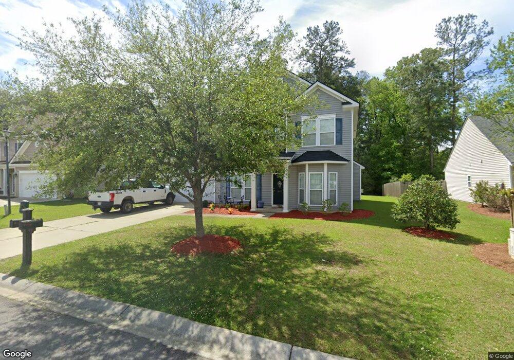
5130 Blair Rd Summerville, SC 29483
Estimated Value: $404,944 - $462,000
4
Beds
3
Baths
2,754
Sq Ft
$158/Sq Ft
Est. Value
About This Home
This home is located at 5130 Blair Rd, Summerville, SC 29483 and is currently estimated at $433,986, approximately $157 per square foot. 5130 Blair Rd is a home located in Dorchester County with nearby schools including Knightsville Elementary School, Charles B. DuBose Middle School, and Summerville High School.
Ownership History
Date
Name
Owned For
Owner Type
Purchase Details
Closed on
Jul 16, 2010
Sold by
The Ryland Group Inc
Bought by
Williams Stephen C and Williams Tikkia S
Current Estimated Value
Home Financials for this Owner
Home Financials are based on the most recent Mortgage that was taken out on this home.
Original Mortgage
$199,175
Interest Rate
4.87%
Mortgage Type
FHA
Purchase Details
Closed on
Apr 22, 2010
Sold by
Myers Mill Llc
Bought by
The Ryland Group Inc
Create a Home Valuation Report for This Property
The Home Valuation Report is an in-depth analysis detailing your home's value as well as a comparison with similar homes in the area
Home Values in the Area
Average Home Value in this Area
Purchase History
| Date | Buyer | Sale Price | Title Company |
|---|---|---|---|
| Williams Stephen C | $202,850 | -- | |
| The Ryland Group Inc | $144,840 | -- |
Source: Public Records
Mortgage History
| Date | Status | Borrower | Loan Amount |
|---|---|---|---|
| Previous Owner | Williams Stephen C | $199,175 |
Source: Public Records
Tax History Compared to Growth
Tax History
| Year | Tax Paid | Tax Assessment Tax Assessment Total Assessment is a certain percentage of the fair market value that is determined by local assessors to be the total taxable value of land and additions on the property. | Land | Improvement |
|---|---|---|---|---|
| 2024 | $1,892 | $14,396 | $4,560 | $9,836 |
| 2023 | $1,892 | $9,177 | $1,800 | $7,377 |
| 2022 | $1,688 | $9,180 | $1,800 | $7,380 |
| 2021 | $1,688 | $9,180 | $1,800 | $7,380 |
| 2020 | $1,579 | $8,070 | $1,600 | $6,470 |
| 2019 | $1,529 | $8,070 | $1,600 | $6,470 |
| 2018 | $1,359 | $8,070 | $1,600 | $6,470 |
| 2017 | $1,350 | $8,070 | $1,600 | $6,470 |
| 2016 | $1,336 | $8,070 | $1,600 | $6,470 |
| 2015 | $1,331 | $8,070 | $1,600 | $6,470 |
| 2014 | $1,292 | $201,200 | $0 | $0 |
| 2013 | -- | $8,050 | $0 | $0 |
Source: Public Records
Map
Nearby Homes
- 4021 Sanderson Ln
- 120 Greenhill Pastures
- 131 County Road S-18-409
- 385 Embassy Dr
- 10001 Begovich Ct
- 133 Stephanie Cir
- 5021 Blair Rd
- 000 Central Ave
- 224 Ruth Anne Dr
- 1745 Central Ave
- 105 Ruth Anne Dr
- 302 Embassy Dr
- 1736 Central Ave
- 990 Augustine Ct
- 169 Cantona Dr
- 176 Cantona Dr
- 139 Reed St
- 155 Cantona Dr
- 1956 Central Ave
- 1960 Central Ave