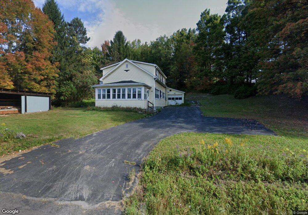
5130 State Route 10 Cobleskill, NY 12043
Estimated Value: $67,000 - $385,000
3
Beds
1
Bath
1,730
Sq Ft
$114/Sq Ft
Est. Value
About This Home
This home is located at 5130 State Route 10, Cobleskill, NY 12043 and is currently estimated at $197,604, approximately $114 per square foot. 5130 State Route 10 is a home located in Schoharie County with nearby schools including George D Ryder Elementary School, Cobleskill Richmondville High School, and Joseph B Radez Elementary School.
Ownership History
Date
Name
Owned For
Owner Type
Purchase Details
Closed on
Sep 1, 2019
Sold by
Terpening Donald and Nationstar Mortgage Llc
Bought by
Us Bank Na Tr
Current Estimated Value
Purchase Details
Closed on
Jun 22, 2007
Sold by
Bowers Douglas
Bought by
Terpening Donald
Home Financials for this Owner
Home Financials are based on the most recent Mortgage that was taken out on this home.
Original Mortgage
$100,000
Interest Rate
6.72%
Mortgage Type
Purchase Money Mortgage
Purchase Details
Closed on
Mar 7, 2002
Sold by
Douglas Bowers
Bought by
Douglas Bowers
Create a Home Valuation Report for This Property
The Home Valuation Report is an in-depth analysis detailing your home's value as well as a comparison with similar homes in the area
Home Values in the Area
Average Home Value in this Area
Purchase History
| Date | Buyer | Sale Price | Title Company |
|---|---|---|---|
| Us Bank Na Tr | $165,896 | -- | |
| Terpening Donald | $100,000 | Paul Sciochetti | |
| Douglas Bowers | -- | -- |
Source: Public Records
Mortgage History
| Date | Status | Borrower | Loan Amount |
|---|---|---|---|
| Previous Owner | Terpening Donald | $100,000 |
Source: Public Records
Tax History Compared to Growth
Tax History
| Year | Tax Paid | Tax Assessment Tax Assessment Total Assessment is a certain percentage of the fair market value that is determined by local assessors to be the total taxable value of land and additions on the property. | Land | Improvement |
|---|---|---|---|---|
| 2024 | $2,741 | $43,500 | $15,500 | $28,000 |
| 2023 | $1,654 | $43,500 | $15,500 | $28,000 |
| 2022 | $1,615 | $43,500 | $15,500 | $28,000 |
| 2021 | $1,624 | $43,500 | $15,500 | $28,000 |
| 2020 | $2,683 | $43,500 | $15,500 | $28,000 |
| 2019 | $3,363 | $103,800 | $15,500 | $88,300 |
| 2018 | $3,363 | $103,800 | $15,500 | $88,300 |
| 2017 | $3,245 | $103,800 | $15,500 | $88,300 |
| 2016 | $3,322 | $103,800 | $15,500 | $88,300 |
| 2015 | -- | $103,800 | $15,500 | $88,300 |
| 2014 | -- | $103,800 | $15,500 | $88,300 |
Source: Public Records
Map
Nearby Homes
- 5231 State Route 10
- L6 Patrick Rd
- L5 Patrick Rd
- 1659 State Route 7
- 1500 State Route 7
- 110 Madison Terrace
- 194 Elm St
- 122 Lincoln Ave
- 162 Elm St
- 427 Patrick Rd
- 109 High St
- 573 E Main St
- 148 High St
- 124 Union St
- 616 E Main St
- L14 New York 7
- 195 North St
- 297 Podpadic Rd
- L11 New York 7
- 277 Red Tail Ridge
- 5130 New York 10
- 5133 State Route 10
- 263 Warnerville Cutoff
- 263 Warnerville Cut Off
- 5144 State Route 10
- 0 State Rt 10
- 5150 State Route 10
- 262 Warnerville Cut Off
- 146 Hawk Hill Rd
- 254 Warnerville Cut Off
- 5160 State Route 10
- 106 Hawk Hill Rd
- 5098 State Route 10
- 262 Warnerville Cutoff Rd
- 5094 State Route 10
- 151 Heron Rd
- 244 Warnerville Cutoff
- 236 Warnerville Cutoff
- 5090 New York 10
- 5090 State Route 10