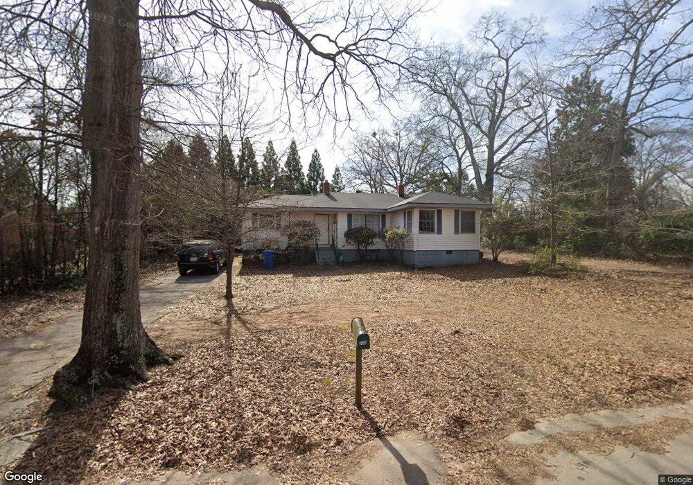
5130 West Dr NE Covington, GA 30014
Estimated Value: $236,973 - $326,000
Studio
2
Baths
1,590
Sq Ft
$175/Sq Ft
Est. Value
About This Home
This home is located at 5130 West Dr NE, Covington, GA 30014 and is currently estimated at $278,743, approximately $175 per square foot. 5130 West Dr NE is a home located in Newton County with nearby schools including East Newton Elementary School, Cousins Middle School, and Eastside High School.
Ownership History
Date
Name
Owned For
Owner Type
Purchase Details
Closed on
Oct 29, 2003
Sold by
Howard Gary and Howard Gwenda
Bought by
White Rentals Llc
Current Estimated Value
Home Financials for this Owner
Home Financials are based on the most recent Mortgage that was taken out on this home.
Original Mortgage
$72,000
Interest Rate
6.03%
Mortgage Type
New Conventional
Purchase Details
Closed on
Mar 30, 1998
Sold by
Murphy Amanda Jane
Bought by
Howard Gary and Howard Gwenda
Home Financials for this Owner
Home Financials are based on the most recent Mortgage that was taken out on this home.
Original Mortgage
$69,690
Interest Rate
6.95%
Mortgage Type
FHA
Create a Home Valuation Report for This Property
The Home Valuation Report is an in-depth analysis detailing your home's value as well as a comparison with similar homes in the area
Home Values in the Area
Average Home Value in this Area
Purchase History
| Date | Buyer | Sale Price | Title Company |
|---|---|---|---|
| White Rentals Llc | $90,000 | -- | |
| Howard Gary | $70,000 | -- |
Source: Public Records
Mortgage History
| Date | Status | Borrower | Loan Amount |
|---|---|---|---|
| Closed | White Rentals Llc | $72,000 | |
| Previous Owner | Howard Gary | $69,690 |
Source: Public Records
Tax History
| Year | Tax Paid | Tax Assessment Tax Assessment Total Assessment is a certain percentage of the fair market value that is determined by local assessors to be the total taxable value of land and additions on the property. | Land | Improvement |
|---|---|---|---|---|
| 2025 | $2,571 | $86,440 | $17,200 | $69,240 |
| 2024 | $2,419 | $80,120 | $17,200 | $62,920 |
| 2023 | $1,641 | $50,480 | $8,800 | $41,680 |
| 2022 | $1,517 | $46,680 | $8,800 | $37,880 |
| 2021 | $1,477 | $40,680 | $8,800 | $31,880 |
| 2020 | $1,484 | $37,200 | $8,800 | $28,400 |
| 2019 | $1,580 | $38,880 | $8,800 | $30,080 |
| 2018 | $786 | $38,240 | $6,000 | $32,240 |
| 2017 | $1,064 | $25,880 | $2,000 | $23,880 |
| 2016 | $1,096 | $26,680 | $2,800 | $23,880 |
| 2015 | $1,042 | $25,320 | $2,000 | $23,320 |
| 2014 | $1,042 | $25,320 | $0 | $0 |
Source: Public Records
Map
Nearby Homes
- 5139 West Dr NE
- 5143 Floyd St NE
- 4117 N Dearing St NE
- 5118 Floyd St NE
- 6104 Floyd St NE
- 5173 Martin St SE
- 6127 Floyd St NE
- 4128 Elizabeth St NE
- 4147 Elizabeth St NE
- 4217 Elizabeth St NE
- 5142 Conyers St SE
- 3127 Mill St SE
- 3149 Thompson Ave SE
- 0 Highway 278 NE Unit 10595588
- 3160 Butler Ave SE
- 5186 Wheat St NE
- 6203 Crestview Dr SE
- 5175 Forest Dr SE
- 5316 N Dearing St SE
- 4138 Pemberton Dr SE
- 5138 West Dr NE
- 5135 West Dr NE
- 5146 West Dr NE
- 5116 West Dr NE
- 5119 West Dr NE
- 5112 Hartsood Dr
- 5112 Hartsook Dr NE
- 5112 Hartsook Dr NE Unit 24
- 5125 West Dr NE
- 5115 Hartsook Dr NE
- 5153 West Dr NE
- 5129 Floyd St NE
- 4140 Dearing St NE
- 4134 N Dearing St NE
- 4156 N Dearing St NE
- 5153 Hazel St NE
- 5157 West Dr NE
- 5115 Floyd St NE
- 5157 Hazel St NE
- 5153 Floyd St NE
Your Personal Tour Guide
Ask me questions while you tour the home.