Estimated Value: $441,000 - $521,000
4
Beds
2
Baths
1,722
Sq Ft
$289/Sq Ft
Est. Value
About This Home
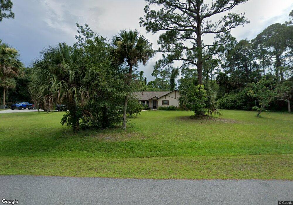
This home is located at 5131 Dalehurst Dr, Cocoa, FL 32926 and is currently estimated at $498,364, approximately $289 per square foot. 5131 Dalehurst Dr is a home located in Brevard County with nearby schools including Saturn Elementary School and Cocoa High School.
Ownership History
Date
Name
Owned For
Owner Type
Purchase Details
Closed on
May 30, 2007
Sold by
Marrine Michael and Marrine Susan E
Bought by
Rogers Clint and Rogers Kendra E
Current Estimated Value
Home Financials for this Owner
Home Financials are based on the most recent Mortgage that was taken out on this home.
Original Mortgage
$226,000
Outstanding Balance
$137,763
Interest Rate
6.12%
Estimated Equity
$360,601
Purchase Details
Closed on
Feb 24, 2003
Sold by
Marrine Susan E and Frahm Susan E
Bought by
Marrine Michael and Marrine Susan E
Home Financials for this Owner
Home Financials are based on the most recent Mortgage that was taken out on this home.
Original Mortgage
$120,000
Interest Rate
5.95%
Create a Home Valuation Report for This Property
The Home Valuation Report is an in-depth analysis detailing your home's value as well as a comparison with similar homes in the area
Home Values in the Area
Average Home Value in this Area
Purchase History
| Date | Buyer | Sale Price | Title Company |
|---|---|---|---|
| Rogers Clint | $265,900 | Federal Title Ins Assoc Inc | |
| Marrine Michael | $43,700 | -- |
Source: Public Records
Mortgage History
| Date | Status | Borrower | Loan Amount |
|---|---|---|---|
| Open | Rogers Clint | $226,000 | |
| Previous Owner | Marrine Michael | $120,000 |
Source: Public Records
Tax History Compared to Growth
Tax History
| Year | Tax Paid | Tax Assessment Tax Assessment Total Assessment is a certain percentage of the fair market value that is determined by local assessors to be the total taxable value of land and additions on the property. | Land | Improvement |
|---|---|---|---|---|
| 2025 | $1,985 | $151,410 | -- | -- |
| 2024 | $1,947 | $147,150 | -- | -- |
| 2023 | $1,947 | $142,870 | $0 | $0 |
| 2022 | $1,818 | $138,710 | $0 | $0 |
| 2021 | $1,839 | $134,670 | $0 | $0 |
| 2020 | $1,783 | $132,820 | $0 | $0 |
| 2019 | $1,724 | $129,840 | $0 | $0 |
| 2018 | $1,722 | $127,420 | $0 | $0 |
| 2017 | $1,727 | $124,800 | $0 | $0 |
| 2016 | $1,742 | $122,240 | $38,850 | $83,390 |
| 2015 | $1,760 | $121,400 | $38,850 | $82,550 |
| 2014 | $1,761 | $120,440 | $30,530 | $89,910 |
Source: Public Records
Map
Nearby Homes
- 2524 Trotters Trail
- 5011 Dalehurst Dr
- 4900 Hidden Pine Place
- 4901 Talbot Blvd
- 2635 Wagon Rd
- 6341 Pony Cir
- TBD Rayburn Rd
- 365 Outer Dr
- 595 Outer Dr Unit 129
- 494 Outer Dr
- 495 Outer Dr Unit 201
- 336 Horseshoe Bend Cir Unit 197
- 436 Horseshoe Bend Cir Unit 192
- Sand Key Plan at Windward Preserve
- Aruba Plan at Windward Preserve
- Amelia Plan at Windward Preserve
- Bahama Plan at Windward Preserve
- Grenada Plan at Windward Preserve
- Saint Croix Plan at Windward Preserve
- Saint Thomas Plan at Windward Preserve
- 5141 Dalehurst Dr
- 5121 Dalehurst Dr
- 5120 Dalehurst Dr
- 5110 Dalehurst Dr
- 5151 Dalehurst Dr
- 2111 Winston Dr
- 2118 Winston Dr
- 5111 Dalehurst Dr
- 5140 Dalehurst Dr
- 5050 Yorkshire Rd
- 5161 Dalehurst Dr
- 2120 Winston Dr
- 5150 Dalehurst Dr
- 5045 Yorkshire Rd
- 5101 Dalehurst Dr
- 2151 Winston Dr
- 5040 Yorkshire Rd
- 2130 Winston Dr
- 2171 Winston Dr
- 5165 Dalehurst Dr