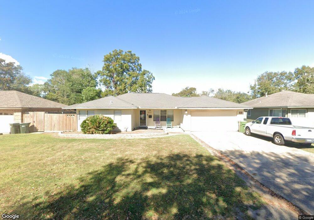
5131 Lakeside Dr Port Arthur, TX 77642
Estimated Value: $105,836 - $130,000
--
Bed
--
Bath
1,272
Sq Ft
$91/Sq Ft
Est. Value
About This Home
This home is located at 5131 Lakeside Dr, Port Arthur, TX 77642 and is currently estimated at $116,209, approximately $91 per square foot. 5131 Lakeside Dr is a home located in Jefferson County with nearby schools including Travis Elementary School, Jefferson Middle School, and Memorial High School.
Ownership History
Date
Name
Owned For
Owner Type
Purchase Details
Closed on
Jun 5, 2007
Sold by
Smith Thea Thompson
Bought by
Smith Darwin Keith
Current Estimated Value
Purchase Details
Closed on
Jun 25, 2003
Sold by
Weeratunge Sisira Sam and Weeratunge Sisira
Bought by
Smith Thea Thompson
Home Financials for this Owner
Home Financials are based on the most recent Mortgage that was taken out on this home.
Original Mortgage
$34,900
Outstanding Balance
$19,865
Interest Rate
10.1%
Mortgage Type
Purchase Money Mortgage
Estimated Equity
$96,344
Create a Home Valuation Report for This Property
The Home Valuation Report is an in-depth analysis detailing your home's value as well as a comparison with similar homes in the area
Home Values in the Area
Average Home Value in this Area
Purchase History
| Date | Buyer | Sale Price | Title Company |
|---|---|---|---|
| Smith Darwin Keith | -- | None Available | |
| Smith Thea Thompson | -- | -- |
Source: Public Records
Mortgage History
| Date | Status | Borrower | Loan Amount |
|---|---|---|---|
| Open | Smith Thea Thompson | $34,900 | |
| Closed | Smith Thea Thompson | $6,500 |
Source: Public Records
Tax History Compared to Growth
Tax History
| Year | Tax Paid | Tax Assessment Tax Assessment Total Assessment is a certain percentage of the fair market value that is determined by local assessors to be the total taxable value of land and additions on the property. | Land | Improvement |
|---|---|---|---|---|
| 2025 | $1,197 | $106,400 | -- | -- |
| 2024 | $1,197 | $96,727 | -- | -- |
| 2023 | $1,197 | $87,934 | $0 | $0 |
| 2022 | $2,539 | $79,940 | $0 | $0 |
| 2021 | $2,409 | $96,733 | $5,490 | $91,243 |
| 2020 | $1,565 | $66,066 | $5,490 | $60,576 |
| 2019 | $1,922 | $60,300 | $5,490 | $54,810 |
| 2018 | $1,345 | $60,300 | $5,490 | $54,810 |
| 2017 | $1,303 | $60,300 | $5,490 | $54,810 |
| 2016 | $1,682 | $57,410 | $5,490 | $51,920 |
| 2015 | $1,400 | $57,410 | $5,490 | $51,920 |
| 2014 | $1,400 | $60,300 | $5,490 | $54,810 |
Source: Public Records
Map
Nearby Homes
- 5135 Lakeside Dr
- 5123 Lakeside Dr
- 5130 Lakeshore Dr
- 5136 Lakeshore Dr
- 5124 Lakeshore Dr
- 5115 Lakeside Dr
- 5143 Lakeside Dr
- 5132 Lakeside Dr
- 5142 Lakeshore Dr
- 5118 Lakeshore Dr
- 5138 Lakeside Dr
- 5124 Lakeside Dr
- 5146 Lakeshore Dr
- 5109 Lakeside Dr
- 5112 Lakeshore Dr
- 5151 Lakeside Dr
- 5116 Lakeside Dr
- 5152 Lakeshore Dr
- 5152 Lakeside Dr
- 5110 Lakeside Dr