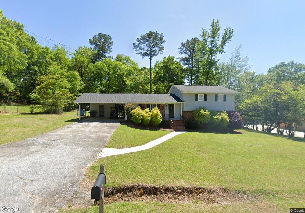
5132 Forest Dr SE Unit 3 Covington, GA 30014
Estimated Value: $331,176 - $337,000
4
Beds
3
Baths
1,777
Sq Ft
$188/Sq Ft
Est. Value
About This Home
This home is located at 5132 Forest Dr SE Unit 3, Covington, GA 30014 and is currently estimated at $334,294, approximately $188 per square foot. 5132 Forest Dr SE Unit 3 is a home located in Newton County with nearby schools including East Newton Elementary School, Cousins Middle School, and Eastside High School.
Ownership History
Date
Name
Owned For
Owner Type
Purchase Details
Closed on
Jul 10, 2015
Sold by
Walton Charles
Bought by
Walton Charles Thomas and Walton Ashleigh Nicole
Current Estimated Value
Home Financials for this Owner
Home Financials are based on the most recent Mortgage that was taken out on this home.
Original Mortgage
$125,681
Outstanding Balance
$96,787
Interest Rate
3.75%
Mortgage Type
FHA
Estimated Equity
$237,507
Create a Home Valuation Report for This Property
The Home Valuation Report is an in-depth analysis detailing your home's value as well as a comparison with similar homes in the area
Home Values in the Area
Average Home Value in this Area
Purchase History
| Date | Buyer | Sale Price | Title Company |
|---|---|---|---|
| Walton Charles Thomas | -- | -- | |
| Walton Charles | $128,000 | -- |
Source: Public Records
Mortgage History
| Date | Status | Borrower | Loan Amount |
|---|---|---|---|
| Open | Walton Charles | $125,681 |
Source: Public Records
Tax History
| Year | Tax Paid | Tax Assessment Tax Assessment Total Assessment is a certain percentage of the fair market value that is determined by local assessors to be the total taxable value of land and additions on the property. | Land | Improvement |
|---|---|---|---|---|
| 2025 | $3,469 | $116,600 | $17,600 | $99,000 |
| 2024 | $2,913 | $96,480 | $17,600 | $78,880 |
| 2023 | $2,890 | $88,920 | $17,600 | $71,320 |
| 2022 | $2,497 | $76,840 | $17,600 | $59,240 |
| 2021 | $2,451 | $67,480 | $16,000 | $51,480 |
| 2020 | $2,631 | $65,960 | $16,000 | $49,960 |
| 2019 | $2,626 | $64,640 | $16,000 | $48,640 |
| 2018 | $2,367 | $57,600 | $12,800 | $44,800 |
| 2017 | $2,199 | $53,520 | $12,800 | $40,720 |
| 2016 | $1,785 | $43,440 | $12,800 | $30,640 |
| 2015 | -- | $43,440 | $0 | $0 |
| 2014 | -- | $43,440 | $0 | $0 |
Source: Public Records
Map
Nearby Homes
- 5316 N Dearing St SE
- 5175 Forest Dr SE
- 4138 Pemberton Dr SE
- 322 Pinewood Dr
- 6134 Linwood Dr SE
- 4208 Brookhaven Dr SE
- 6169 Pinewood Dr SE
- 6203 Crestview Dr SE
- 5142 Conyers St SE
- 5118 Floyd St NE
- 3160 Butler Ave SE
- 3149 Thompson Ave SE
- 3127 Mill St SE
- 4117 N Dearing St NE
- 5143 Floyd St NE
- 8239 High Lake Terrace SE
- 4128 Elizabeth St NE
- 5152 Petty St SW
- 2225 East St
- 4147 Elizabeth St NE
- 0 Dinah Cir Unit 20123796
- 0 Dinah Cir Unit 10116279
- 0 Dinah Cir Unit 20088089
- 0 Dinah Cir Unit 20015553
- 0 2 Package
- 5120 Forest Dr SE
- 5148 Forest Dr SE
- 5175 Linwood Dr SE
- 5125 Forest Dr SE
- 5137 Forest Dr SE
- 5161 Linwood Dr SE
- 5147 Forest Dr SE
- 5158 Forest Dr SE
- 5108 Forest Dr SE
- 5115 Forest Dr SE
- 0 Pinewood Linwood Unit 10333568
- 5157 Forest Dr SE
- 5152 Linwood Dr SE Unit 5
- 5152 Linwood Dr SE Unit 2
- 9129 Jim Purcell Dr
Your Personal Tour Guide
Ask me questions while you tour the home.